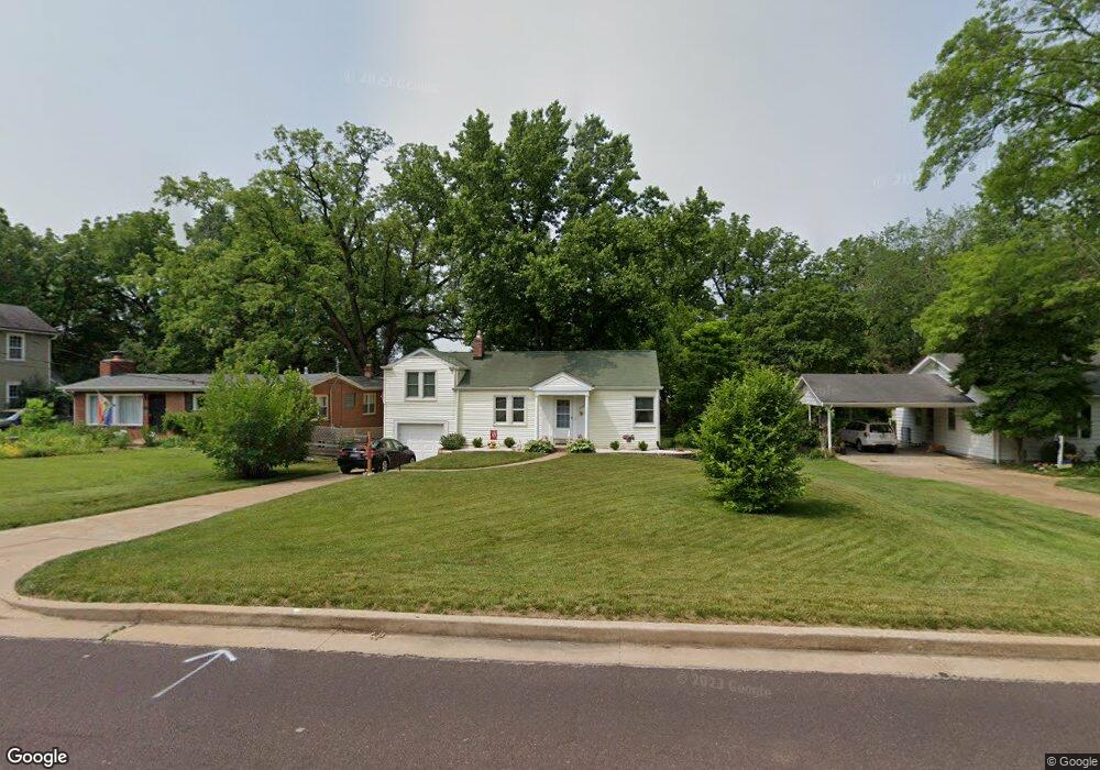
1239 Grant Rd Saint Louis, MO 63119
Estimated Value: $289,410 - $365,000
3
Beds
1
Bath
1,113
Sq Ft
$294/Sq Ft
Est. Value
About This Home
This home is located at 1239 Grant Rd, Saint Louis, MO 63119 and is currently estimated at $326,853, approximately $293 per square foot. 1239 Grant Rd is a home located in St. Louis County with nearby schools including Clark Elementary School, Hixson Middle School, and Webster Groves High School.
Ownership History
Date
Name
Owned For
Owner Type
Purchase Details
Closed on
Aug 29, 1997
Sold by
John Szabo and John Audrey C
Bought by
Miano Anthony S and Miano Patricia A
Current Estimated Value
Home Financials for this Owner
Home Financials are based on the most recent Mortgage that was taken out on this home.
Original Mortgage
$84,000
Outstanding Balance
$12,469
Interest Rate
7.43%
Estimated Equity
$314,384
Create a Home Valuation Report for This Property
The Home Valuation Report is an in-depth analysis detailing your home's value as well as a comparison with similar homes in the area
Home Values in the Area
Average Home Value in this Area
Purchase History
| Date | Buyer | Sale Price | Title Company |
|---|---|---|---|
| Miano Anthony S | -- | -- |
Source: Public Records
Mortgage History
| Date | Status | Borrower | Loan Amount |
|---|---|---|---|
| Open | Miano Anthony S | $84,000 |
Source: Public Records
Tax History
| Year | Tax Paid | Tax Assessment Tax Assessment Total Assessment is a certain percentage of the fair market value that is determined by local assessors to be the total taxable value of land and additions on the property. | Land | Improvement |
|---|---|---|---|---|
| 2025 | $3,470 | $53,160 | $48,620 | $4,540 |
| 2024 | $3,470 | $49,660 | $38,910 | $10,750 |
| 2023 | $3,453 | $49,660 | $38,910 | $10,750 |
| 2022 | $3,458 | $43,040 | $35,020 | $8,020 |
| 2021 | $3,189 | $43,040 | $35,020 | $8,020 |
| 2020 | $3,008 | $37,780 | $26,870 | $10,910 |
| 2019 | $3,013 | $37,780 | $26,870 | $10,910 |
| 2018 | $2,792 | $31,050 | $19,230 | $11,820 |
| 2017 | $2,773 | $31,050 | $19,230 | $11,820 |
| 2016 | $2,640 | $28,310 | $13,510 | $14,800 |
Source: Public Records
Map
Nearby Homes
- 14 Armin Ln
- 1048 Diversey Dr
- 638 Conover Ln
- 429 Forest Green Dr
- 1038 Leawood Dr
- 1139 Hawken Place Unit 6
- 1006 Briarton Dr
- 401 Reavis Place Unit 29
- 9722 Big Bend Blvd
- 9735 Big Bend Blvd
- 649 S Sappington Rd
- 1653 Crabapple Ln
- 618 S Rock Hill Rd
- 1527 S Rock Hill Rd
- 319 Baker Ave
- 55 W Drake Ave
- 0 Unknown Unit MIS25067424
- 0 Unknown Unit MIS25078799
- 0 Unknown Unit MIS26007827
- 1412 Gardenia Dr
- 1243 Grant Rd
- 1231 Grant Rd
- 1251 Grant Rd
- 1227 Grant Rd
- 104 Webster Woods Dr
- 838 Hawkins Ct
- 98 Webster Woods Dr
- 846 Hawkins Ct
- 834 Hawkins Ct
- 848 Hawkins Ct
- 108 Webster Woods Dr
- 92 Webster Woods Dr
- 830 Hawkins Ct
- 850 Hawkins Ct
- 1257 Grant Rd
- 858 Hawkins Ct
- 84 Webster Woods Dr
- 822 Hawkins Ct
- 120 Webster Woods Dr
- 121 Webster Woods Dr
Your Personal Tour Guide
Ask me questions while you tour the home.