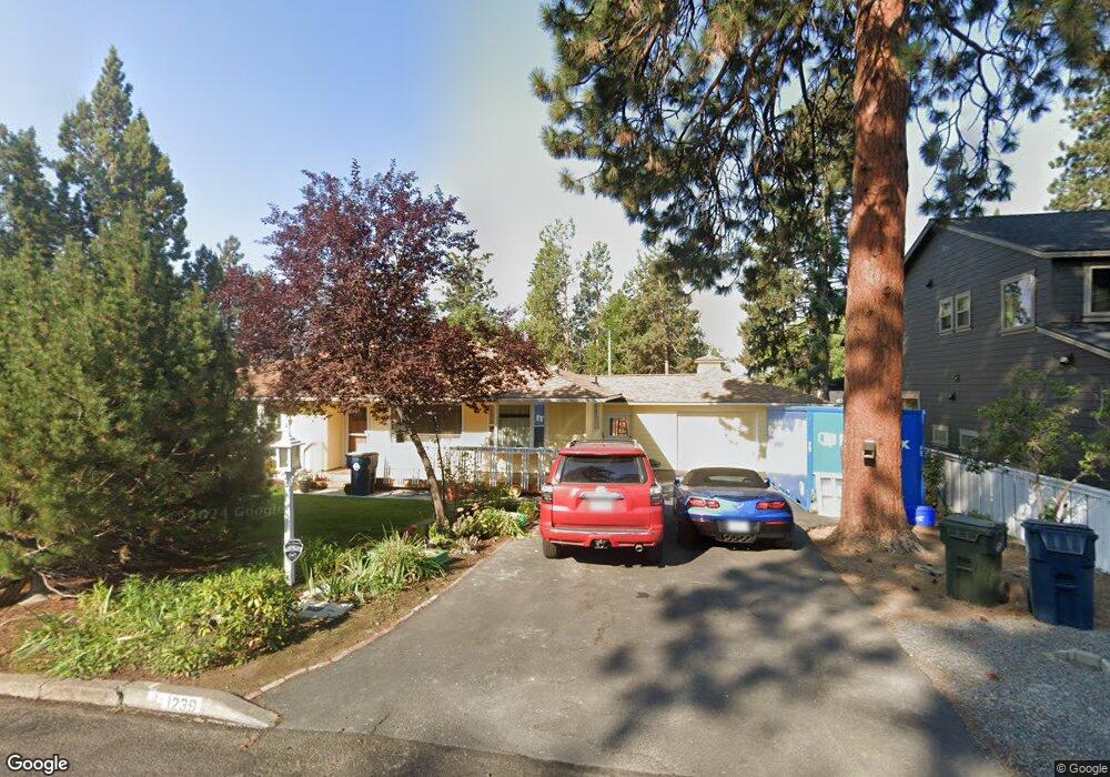
1239 NE 10th St Bend, OR 97701
Orchard District NeighborhoodEstimated Value: $639,000 - $704,000
2
Beds
1
Bath
1,358
Sq Ft
$485/Sq Ft
Est. Value
About This Home
This home is located at 1239 NE 10th St, Bend, OR 97701 and is currently estimated at $658,985, approximately $485 per square foot. 1239 NE 10th St is a home located in Deschutes County with nearby schools including Juniper Elementary School, Pilot Butte Middle School, and Bend Senior High School.
Ownership History
Date
Name
Owned For
Owner Type
Purchase Details
Closed on
May 15, 2009
Sold by
Parr Susie M
Bought by
Parr Susie M and Susie M Parr Revocable Trust
Current Estimated Value
Home Financials for this Owner
Home Financials are based on the most recent Mortgage that was taken out on this home.
Original Mortgage
$40,000
Interest Rate
4.82%
Mortgage Type
New Conventional
Purchase Details
Closed on
Oct 2, 2008
Sold by
Parr Susie M
Bought by
Parr Susie M and Susie M Parr Revocable Trust
Create a Home Valuation Report for This Property
The Home Valuation Report is an in-depth analysis detailing your home's value as well as a comparison with similar homes in the area
Home Values in the Area
Average Home Value in this Area
Purchase History
We collect this data history from publicly available records. To have your information removed, we recommend requesting removal directly through your county’s website.
| Date | Buyer | Sale Price | Title Company |
|---|---|---|---|
| Parr Susie M | -- | Accommodation | |
| Parr Susie M | -- | Accommodation | |
| Parr Susie M | -- | None Available |
Source: Public Records
Mortgage History
We collect this data history from publicly available records. To have your information removed, we recommend requesting removal directly through your county’s website.
| Date | Status | Borrower | Loan Amount |
|---|---|---|---|
| Closed | Parr Susie M | $40,000 |
Source: Public Records
Tax History
| Year | Tax Paid | Tax Assessment Tax Assessment Total Assessment is a certain percentage of the fair market value that is determined by local assessors to be the total taxable value of land and additions on the property. | Land | Improvement |
|---|---|---|---|---|
| 2025 | $3,732 | $220,880 | -- | -- |
| 2024 | $3,591 | $214,450 | -- | -- |
| 2023 | $3,329 | $208,210 | $0 | $0 |
| 2022 | $3,106 | $196,270 | $0 | $0 |
| 2021 | $3,110 | $190,560 | $0 | $0 |
| 2020 | $2,951 | $190,560 | $0 | $0 |
| 2019 | $2,869 | $185,010 | $0 | $0 |
| 2018 | $2,788 | $179,630 | $0 | $0 |
| 2017 | $2,706 | $174,400 | $0 | $0 |
| 2016 | $2,581 | $169,330 | $0 | $0 |
| 2015 | $2,509 | $164,400 | $0 | $0 |
| 2014 | $2,435 | $159,620 | $0 | $0 |
Source: Public Records
Map
Nearby Homes
- 1401 NE 10th St
- 1334 NE 8th St
- 920 NE Norton Ave Unit Lot 2
- 980 NE Norton Ave Unit Lot 8
- 1532 NE 9th St
- 637 NE Marshall Ave
- 924 NE 9th St
- 633 NE Marshall Ave
- 644 NE Norton Ave Unit 1 and 2
- 649 NE Kearney Ave
- 566 NE Lafayette Ave Unit 1
- 558 NE Lafayette Ave
- 758 NE Quimby Ave
- 714 NE 10th St
- 1602 NE 5th St
- 608 NE 10th St
- 1440 NE 4th
- 429 NE Irving Ave
- 642 NE Seward Ave
- 438 NE 9th St
- 1257 NE 10th St
- 1267 NE 10th St
- 1223 NE 10th St
- 1238 NE 9th St
- 1275 NE 10th St
- 1258 NE 10th St
- 1216 NE 9th St
- 1260 NE 9th St
- 1207 NE 10th St
- 1204 NE 9th St
- 1224 NE 10th St
- 1262 NE 10th St
- 1307 NE 10th St
- 1016 NE Lafayette Ave
- 1239 NE 11th St
- 1223 NE 11th St
- 1314 NE 9th St
- 1316 NE 10th St
- 1155 NE 10th St
- 1261 NE 11th St
Your Personal Tour Guide
Ask me questions while you tour the home.