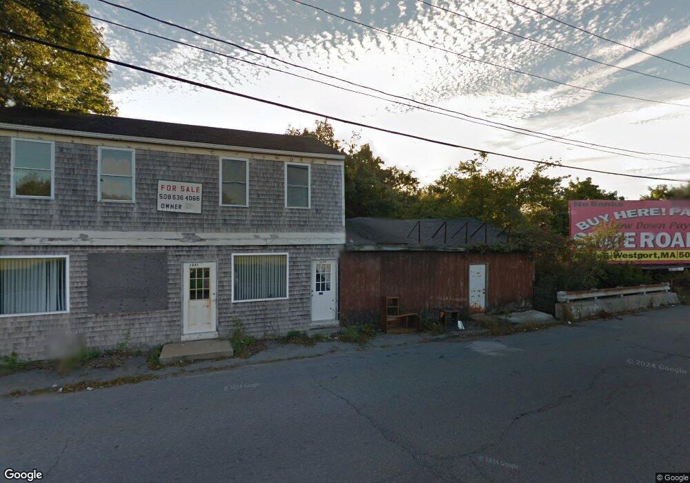
1239 State Rd Unit 1241 Westport, MA 02790
North Westport NeighborhoodEstimated Value: $313,000 - $452,000
Studio
--
Bath
1,768
Sq Ft
$220/Sq Ft
Est. Value
About This Home
This home is located at 1239 State Rd Unit 1241, Westport, MA 02790 and is currently estimated at $389,587, approximately $220 per square foot. 1239 State Rd Unit 1241 is a home located in Bristol County with nearby schools including Alice A. Macomber Primary School, Westport Elementary School, and Westport Middle-High School.
Ownership History
Date
Name
Owned For
Owner Type
Purchase Details
Closed on
Mar 29, 2022
Sold by
Heroux Charles E
Bought by
Simmons Christopher
Current Estimated Value
Home Financials for this Owner
Home Financials are based on the most recent Mortgage that was taken out on this home.
Original Mortgage
$100,000
Outstanding Balance
$93,014
Interest Rate
3.69%
Mortgage Type
Purchase Money Mortgage
Estimated Equity
$296,573
Purchase Details
Closed on
Aug 23, 1990
Sold by
Vieira Lauriana
Bought by
Herous Charles E
Home Financials for this Owner
Home Financials are based on the most recent Mortgage that was taken out on this home.
Original Mortgage
$38,000
Interest Rate
10.01%
Mortgage Type
Purchase Money Mortgage
Create a Home Valuation Report for This Property
The Home Valuation Report is an in-depth analysis detailing your home's value as well as a comparison with similar homes in the area
Home Values in the Area
Average Home Value in this Area
Purchase History
| Date | Buyer | Sale Price | Title Company |
|---|---|---|---|
| Simmons Christopher | $140,000 | None Available | |
| Herous Charles E | $34,250 | -- |
Source: Public Records
Mortgage History
| Date | Status | Borrower | Loan Amount |
|---|---|---|---|
| Open | Simmons Christopher | $100,000 | |
| Previous Owner | Herous Charles E | $30,000 | |
| Previous Owner | Herous Charles E | $110,000 | |
| Previous Owner | Herous Charles E | $38,000 |
Source: Public Records
Tax History
| Year | Tax Paid | Tax Assessment Tax Assessment Total Assessment is a certain percentage of the fair market value that is determined by local assessors to be the total taxable value of land and additions on the property. | Land | Improvement |
|---|---|---|---|---|
| 2025 | $1,361 | $182,700 | $131,100 | $51,600 |
| 2024 | $1,335 | $172,700 | $121,500 | $51,200 |
| 2023 | $1,279 | $156,700 | $103,500 | $53,200 |
| 2022 | $1,339 | $164,700 | $103,500 | $61,200 |
| 2021 | $1,339 | $155,300 | $94,100 | $61,200 |
| 2020 | $1,277 | $151,500 | $90,300 | $61,200 |
| 2019 | $1,274 | $154,000 | $95,700 | $58,300 |
| 2018 | $1,415 | $173,200 | $114,000 | $59,200 |
| 2017 | $1,373 | $172,300 | $114,000 | $58,300 |
| 2016 | $1,374 | $173,700 | $114,000 | $59,700 |
| 2015 | $1,321 | $166,600 | $114,000 | $52,600 |
Source: Public Records
Map
Nearby Homes
- 3 Roller Coaster Way Unit Lot 1
- 162 Reed Rd
- 2 Winterberry Ln
- 2 Fieldstone Dr
- 588 Gifford Rd
- 21 Evergreen St
- 818 Reed Rd
- 15 S Breault St
- 441 Old County Rd
- 565 Highland Ave
- 0 American Legion Hwy Unit 73473517
- 16 Lenox Ave
- 2 Van Buren St
- 13 3rd Ave
- 4 Main Rd
- 116 Gifford Rd
- Lot 6 Rafael Rd
- 45 Marcotte Unit Lot 7
- 11 Marcotte Dr Unit Lot 2
- 19 Charles Joseph Dr
- 0 Beeden Rd
- 1246 American Legion Hwy Unit 1248
- 1223 State Rd
- 3 Beeden Rd
- 3 Beeden Rd Unit B
- 3 Beeden Rd Unit A
- 9 Beeden Rd Unit 11
- 9 Beeden Rd Unit 1
- 1245 American Legion Hwy
- 11 Beeden Rd Unit 1
- 11 Beeden Rd
- 13 Beeden Rd
- 9 Union Ave
- 1241 American Legion Hwy
- 15 Beeden Rd Unit 17
- 15 Beeden Rd Unit 2
- 15 Union Ave
- 19 Union Ave
- 2 Rose Ave
- 19 Beeden Rd
Your Personal Tour Guide
Ask me questions while you tour the home.