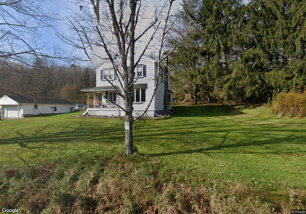
1239 State Route 29 Hwy Hunlock Creek, PA 18621
Estimated Value: $264,246 - $370,000
--
Bed
--
Bath
1,548
Sq Ft
$213/Sq Ft
Est. Value
About This Home
This home is located at 1239 State Route 29 Hwy, Hunlock Creek, PA 18621 and is currently estimated at $329,562, approximately $212 per square foot. 1239 State Route 29 Hwy is a home.
Ownership History
Date
Name
Owned For
Owner Type
Purchase Details
Closed on
Oct 9, 2018
Sold by
Wall Bradley J and Wall Amy J
Bought by
Dennis Marcia S and Coimbra Ariel
Current Estimated Value
Home Financials for this Owner
Home Financials are based on the most recent Mortgage that was taken out on this home.
Original Mortgage
$162,011
Outstanding Balance
$141,283
Interest Rate
4.5%
Mortgage Type
FHA
Estimated Equity
$188,279
Purchase Details
Closed on
Jul 29, 2005
Sold by
Achuff Audrey J
Bought by
Wall Bradley J and Wall Amy J
Home Financials for this Owner
Home Financials are based on the most recent Mortgage that was taken out on this home.
Original Mortgage
$130,000
Interest Rate
5.67%
Mortgage Type
New Conventional
Purchase Details
Closed on
May 23, 2005
Sold by
Edwards Dale G and Edwards Brenda
Bought by
Achuff Audrey J
Create a Home Valuation Report for This Property
The Home Valuation Report is an in-depth analysis detailing your home's value as well as a comparison with similar homes in the area
Home Values in the Area
Average Home Value in this Area
Purchase History
| Date | Buyer | Sale Price | Title Company |
|---|---|---|---|
| Dennis Marcia S | $165,000 | Centurion Abstract Inc | |
| Wall Bradley J | $145,000 | None Available | |
| Achuff Audrey J | -- | None Available |
Source: Public Records
Mortgage History
| Date | Status | Borrower | Loan Amount |
|---|---|---|---|
| Open | Dennis Marcia S | $162,011 | |
| Previous Owner | Wall Bradley J | $130,000 |
Source: Public Records
Tax History Compared to Growth
Tax History
| Year | Tax Paid | Tax Assessment Tax Assessment Total Assessment is a certain percentage of the fair market value that is determined by local assessors to be the total taxable value of land and additions on the property. | Land | Improvement |
|---|---|---|---|---|
| 2025 | $2,842 | $151,600 | $48,400 | $103,200 |
| 2024 | $2,846 | $151,600 | $48,400 | $103,200 |
| 2023 | $2,845 | $151,600 | $48,400 | $103,200 |
| 2022 | $2,817 | $151,600 | $48,400 | $103,200 |
| 2021 | $2,766 | $151,600 | $48,400 | $103,200 |
| 2020 | $2,766 | $151,600 | $48,400 | $103,200 |
| 2019 | $2,655 | $151,600 | $48,400 | $103,200 |
| 2018 | $2,589 | $151,600 | $48,400 | $103,200 |
| 2017 | $2,540 | $151,600 | $48,400 | $103,200 |
| 2016 | -- | $151,600 | $48,400 | $103,200 |
| 2015 | -- | $151,600 | $48,400 | $103,200 |
| 2014 | -- | $151,600 | $48,400 | $103,200 |
Source: Public Records
Map
Nearby Homes
- 2056 Pennsylvania 118
- 983 Swamp Rd
- 15 Pearl St
- 102 Lakeview Dr
- 0 Sunnyside Dr
- 141 Sayre Rd
- 0 Beech St
- 41 Northview Ave
- 641 Sorbertown Hill Rd
- 1011 Mill St
- 33 Dudley Street Harveys Lake Pennsylvania St
- 222 Noble St
- 2 Noble St
- 1B & C Hayfield Rd
- 14 May Ave
- 356 Old Tavern Rd
- 86 Baird St
- 2633 Lakeside Dr
- 4647 Memorial Hwy
- 127 White Oak Dr
- 2376 Pennsylvania 118
- 2427 State Route 118
- 2453 State Route 118
- 5937 Main Rd
- 5937 Main Rd
- 2378 Pennsylvania 118
- 1406 Pennsylvania 29
- 1409 State Route 29 Hwy
- 5929 Main Rd
- 5928 Main Rd
- 0 Rt 29 & Rt 118
- 1405 State Route 29 Hwy
- 2406 State Route 118
- 1419 State Route 29 Hwy
- 1412 State Route 29 Hwy
- 2311 Pennsylvania 118
- 2416 State Route 118
- 2311 State Route 118
- 5906 Main Rd
- 5906 Main Rd