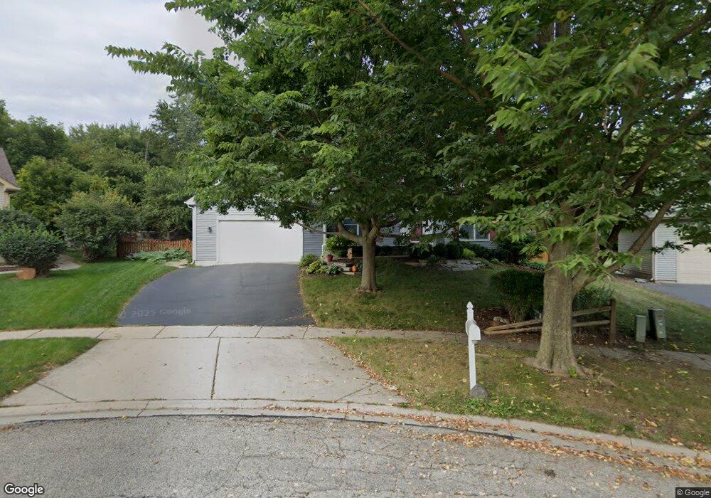
1239 Thatcher Trail West Dundee, IL 60118
Estimated Value: $437,525 - $511,000
4
Beds
--
Bath
2,346
Sq Ft
$200/Sq Ft
Est. Value
About This Home
This home is located at 1239 Thatcher Trail, West Dundee, IL 60118 and is currently estimated at $468,381, approximately $199 per square foot. 1239 Thatcher Trail is a home located in Kane County with nearby schools including Dundee Highlands Elementary School, Dundee Middle School, and West Prairie Middle School.
Ownership History
Date
Name
Owned For
Owner Type
Purchase Details
Closed on
Mar 26, 1999
Sold by
Forrester Susan M
Bought by
Mcgreer Matthew P and Mcgreer Diane L
Current Estimated Value
Home Financials for this Owner
Home Financials are based on the most recent Mortgage that was taken out on this home.
Original Mortgage
$170,000
Outstanding Balance
$42,510
Interest Rate
6.89%
Estimated Equity
$425,871
Purchase Details
Closed on
Feb 20, 1996
Sold by
Harris Bank Barrington
Bought by
Forrester Susan M
Home Financials for this Owner
Home Financials are based on the most recent Mortgage that was taken out on this home.
Original Mortgage
$19,600
Interest Rate
7.06%
Purchase Details
Closed on
Oct 11, 1995
Sold by
The Hills Of Dundee Joint Venture
Bought by
Windsor Development Corp
Create a Home Valuation Report for This Property
The Home Valuation Report is an in-depth analysis detailing your home's value as well as a comparison with similar homes in the area
Home Values in the Area
Average Home Value in this Area
Purchase History
| Date | Buyer | Sale Price | Title Company |
|---|---|---|---|
| Mcgreer Matthew P | $226,000 | Republic Title | |
| Forrester Susan M | $218,000 | Chicago Title Insurance Co | |
| Windsor Development Corp | $34,000 | Chicago Title Insurance Co |
Source: Public Records
Mortgage History
| Date | Status | Borrower | Loan Amount |
|---|---|---|---|
| Open | Mcgreer Matthew P | $170,000 | |
| Previous Owner | Forrester Susan M | $19,600 |
Source: Public Records
Tax History Compared to Growth
Tax History
| Year | Tax Paid | Tax Assessment Tax Assessment Total Assessment is a certain percentage of the fair market value that is determined by local assessors to be the total taxable value of land and additions on the property. | Land | Improvement |
|---|---|---|---|---|
| 2024 | $9,601 | $125,783 | $28,016 | $97,767 |
| 2023 | $9,000 | $113,175 | $25,208 | $87,967 |
| 2022 | $8,854 | $106,495 | $25,208 | $81,287 |
| 2021 | $8,544 | $100,552 | $23,801 | $76,751 |
| 2020 | $8,386 | $98,291 | $23,266 | $75,025 |
| 2019 | $8,116 | $93,309 | $22,087 | $71,222 |
| 2018 | $8,453 | $94,634 | $21,650 | $72,984 |
| 2017 | $8,051 | $88,526 | $20,253 | $68,273 |
| 2016 | $7,929 | $83,025 | $23,811 | $59,214 |
| 2015 | -- | $77,797 | $22,312 | $55,485 |
| 2014 | -- | $75,649 | $21,696 | $53,953 |
| 2013 | -- | $77,964 | $22,360 | $55,604 |
Source: Public Records
Map
Nearby Homes
- Marianne Plan at Hickory Glen
- Charlotte Plan at Hickory Glen
- 1023 Shagbark Ln
- 1031 Shagbark Ln
- 812 Lindsay Ln
- 822 Lindsay Ln
- 814 Lindsay Ln
- 816 Lindsay Ln
- 813 Lindsay Ln
- 825 Lindsay Ln
- 818 Lindsay Ln
- 1601 Higgins Rd
- 1715 W Main St
- 36W461 Binnie Rd
- 215 Sharon Dr
- 17N448 Il Route 31
- 36W340 Huntley Rd
- 325 Sharon Dr
- 2742 Connolly Ln
- 1 S Lincoln Ave
- 1227 Thatcher Trail
- 1245 Thatcher Trail Unit 2
- 1215 Thatcher Trail
- 1236 Thatcher Trail Unit 2
- 35W721 Huntley Rd
- 1201 Thatcher Trail
- 1218 Thatcher Trail Unit 2
- 2183 Hamilton Dr
- 1224 Thatcher Trail
- 1365 Westley Ln
- 1160 Pember Cir Unit 2
- 1355 Westley Ln
- 1157 Thatcher Trail Unit 2
- 2191 Hamilton Dr
- 2175 Hamilton Dr
- 000 Huntley Rd
- 1152 Pember Cir Unit 2
- 2377 Preston Ln
- 1375 Westley Ln
- 1335 Westley Ln