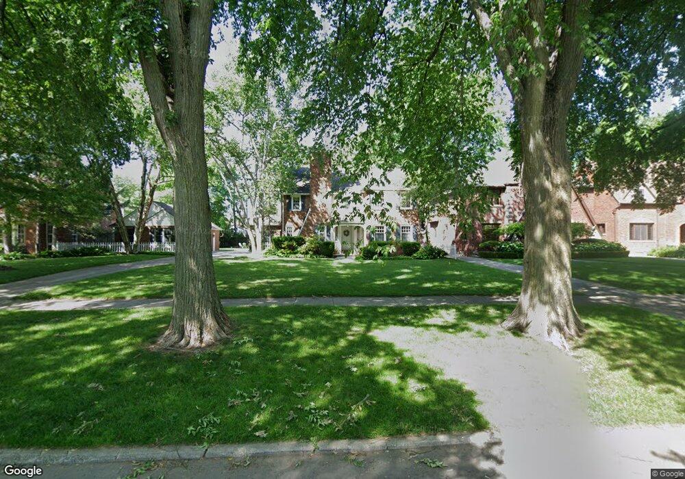
1239 Whittier Rd Grosse Pointe Park, MI 48230
Estimated Value: $655,000 - $708,000
Studio
1
Bath
2,621
Sq Ft
$263/Sq Ft
Est. Value
About This Home
This home is located at 1239 Whittier Rd, Grosse Pointe Park, MI 48230 and is currently estimated at $689,638, approximately $263 per square foot. 1239 Whittier Rd is a home located in Wayne County with nearby schools including George Defer Elementary School, Pierce Middle School, and Grosse Pointe South High School.
Ownership History
Date
Name
Owned For
Owner Type
Purchase Details
Closed on
May 27, 1997
Sold by
Dana S and Heston David D
Bought by
Christopher A and Lewandowski Jeanne G
Current Estimated Value
Create a Home Valuation Report for This Property
The Home Valuation Report is an in-depth analysis detailing your home's value as well as a comparison with similar homes in the area
Home Values in the Area
Average Home Value in this Area
Purchase History
| Date | Buyer | Sale Price | Title Company |
|---|---|---|---|
| Christopher A | $359,500 | -- |
Source: Public Records
Tax History
| Year | Tax Paid | Tax Assessment Tax Assessment Total Assessment is a certain percentage of the fair market value that is determined by local assessors to be the total taxable value of land and additions on the property. | Land | Improvement |
|---|---|---|---|---|
| 2025 | $6,990 | $352,700 | $0 | $0 |
| 2024 | $6,728 | $396,400 | $0 | $0 |
| 2023 | $6,425 | $366,700 | $0 | $0 |
| 2022 | $6,104 | $343,500 | $0 | $0 |
| 2021 | $12,036 | $337,300 | $0 | $0 |
| 2019 | $12,386 | $309,000 | $0 | $0 |
| 2018 | $5,820 | $277,100 | $0 | $0 |
| 2017 | $12,797 | $182,700 | $0 | $0 |
| 2016 | $12,047 | $259,900 | $0 | $0 |
| 2015 | $21,781 | $255,500 | $0 | $0 |
| 2013 | $21,100 | $214,800 | $0 | $0 |
| 2012 | $5,949 | $225,800 | $77,200 | $148,600 |
Source: Public Records
Map
Nearby Homes
- 1264 Bishop Rd
- 612 Cadieux Rd
- 781 Loraine St
- 3430 Bedford St
- 1030 Bishop Rd
- 3520 Audubon Rd
- 3460 Bedford St
- 775 Notre Dame St
- 3482 Grayton St
- 25 Village Ln
- 30 Cranford Ln
- 47 Cranford Ln
- 42 Cranford Ln
- 1206 Balfour St
- 3690 Three Mile Dr
- 3675 Bedford St
- 3829 Harvard Rd
- 516 Neff Ln
- 3921 Three Mile Dr
- 3808 Cadieux Rd
- 1245 Whittier Rd
- 1251 Whittier Rd
- 1227 Whittier Rd
- 1257 Whittier Rd
- 1221 Whittier Rd
- 1238 Audubon Rd
- 1234 Audubon Rd
- 1250 Audubon Rd
- 1226 Audubon Rd
- 1215 Whittier Rd
- 1256 Audubon Rd
- 1220 Audubon Rd
- 1263 Whittier Rd
- 1238 Whittier Rd
- 1232 Whittier Rd
- 1244 Whittier Rd
- 1209 Whittier Rd
- 1262 Audubon Rd
- 1214 Audubon Rd
- 1250 Whittier Rd
Your Personal Tour Guide
Ask me questions while you tour the home.