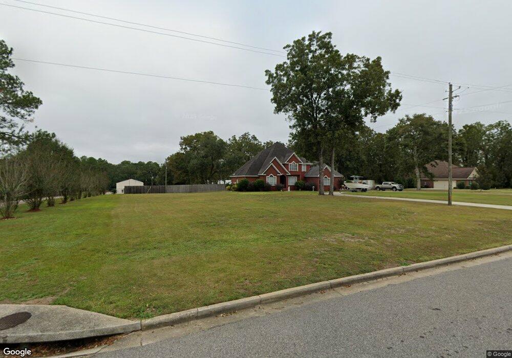
12390 Airport Blvd Mobile, AL 36608
Outer West Mobile NeighborhoodEstimated Value: $615,919
4
Beds
4
Baths
3,860
Sq Ft
$160/Sq Ft
Est. Value
About This Home
This home is located at 12390 Airport Blvd, Mobile, AL 36608 and is currently estimated at $615,919, approximately $159 per square foot. 12390 Airport Blvd is a home located in Mobile County with nearby schools including Taylor White Elementary School, Bernice J Causey Middle School, and Baker High School.
Ownership History
Date
Name
Owned For
Owner Type
Purchase Details
Closed on
Nov 29, 2023
Sold by
Thornton Christopher and Thornton Carolyn B
Bought by
C Thornton Inc
Current Estimated Value
Purchase Details
Closed on
Mar 10, 2017
Sold by
Thornton Christopher and Thornton Carolyn B
Bought by
Evans William N and Evans Toni R
Home Financials for this Owner
Home Financials are based on the most recent Mortgage that was taken out on this home.
Original Mortgage
$349,900
Interest Rate
4.19%
Mortgage Type
VA
Purchase Details
Closed on
Aug 4, 2014
Sold by
C Thornton Inc
Bought by
C Thornton Inc
Create a Home Valuation Report for This Property
The Home Valuation Report is an in-depth analysis detailing your home's value as well as a comparison with similar homes in the area
Home Values in the Area
Average Home Value in this Area
Purchase History
| Date | Buyer | Sale Price | Title Company |
|---|---|---|---|
| C Thornton Inc | $208,500 | None Listed On Document | |
| Evans William N | $349,900 | None Available | |
| C Thornton Inc | -- | None Available |
Source: Public Records
Mortgage History
| Date | Status | Borrower | Loan Amount |
|---|---|---|---|
| Previous Owner | Evans William N | $349,900 |
Source: Public Records
Tax History Compared to Growth
Tax History
| Year | Tax Paid | Tax Assessment Tax Assessment Total Assessment is a certain percentage of the fair market value that is determined by local assessors to be the total taxable value of land and additions on the property. | Land | Improvement |
|---|---|---|---|---|
| 2024 | $5,271 | $105,800 | $50,540 | $55,260 |
| 2023 | $5,271 | $86,680 | $50,540 | $36,140 |
| 2022 | $4,185 | $86,280 | $50,140 | $36,140 |
| 2021 | $2,531 | $52,180 | $16,040 | $36,140 |
| 2020 | $2,531 | $52,180 | $16,040 | $36,140 |
| 2019 | $2,020 | $20,820 | $8,020 | $12,800 |
| 2018 | $2,020 | $41,640 | $0 | $0 |
| 2017 | $2,164 | $43,180 | $0 | $0 |
| 2016 | $2,139 | $44,100 | $0 | $0 |
| 2013 | $1,385 | $27,240 | $0 | $0 |
Source: Public Records
Map
Nearby Homes
- 2760 Wildflower Dr W
- 12171 Yancey Glen Dr
- 0 Busby Rd
- 11920 Ives Ln
- 0 Newman Rd Unit 7670125
- 0 Newman Rd Unit 7652668
- 0 Newman Rd Unit 7559711
- 0 Newman Rd Unit 7559708
- 0 Newman Rd Unit 7559706
- 0 Newman Rd Unit 7559705
- 0 Newman Rd Unit 7559703
- 0 Newman Rd Unit 22348697
- 0 Newman Rd Unit 22348691
- 0 Newman Rd Unit 21040182
- 0 Newman Rd Unit 21040073
- 0 Newman Rd Unit 13 20683522
- 0 Newman Rd Unit 7499863
- 0 Newman Rd Unit 7493775
- 0 Newman Rd Unit 7427944
- 0 Newman Rd Unit 3 365680
- 12388 Airport Blvd
- 12370 Airport Blvd
- 12400 Airport Blvd
- 12400 Airport Blvd
- 12371 Airport Blvd
- 12405 Airport Blvd
- 12430 Airport Blvd
- 12300 Airport Blvd
- 12439 Airport Blvd
- 12289 Airport Blvd Unit 1,2,3
- 12289 Airport Blvd Unit 1
- 12289 Airport Blvd
- 12278 Yancey Glen Dr Unit 20
- 12278 Yancey Glen Dr Unit 19
- 12278 Yancey Glen Dr
- 2731 Wildflower Dr W
- 2741 Wildflower Dr W
- 12279 Yancey Glen Dr
- 12741 Wildflower Dr W
- 12411 Wildflower Dr W