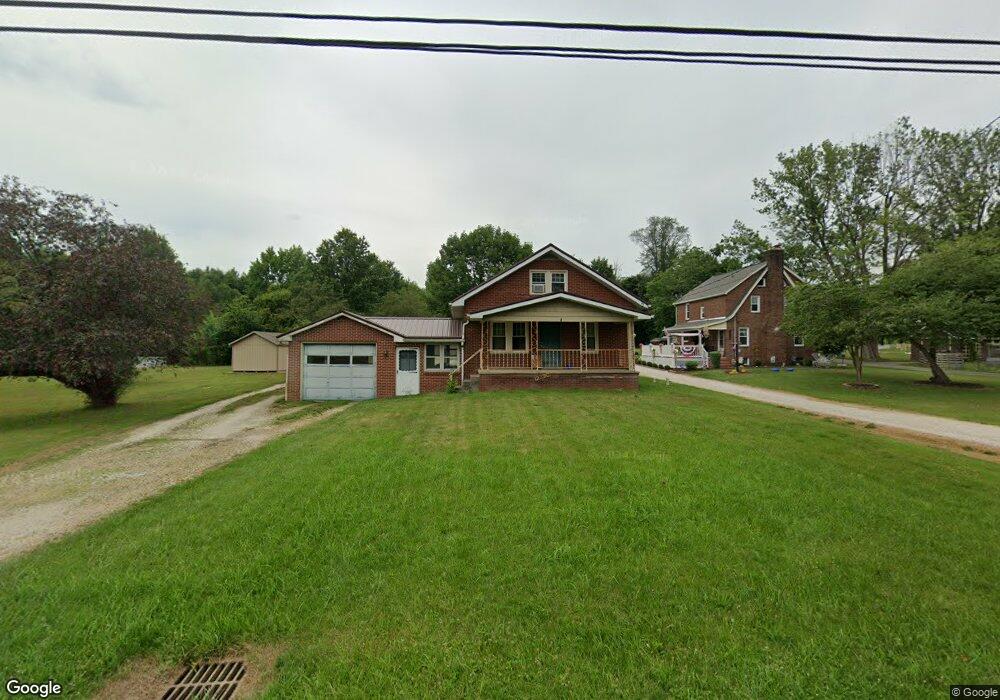
12390 Beeson St NE Alliance, OH 44601
Estimated Value: $149,000 - $182,182
3
Beds
1
Bath
1,224
Sq Ft
$132/Sq Ft
Est. Value
About This Home
This home is located at 12390 Beeson St NE, Alliance, OH 44601 and is currently estimated at $161,046, approximately $131 per square foot. 12390 Beeson St NE is a home located in Stark County with nearby schools including Marlington High School and Regina Coeli/St Joseph School.
Ownership History
Date
Name
Owned For
Owner Type
Purchase Details
Closed on
Apr 13, 2010
Sold by
Good Bye Properties Ltd
Bought by
Stollings Colleen M
Current Estimated Value
Home Financials for this Owner
Home Financials are based on the most recent Mortgage that was taken out on this home.
Original Mortgage
$70,000
Outstanding Balance
$46,853
Interest Rate
5.1%
Mortgage Type
Seller Take Back
Estimated Equity
$114,193
Purchase Details
Closed on
Feb 15, 2010
Sold by
Us Bank National Association
Bought by
Good Bye Properties Ltd
Home Financials for this Owner
Home Financials are based on the most recent Mortgage that was taken out on this home.
Original Mortgage
$70,000
Outstanding Balance
$46,853
Interest Rate
5.1%
Mortgage Type
Seller Take Back
Estimated Equity
$114,193
Purchase Details
Closed on
Oct 6, 2009
Sold by
Ritch Richard E
Bought by
Us Bank National Association
Purchase Details
Closed on
Sep 15, 2005
Sold by
Mason Heath D
Bought by
Ritch Richard E and Ritch Crystal L
Home Financials for this Owner
Home Financials are based on the most recent Mortgage that was taken out on this home.
Original Mortgage
$76,800
Interest Rate
8.64%
Mortgage Type
Fannie Mae Freddie Mac
Purchase Details
Closed on
Mar 25, 1999
Sold by
Roberts Robert K and Manypenny Jessie M
Bought by
Mason Heath D
Home Financials for this Owner
Home Financials are based on the most recent Mortgage that was taken out on this home.
Original Mortgage
$25,000
Interest Rate
6.85%
Purchase Details
Closed on
Sep 4, 1996
Sold by
Mudrick Stephen E
Bought by
Roberts Robert K and Manypenny Jessie M
Home Financials for this Owner
Home Financials are based on the most recent Mortgage that was taken out on this home.
Original Mortgage
$75,120
Interest Rate
8.27%
Mortgage Type
New Conventional
Create a Home Valuation Report for This Property
The Home Valuation Report is an in-depth analysis detailing your home's value as well as a comparison with similar homes in the area
Home Values in the Area
Average Home Value in this Area
Purchase History
| Date | Buyer | Sale Price | Title Company |
|---|---|---|---|
| Stollings Colleen M | $80,300 | Attorney | |
| Good Bye Properties Ltd | $35,000 | None Available | |
| Us Bank National Association | $62,000 | None Available | |
| Ritch Richard E | $96,000 | Americas Choice Title Agency | |
| Mason Heath D | $100,000 | -- | |
| Roberts Robert K | $93,900 | -- |
Source: Public Records
Mortgage History
| Date | Status | Borrower | Loan Amount |
|---|---|---|---|
| Open | Stollings Colleen M | $70,000 | |
| Previous Owner | Ritch Richard E | $76,800 | |
| Previous Owner | Mason Heath D | $25,000 | |
| Previous Owner | Roberts Robert K | $75,120 |
Source: Public Records
Tax History Compared to Growth
Tax History
| Year | Tax Paid | Tax Assessment Tax Assessment Total Assessment is a certain percentage of the fair market value that is determined by local assessors to be the total taxable value of land and additions on the property. | Land | Improvement |
|---|---|---|---|---|
| 2025 | -- | $36,260 | $11,340 | $24,920 |
| 2024 | -- | $36,260 | $11,340 | $24,920 |
| 2023 | $1,238 | $35,080 | $10,540 | $24,540 |
| 2022 | $1,242 | $35,080 | $10,540 | $24,540 |
| 2021 | $1,246 | $35,080 | $10,540 | $24,540 |
| 2020 | $1,175 | $29,470 | $9,100 | $20,370 |
| 2019 | $1,167 | $29,480 | $9,100 | $20,380 |
| 2018 | $1,169 | $29,480 | $9,100 | $20,380 |
| 2017 | $1,811 | $26,330 | $6,760 | $19,570 |
| 2016 | $1,763 | $27,910 | $6,760 | $21,150 |
| 2015 | $1,184 | $27,910 | $6,760 | $21,150 |
| 2014 | $1,146 | $25,910 | $6,270 | $19,640 |
| 2013 | $570 | $25,910 | $6,270 | $19,640 |
Source: Public Records
Map
Nearby Homes
- 10666 Wilma Ave NE
- 13334 Cindy St NE
- 0 Meadow St NE
- 1430 Westwood Ave
- 0 W Main St Unit 5090123
- 12355 Edison St NE
- 11960 Freshley Ave NE
- 11480 Aebi Ave NE
- 2081 Marwood Cir
- 2377 Ansley St Unit 2377
- 13109 Edison St NE
- 0 Reeder Ave NE
- 12252 Snode St NE
- 000 Klinger Ave
- 12415 Snode St NE
- 2851 Patriots Path Unit 3D
- 432 Johnson Ave
- 0 Klinger Ave NE
- 2435 Queensbury Rd
- 1201 Overlook Dr
- 12414 Beeson St NE
- 12366 Beeson St NE
- 10533 Dot Ave NE
- 10530 Dot Ave NE
- 10545 Dot Ave NE
- 10544 Dot Ave NE
- 12464 Beeson St NE
- 10567 Dot Ave NE
- 10533 Barcus Ave NE
- 10570 Dot Ave NE
- 10545 Barcus Ave NE
- 10585 Dot Ave NE
- 12488 Beeson St NE
- 10588 Dot Ave NE
- 10567 Barcus Ave NE
- 12280 Beeson St NE
- 10605 Dot Ave NE
- 10585 Barcus Ave NE
- 10530 Barcus Ave NE
- 10606 Dot Ave NE