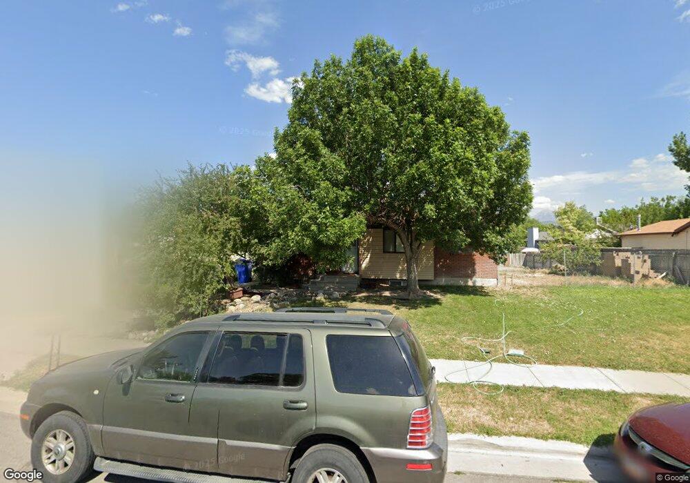
12393 S 1510 W Riverton, UT 84065
Estimated Value: $489,000 - $568,000
4
Beds
2
Baths
2,026
Sq Ft
$262/Sq Ft
Est. Value
About This Home
This home is located at 12393 S 1510 W, Riverton, UT 84065 and is currently estimated at $530,009, approximately $261 per square foot. 12393 S 1510 W is a home located in Salt Lake County with nearby schools including Rosamond Elementary School, Oquirrh Hills Middle School, and Riverton High School.
Ownership History
Date
Name
Owned For
Owner Type
Purchase Details
Closed on
Feb 8, 2005
Sold by
Monk Doyle L and Monk Sue E
Bought by
Monk Doyle L and Monk Sue E
Current Estimated Value
Purchase Details
Closed on
Jul 9, 2004
Sold by
Boop Maria J and Boop John D
Bought by
Monk Doyle L and Monk Sue E
Purchase Details
Closed on
Jun 10, 2002
Sold by
Boop John D and Boop Maria J
Bought by
Boop John D and Boop Maria J
Home Financials for this Owner
Home Financials are based on the most recent Mortgage that was taken out on this home.
Original Mortgage
$106,000
Interest Rate
6.74%
Purchase Details
Closed on
Dec 16, 1997
Sold by
Stevens David H and Stevens Carol S
Bought by
Boop John D and Boop Maria J
Home Financials for this Owner
Home Financials are based on the most recent Mortgage that was taken out on this home.
Original Mortgage
$100,400
Interest Rate
7.23%
Create a Home Valuation Report for This Property
The Home Valuation Report is an in-depth analysis detailing your home's value as well as a comparison with similar homes in the area
Home Values in the Area
Average Home Value in this Area
Purchase History
| Date | Buyer | Sale Price | Title Company |
|---|---|---|---|
| Monk Doyle L | -- | -- | |
| Monk Doyle L | -- | Surety Title | |
| Boop John D | -- | Meridian Title | |
| Boop John D | -- | -- |
Source: Public Records
Mortgage History
| Date | Status | Borrower | Loan Amount |
|---|---|---|---|
| Previous Owner | Boop John D | $106,000 | |
| Previous Owner | Boop John D | $100,400 | |
| Closed | Boop John D | $25,100 |
Source: Public Records
Tax History Compared to Growth
Tax History
| Year | Tax Paid | Tax Assessment Tax Assessment Total Assessment is a certain percentage of the fair market value that is determined by local assessors to be the total taxable value of land and additions on the property. | Land | Improvement |
|---|---|---|---|---|
| 2025 | $2,700 | $475,600 | $213,100 | $262,500 |
| 2024 | $2,700 | $467,300 | $209,200 | $258,100 |
| 2023 | $2,621 | $427,700 | $193,700 | $234,000 |
| 2022 | $2,737 | $438,100 | $189,900 | $248,200 |
| 2021 | $2,357 | $335,900 | $142,400 | $193,500 |
| 2020 | $2,187 | $290,600 | $127,700 | $162,900 |
| 2019 | $2,195 | $286,700 | $116,100 | $170,600 |
| 2018 | $2,069 | $266,100 | $116,100 | $150,000 |
| 2017 | $1,974 | $247,400 | $116,100 | $131,300 |
| 2016 | $1,893 | $227,700 | $105,100 | $122,600 |
| 2015 | $1,903 | $221,900 | $106,900 | $115,000 |
| 2014 | $1,837 | $210,000 | $101,900 | $108,100 |
Source: Public Records
Map
Nearby Homes
- 12294 S 1490 W
- 1056 W Kate Springs Ln S Unit 10
- 12392 S 1300 W
- 1373 W Stewart Falls Dr
- 1371 W Stewart Falls Dr
- 12345 S Redwood Rd
- 12325 S Redwood Rd
- 12317 S Redwood Rd
- 12216 S 1300 W
- 1661 W Madison View Dr
- 1410 W 12115 S
- 1233 W 12500 S
- 1560 W 12730 S
- 12566 S Tithing Hill Dr
- 12736 S Mccartney Way Unit 104
- 1273 W Hendrix St Unit 145
- 1269 W Hendrix St Unit 146
- 1184 W Margaret Rose Dr
- 1259 W Moon Way Unit 134
- 12091 S Lampton View Dr
- 12405 S 1510 W
- 12379 S 1510 W
- 12394 S Harvest Ave
- 12394 Harvest Ave
- 12394 S 1450 W
- 12406 S 1450 W
- 12380 Harvest Ave
- 12406 Harvest Ave
- 12388 S 1510 W
- 12419 S 1510 W
- 12323 S Harvest Ave
- 12402 S 1510 W
- 12374 S 1510 W
- 12365 S 1510 W
- 12424 Harvest Ave
- 12424 S 1450 W
- 12412 S 1510 W
- 12364 Harvest Ave
- 12362 S 1510 W
- 12397 Harvest Ave