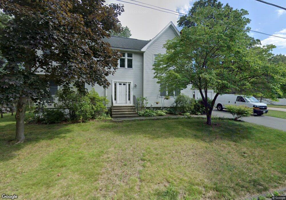
124 Daly Drive Extension Stoughton, MA 02072
Estimated Value: $683,000 - $870,000
4
Beds
3
Baths
2,905
Sq Ft
$262/Sq Ft
Est. Value
About This Home
This home is located at 124 Daly Drive Extension, Stoughton, MA 02072 and is currently estimated at $760,807, approximately $261 per square foot. 124 Daly Drive Extension is a home located in Norfolk County with nearby schools including South Elementary School, Dr. Robert G. O'Donnell Middle School, and Stoughton High School.
Ownership History
Date
Name
Owned For
Owner Type
Purchase Details
Closed on
Nov 30, 2000
Sold by
Doucette Michael S and Doucette Lisa A
Bought by
Leblanc Timothy T and Leblanc Audre M
Current Estimated Value
Home Financials for this Owner
Home Financials are based on the most recent Mortgage that was taken out on this home.
Original Mortgage
$189,600
Outstanding Balance
$70,171
Interest Rate
7.76%
Mortgage Type
Purchase Money Mortgage
Estimated Equity
$690,636
Create a Home Valuation Report for This Property
The Home Valuation Report is an in-depth analysis detailing your home's value as well as a comparison with similar homes in the area
Home Values in the Area
Average Home Value in this Area
Purchase History
| Date | Buyer | Sale Price | Title Company |
|---|---|---|---|
| Leblanc Timothy T | $237,000 | -- |
Source: Public Records
Mortgage History
| Date | Status | Borrower | Loan Amount |
|---|---|---|---|
| Open | Leblanc Timothy T | $189,600 | |
| Previous Owner | Leblanc Timothy T | $11,000 | |
| Previous Owner | Leblanc Timothy T | $94,000 |
Source: Public Records
Tax History Compared to Growth
Tax History
| Year | Tax Paid | Tax Assessment Tax Assessment Total Assessment is a certain percentage of the fair market value that is determined by local assessors to be the total taxable value of land and additions on the property. | Land | Improvement |
|---|---|---|---|---|
| 2025 | $8,267 | $667,800 | $231,000 | $436,800 |
| 2024 | $8,043 | $631,800 | $211,000 | $420,800 |
| 2023 | $7,912 | $583,900 | $192,800 | $391,100 |
| 2022 | $7,696 | $534,100 | $185,500 | $348,600 |
| 2021 | $7,420 | $491,400 | $163,700 | $327,700 |
| 2020 | $7,208 | $484,100 | $163,700 | $320,400 |
| 2019 | $7,150 | $466,100 | $163,700 | $302,400 |
| 2018 | $6,391 | $431,500 | $156,400 | $275,100 |
| 2017 | $6,154 | $424,700 | $154,600 | $270,100 |
| 2016 | $5,889 | $393,400 | $140,100 | $253,300 |
| 2015 | $5,842 | $386,100 | $132,800 | $253,300 |
| 2014 | $5,764 | $366,200 | $121,900 | $244,300 |
Source: Public Records
Map
Nearby Homes
- 114 Daly Drive Extension
- 72 Esten Rd
- 104 Daly Drive Extension
- 12 Mears Ln
- 2 Mears Ln
- 22 Mears Ln
- 2 Mears Ln
- 6 Davis Rd
- 138 Daly Drive Extension
- 62 Esten Rd
- 69 Esten Rd
- 32 Mears Ln
- 94 Daly Drive Extension
- 13 Mears Ln
- 3 Mears Ln
- 42 Mears Ln
- 148 Daly Drive Extension
- 16 Davis Rd
- 23 Mears Ln
- 52 McEachron Dr