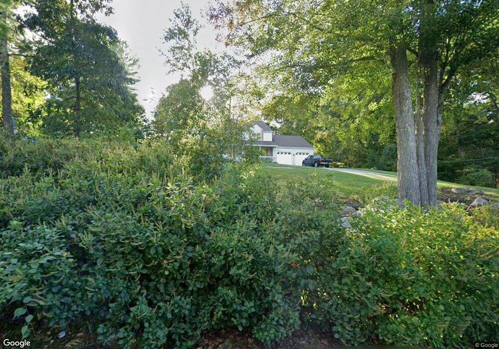
124 Dunstable Rd Westford, MA 01886
Estimated Value: $830,000 - $1,039,000
4
Beds
3
Baths
2,521
Sq Ft
$374/Sq Ft
Est. Value
About This Home
This home is located at 124 Dunstable Rd, Westford, MA 01886 and is currently estimated at $942,484, approximately $373 per square foot. 124 Dunstable Rd is a home located in Middlesex County with nearby schools including Rita E. Miller Elementary School, Day Elementary School, and Stony Brook School.
Ownership History
Date
Name
Owned For
Owner Type
Purchase Details
Closed on
Jun 25, 2010
Sold by
Riley Patrick E and Riley Angela C
Bought by
Clark Thomas
Current Estimated Value
Home Financials for this Owner
Home Financials are based on the most recent Mortgage that was taken out on this home.
Original Mortgage
$425,157
Outstanding Balance
$286,171
Interest Rate
4.98%
Mortgage Type
Purchase Money Mortgage
Estimated Equity
$656,313
Create a Home Valuation Report for This Property
The Home Valuation Report is an in-depth analysis detailing your home's value as well as a comparison with similar homes in the area
Home Values in the Area
Average Home Value in this Area
Purchase History
| Date | Buyer | Sale Price | Title Company |
|---|---|---|---|
| Clark Thomas | $433,000 | -- |
Source: Public Records
Mortgage History
| Date | Status | Borrower | Loan Amount |
|---|---|---|---|
| Open | Clark Thomas | $425,157 |
Source: Public Records
Tax History Compared to Growth
Tax History
| Year | Tax Paid | Tax Assessment Tax Assessment Total Assessment is a certain percentage of the fair market value that is determined by local assessors to be the total taxable value of land and additions on the property. | Land | Improvement |
|---|---|---|---|---|
| 2025 | $10,135 | $736,000 | $288,500 | $447,500 |
| 2024 | $10,135 | $736,000 | $288,500 | $447,500 |
| 2023 | $9,904 | $671,000 | $274,900 | $396,100 |
| 2022 | $9,907 | $614,600 | $228,100 | $386,500 |
| 2021 | $23,395 | $556,800 | $228,100 | $328,700 |
| 2020 | $67 | $559,800 | $228,100 | $331,700 |
| 2019 | $8,742 | $527,900 | $218,600 | $309,300 |
| 2018 | $4,847 | $518,400 | $209,100 | $309,300 |
| 2017 | $4,555 | $489,900 | $209,100 | $280,800 |
| 2016 | $8,024 | $492,300 | $209,100 | $283,200 |
| 2015 | $7,563 | $465,700 | $200,300 | $265,400 |
| 2014 | $6,896 | $415,400 | $192,400 | $223,000 |
Source: Public Records
Map
Nearby Homes
- 1 Summer Village Rd
- 18 Big Rock Trail Unit 115
- 11 Big Rock Trail
- 9 Whispering Pines Rd Unit 9
- 2 Courtview Ln Unit 2
- 4 Tenney Rd
- 16 Saint Paul Ln Unit Lot 20
- 80 Tenney Rd
- 35 Keyes Rd
- 1 Appian Way
- 6 Ingalls Rd
- 239 Groton Rd
- 18 Ingalls Rd
- 24 Dunstable Rd
- 3 Colonel Rolls Dr
- 18 B Pilgrim Dr Unit 24
- 26 N Hill Rd
- 2 Alder Point Unit 2
- 16 Shipley Cir
- 2 Wendell Place Unit 1
- 122 Dunstable Rd
- Lt6-16 Rome Dr
- LOT 2 So Chelmsford Rd
- LOT24 Juneberry Ln
- LOT 19 Casie Ln
- LOT 26 Chamberlain Rd
- LOT 23 Vineyard Rd
- LOT 13 Hyacinth Dr
- LOT 12 Sweetser Place
- LOT 1 Tadmuck Rd
- L 30 Hyacinth Dr
- LOT107 Blue Heron Dr
- LOT 1 Providence Rd
- LOT 4A Stoneybrook Rd
- LOT 11 Sweetser Place
- LOT 2A Providence Rd
- LOT20 Nutting Rd
- LOT 3 Sweetser Place
- Lot 0 Depot
- 120 Dunstable Rd