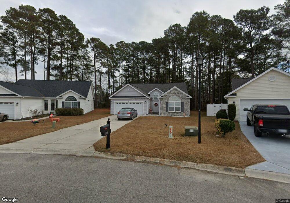
124 Governors Loop Myrtle Beach, SC 29588
Estimated Value: $268,000 - $361,000
3
Beds
2
Baths
1,444
Sq Ft
$210/Sq Ft
Est. Value
About This Home
This home is located at 124 Governors Loop, Myrtle Beach, SC 29588 and is currently estimated at $303,544, approximately $210 per square foot. 124 Governors Loop is a home located in Horry County with nearby schools including Socastee Elementary School, Forestbrook Middle School, and Socastee High School.
Ownership History
Date
Name
Owned For
Owner Type
Purchase Details
Closed on
Aug 1, 2005
Sold by
H & H Properties Llc
Bought by
Caulkins James and Caulkins Cheryl
Current Estimated Value
Purchase Details
Closed on
Jan 28, 2005
Sold by
Independent Builders Development Inc
Bought by
H & H Properties Llc
Home Financials for this Owner
Home Financials are based on the most recent Mortgage that was taken out on this home.
Original Mortgage
$131,254
Interest Rate
5.69%
Mortgage Type
Construction
Create a Home Valuation Report for This Property
The Home Valuation Report is an in-depth analysis detailing your home's value as well as a comparison with similar homes in the area
Home Values in the Area
Average Home Value in this Area
Purchase History
| Date | Buyer | Sale Price | Title Company |
|---|---|---|---|
| Caulkins James | $159,900 | -- | |
| H & H Properties Llc | $349,000 | -- |
Source: Public Records
Mortgage History
| Date | Status | Borrower | Loan Amount |
|---|---|---|---|
| Previous Owner | H & H Properties Llc | $131,254 |
Source: Public Records
Tax History
| Year | Tax Paid | Tax Assessment Tax Assessment Total Assessment is a certain percentage of the fair market value that is determined by local assessors to be the total taxable value of land and additions on the property. | Land | Improvement |
|---|---|---|---|---|
| 2025 | $2,120 | $0 | $0 | $0 |
| 2024 | $2,120 | $10,983 | $2,907 | $8,076 |
| 2023 | $2,120 | $8,783 | $2,450 | $6,333 |
| 2021 | $1,957 | $7,236 | $1,728 | $5,508 |
| 2020 | $1,845 | $7,236 | $1,728 | $5,508 |
| 2019 | $1,845 | $7,236 | $1,728 | $5,508 |
| 2018 | $1,669 | $5,092 | $1,420 | $3,672 |
| 2017 | $1,654 | $5,092 | $1,420 | $3,672 |
| 2016 | -- | $5,092 | $1,420 | $3,672 |
| 2015 | $1,668 | $5,092 | $1,420 | $3,672 |
| 2014 | $1,613 | $5,092 | $1,420 | $3,672 |
Source: Public Records
Map
Nearby Homes
- 525 Sims Dr Unit MB
- 1412 Reid Ct
- 708 Luttie Rd
- 101 Horizon River Dr Unit H8
- 721 Luttie Rd
- TBD W Oak Circle Dr
- 245 Colby Ct
- 111 Horizon River Dr Unit F-8
- 188 Governors Loop
- 244 Colby Ct
- 4101 John Luther Rd
- 240 Foxpath Loop
- 202 Luttie Rd
- 607 Geddings Dr
- 811 Luttie Rd
- 252 Stonebrook Dr
- 31 Smith Blvd
- 622 River Bend Rd
- 13 Smith Blvd
- 53 Smith Blvd
- 128 Governors Loop
- 120 Governors Loop
- 510 Sims Dr
- 508 Sims Dr Unit Watsons Riverside
- 508 Sims Dr
- 703 Luttie Rd
- 116 Governors Loop Unit Lawson's Landing lot
- 116 Governors Loop Unit Lawson's Landing
- 116 Governors Loop
- 132 Governors Loop
- 701 Luttie Rd
- 705 Luttie Rd
- 129 Governors Loop
- 607 Luttie Rd
- 112 Governors Loop
- 136 Governors Loop
- 512 Sims Dr
- 605 Luttie Rd
- 506 Sims Dr
- 506 Sims Dr Unit Watsons Riverside; L
Your Personal Tour Guide
Ask me questions while you tour the home.