Estimated Value: $264,000 - $385,463
4
Beds
3
Baths
2,566
Sq Ft
$130/Sq Ft
Est. Value
About This Home
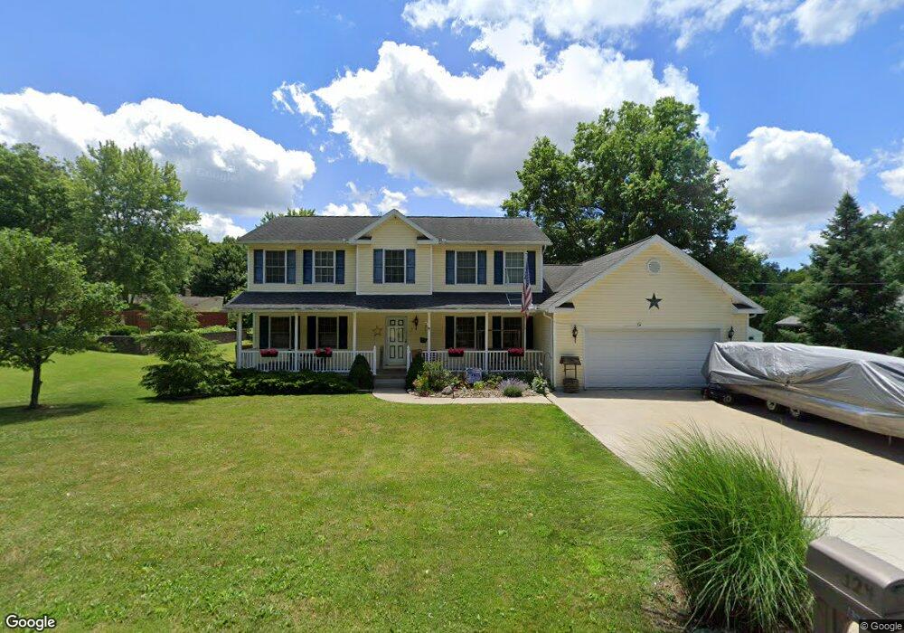
This home is located at 124 Grove St, Lodi, OH 44254 and is currently estimated at $334,366, approximately $130 per square foot. 124 Grove St is a home located in Medina County.
Ownership History
Date
Name
Owned For
Owner Type
Purchase Details
Closed on
Apr 20, 2019
Sold by
Webb Mark A
Bought by
Webb Jennifer M
Current Estimated Value
Purchase Details
Closed on
Aug 29, 2007
Sold by
Martinson Candace 33.34%
Bought by
Webb Mark A
Home Financials for this Owner
Home Financials are based on the most recent Mortgage that was taken out on this home.
Original Mortgage
$187,000
Outstanding Balance
$122,634
Interest Rate
6.71%
Mortgage Type
Construction
Estimated Equity
$211,732
Purchase Details
Closed on
Jan 6, 2003
Sold by
Estate Of Barbara Brewster Martinson
Bought by
Martinson Candance and Martinson Linda
Create a Home Valuation Report for This Property
The Home Valuation Report is an in-depth analysis detailing your home's value as well as a comparison with similar homes in the area
Home Values in the Area
Average Home Value in this Area
Purchase History
| Date | Buyer | Sale Price | Title Company |
|---|---|---|---|
| Webb Jennifer M | -- | None Available | |
| Webb Mark A | $25,500 | -- | |
| Martinson Candance | -- | -- |
Source: Public Records
Mortgage History
| Date | Status | Borrower | Loan Amount |
|---|---|---|---|
| Open | Webb Mark A | $187,000 |
Source: Public Records
Tax History Compared to Growth
Tax History
| Year | Tax Paid | Tax Assessment Tax Assessment Total Assessment is a certain percentage of the fair market value that is determined by local assessors to be the total taxable value of land and additions on the property. | Land | Improvement |
|---|---|---|---|---|
| 2024 | $4,072 | $94,670 | $18,170 | $76,500 |
| 2023 | $4,072 | $94,670 | $18,170 | $76,500 |
| 2022 | $4,491 | $94,670 | $18,170 | $76,500 |
| 2021 | $4,251 | $80,230 | $15,400 | $64,830 |
| 2020 | $4,312 | $80,230 | $15,400 | $64,830 |
| 2019 | $4,331 | $80,230 | $15,400 | $64,830 |
| 2018 | $4,289 | $74,890 | $12,970 | $61,920 |
| 2017 | $4,296 | $74,890 | $12,970 | $61,920 |
| 2016 | $4,351 | $74,890 | $12,970 | $61,920 |
| 2015 | $4,234 | $69,260 | $12,970 | $56,290 |
| 2014 | $3,871 | $69,260 | $12,970 | $56,290 |
| 2013 | $3,633 | $69,260 | $12,970 | $56,290 |
Source: Public Records
Map
Nearby Homes
- 403 Young Dr
- 720 Medina St
- 221 N Market St
- 106 Anderson Cove Unit 206
- 108 River St
- 125 Bank St
- 133 S Broadway St
- 0 Greenwich Rd Unit 5170888
- 8123 Vandemark Rd
- 7595 Kings Creek Dr
- 7660 Vandemark Rd
- 7680 Vandemark Rd
- 7101 Greenwich Rd
- 0 Cemetery Rd
- 7009 Greenwich Rd
- 7908 Garman Rd
- 6895 Grant Dr
- 131 Mill St
- 8849 Concord Dr
- 9835 Congress Rd