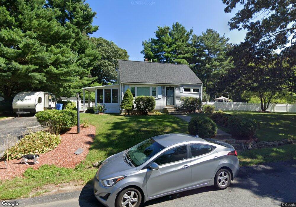
124 Hamilton Rd Wrentham, MA 02093
Estimated Value: $564,000 - $581,000
4
Beds
2
Baths
1,080
Sq Ft
$532/Sq Ft
Est. Value
About This Home
This home is located at 124 Hamilton Rd, Wrentham, MA 02093 and is currently estimated at $574,061, approximately $531 per square foot. 124 Hamilton Rd is a home located in Norfolk County with nearby schools including Delaney Elementary School, Charles E Roderick, and The Sage School.
Ownership History
Date
Name
Owned For
Owner Type
Purchase Details
Closed on
Aug 7, 2013
Sold by
Matthews Robert and Matthews Denise M
Bought by
Matthews Robert
Current Estimated Value
Purchase Details
Closed on
Aug 31, 2004
Sold by
Weir Nancy C and Weir William F
Bought by
Matthews Denise M and Matthews Robert
Home Financials for this Owner
Home Financials are based on the most recent Mortgage that was taken out on this home.
Original Mortgage
$305,550
Interest Rate
6.02%
Mortgage Type
Purchase Money Mortgage
Purchase Details
Closed on
Apr 1, 1996
Sold by
Davis Rose M
Bought by
Weir William F and Weir Nancy C
Home Financials for this Owner
Home Financials are based on the most recent Mortgage that was taken out on this home.
Original Mortgage
$97,750
Interest Rate
6.9%
Mortgage Type
Purchase Money Mortgage
Create a Home Valuation Report for This Property
The Home Valuation Report is an in-depth analysis detailing your home's value as well as a comparison with similar homes in the area
Home Values in the Area
Average Home Value in this Area
Purchase History
| Date | Buyer | Sale Price | Title Company |
|---|---|---|---|
| Matthews Robert | -- | -- | |
| Matthews Denise M | $315,000 | -- | |
| Weir William F | $115,000 | -- |
Source: Public Records
Mortgage History
| Date | Status | Borrower | Loan Amount |
|---|---|---|---|
| Previous Owner | Matthews Denise M | $305,550 | |
| Previous Owner | Weir William F | $128,500 | |
| Previous Owner | Weir William F | $97,750 |
Source: Public Records
Tax History Compared to Growth
Tax History
| Year | Tax Paid | Tax Assessment Tax Assessment Total Assessment is a certain percentage of the fair market value that is determined by local assessors to be the total taxable value of land and additions on the property. | Land | Improvement |
|---|---|---|---|---|
| 2025 | $5,983 | $516,200 | $291,200 | $225,000 |
| 2024 | $5,743 | $478,600 | $291,200 | $187,400 |
| 2023 | $5,433 | $430,500 | $264,800 | $165,700 |
| 2022 | $4,661 | $341,000 | $203,900 | $137,100 |
| 2021 | $4,839 | $343,900 | $213,600 | $130,300 |
| 2020 | $4,795 | $336,500 | $192,600 | $143,900 |
| 2019 | $4,437 | $314,200 | $177,800 | $136,400 |
| 2018 | $4,288 | $301,100 | $177,800 | $123,300 |
| 2017 | $4,080 | $286,300 | $174,400 | $111,900 |
| 2016 | $3,987 | $279,200 | $169,400 | $109,800 |
| 2015 | $3,886 | $259,400 | $162,800 | $96,600 |
| 2014 | $3,639 | $237,700 | $143,500 | $94,200 |
Source: Public Records
Map
Nearby Homes
- 1 Lorraine Metcalf Dr
- 362 East St
- 270 Dedham St
- 10 Nature View Dr
- 15 Nature View Dr
- 65 Pond St
- 319 Taunton St
- 131 Creek St Unit 7
- 120 Hawes St
- 11 Earle Stewart Ln
- 25 Foxboro Rd
- 483 Thurston St
- Lot 3 - 14 Earle Stewart Ln
- 246 Forest Grove Ave
- Lot 1 - Blueberry 2 Car Plan at King Philip Estates
- Lot 8 - Blueberry 2 Car Plan at King Philip Estates
- Lot 6 - Blueberry 3 Car Plan at King Philip Estates
- Lot 2 - Camden 2 Car Plan at King Philip Estates
- Lot 7 - Cedar Plan at King Philip Estates
- Lot 4 - Hemingway 2 Car Plan at King Philip Estates
- 121 Hamilton Rd
- 226 Janice Cir
- 129 Hamilton Rd
- 136 Hamilton Rd
- 110 Hamilton Rd
- 154 Janice Cir
- 218 Janice Cir
- 109 Hamilton Rd
- 223 Janice Cir
- 137 Hamilton Rd
- 102 Hamilton Rd
- 162 Janice Cir
- 101 Hamilton Rd
- 198 Janice Cir
- 215 Janice Cir
- 207 Janice Cir
- 94 Hamilton Rd
- 186 Janice Cir
- 145 Hamilton Rd
- 151 Janice Cir