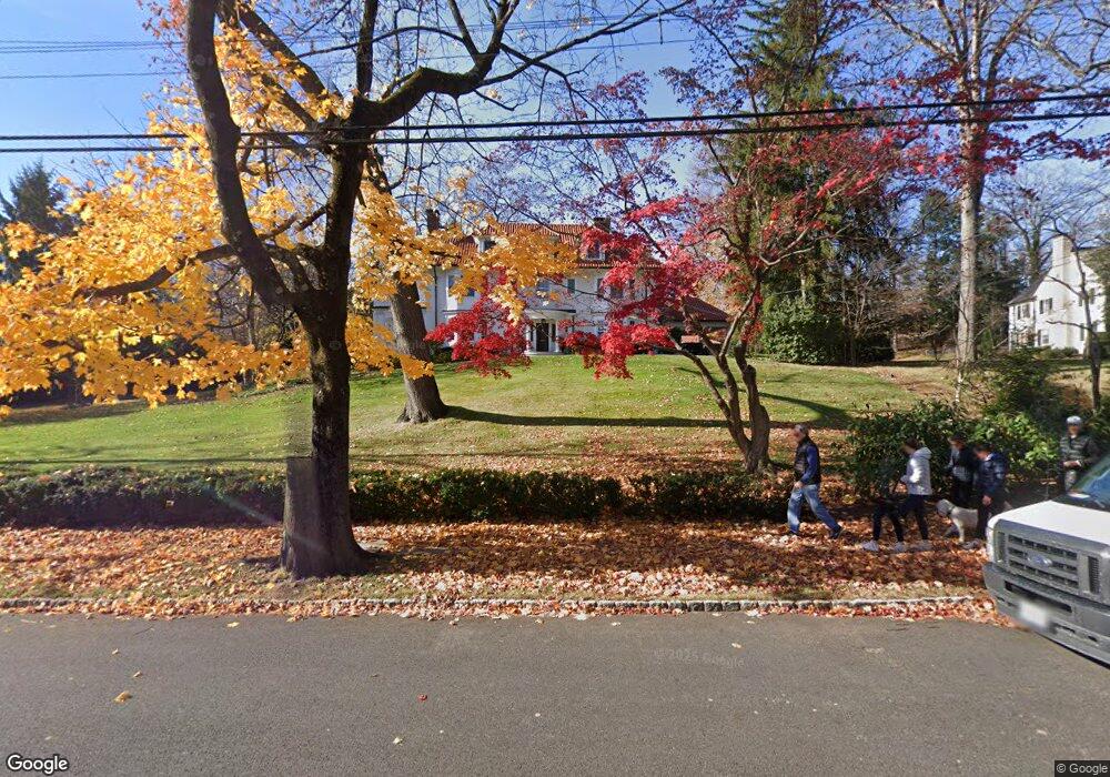
124 Hobart Ave Summit, NJ 07901
Estimated Value: $4,193,372 - $5,204,000
Studio
--
Bath
5,969
Sq Ft
$778/Sq Ft
Est. Value
About This Home
This home is located at 124 Hobart Ave, Summit, NJ 07901 and is currently estimated at $4,642,791, approximately $777 per square foot. 124 Hobart Ave is a home located in Union County with nearby schools including L C Johnson Summit Middle School, Summit Sr High School, and Kent Place School.
Ownership History
Date
Name
Owned For
Owner Type
Purchase Details
Closed on
May 31, 2011
Sold by
Tamagni John S
Bought by
Cagnassola Michael A and Cagnassola Susan E
Current Estimated Value
Home Financials for this Owner
Home Financials are based on the most recent Mortgage that was taken out on this home.
Original Mortgage
$2,475,000
Outstanding Balance
$1,675,462
Interest Rate
4.25%
Mortgage Type
Adjustable Rate Mortgage/ARM
Estimated Equity
$2,967,329
Purchase Details
Closed on
Apr 29, 1998
Sold by
Sabo John C and Sabo Linda
Bought by
Tamagni John S and Tamagni Jeannette B
Home Financials for this Owner
Home Financials are based on the most recent Mortgage that was taken out on this home.
Original Mortgage
$1,000,000
Interest Rate
7.62%
Create a Home Valuation Report for This Property
The Home Valuation Report is an in-depth analysis detailing your home's value as well as a comparison with similar homes in the area
Home Values in the Area
Average Home Value in this Area
Purchase History
| Date | Buyer | Sale Price | Title Company |
|---|---|---|---|
| Cagnassola Michael A | $3,300,000 | Stewart Title & Guaranty Co | |
| Tamagni John S | $2,270,000 | -- |
Source: Public Records
Mortgage History
| Date | Status | Borrower | Loan Amount |
|---|---|---|---|
| Open | Cagnassola Michael A | $2,475,000 | |
| Previous Owner | Tamagni John S | $1,000,000 |
Source: Public Records
Tax History
| Year | Tax Paid | Tax Assessment Tax Assessment Total Assessment is a certain percentage of the fair market value that is determined by local assessors to be the total taxable value of land and additions on the property. | Land | Improvement |
|---|---|---|---|---|
| 2025 | $65,340 | $1,500,000 | $601,000 | $899,000 |
| 2024 | $70,725 | $1,500,000 | $601,000 | $899,000 |
| 2023 | $70,725 | $1,634,500 | $601,000 | $1,033,500 |
| 2022 | $70,006 | $1,634,500 | $601,000 | $1,033,500 |
| 2021 | $70,561 | $1,634,500 | $601,000 | $1,033,500 |
| 2020 | $71,264 | $1,634,500 | $601,000 | $1,033,500 |
| 2019 | $71,346 | $1,634,500 | $601,000 | $1,033,500 |
| 2018 | $70,888 | $1,634,500 | $601,000 | $1,033,500 |
| 2017 | $71,346 | $1,634,500 | $601,000 | $1,033,500 |
| 2016 | $70,300 | $1,634,500 | $601,000 | $1,033,500 |
| 2015 | $68,927 | $1,634,500 | $601,000 | $1,033,500 |
| 2014 | $67,145 | $1,634,500 | $601,000 | $1,033,500 |
Source: Public Records
Map
Nearby Homes
- 25 Dogwood Dr
- 60 Fernwood Rd
- 55 Oxbow Ln
- 11 Euclid Ave Unit 4D
- 14 Euclid Ave Unit 102
- 133 Summit Ave Unit 16A
- 23 Euclid Ave
- 149 Hillcrest Ave
- 1 Irving Place
- 24 Franklin Place
- 30 Colonial Way
- 16 West Rd
- 49 Norwood Ave
- 39 Huntley Rd
- 25 Bedford Rd
- 12 Coniston Rd
- 87 Addison Dr
- 133 Morris Ave
- 1 Milton Ave
- 19 Shelley Rd
Your Personal Tour Guide
Ask me questions while you tour the home.