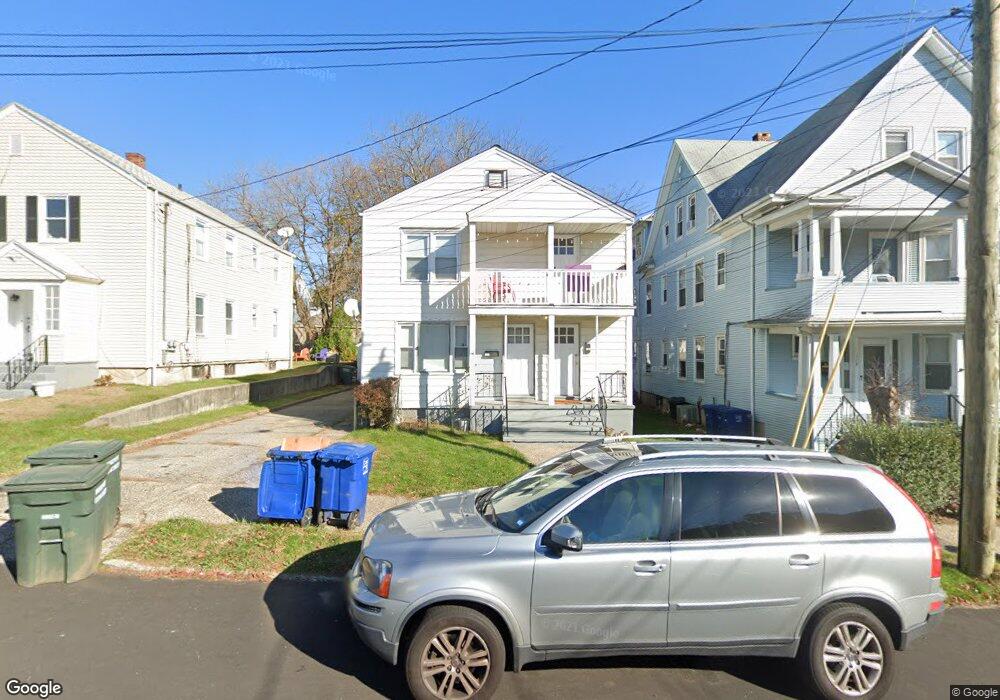
124 King St Unit 126 Bridgeport, CT 06605
Black Rock NeighborhoodEstimated Value: $413,000 - $589,000
4
Beds
2
Baths
1,728
Sq Ft
$285/Sq Ft
Est. Value
About This Home
This home is located at 124 King St Unit 126, Bridgeport, CT 06605 and is currently estimated at $492,753, approximately $285 per square foot. 124 King St Unit 126 is a home located in Fairfield County with nearby schools including Black Rock School, Bassick High School, and Great Oaks Charter School Bridgeport.
Ownership History
Date
Name
Owned For
Owner Type
Purchase Details
Closed on
Jan 31, 2003
Sold by
Ung Sokhim and Ung Kim N
Bought by
Bodine Thomas
Current Estimated Value
Home Financials for this Owner
Home Financials are based on the most recent Mortgage that was taken out on this home.
Original Mortgage
$148,000
Interest Rate
6.09%
Purchase Details
Closed on
Nov 13, 1997
Sold by
Rogers Jayo Est
Bought by
Westville Assoc Llc
Purchase Details
Closed on
Dec 24, 1991
Sold by
Jones Frank and Jones Margaret
Bought by
Peng Cheng and Peng Eng
Create a Home Valuation Report for This Property
The Home Valuation Report is an in-depth analysis detailing your home's value as well as a comparison with similar homes in the area
Home Values in the Area
Average Home Value in this Area
Purchase History
| Date | Buyer | Sale Price | Title Company |
|---|---|---|---|
| Bodine Thomas | $185,000 | -- | |
| Bodine Thomas | $185,000 | -- | |
| Westville Assoc Llc | $405,000 | -- | |
| Westville Assoc Llc | $405,000 | -- | |
| Peng Cheng | $110,000 | -- | |
| Peng Cheng | $110,000 | -- |
Source: Public Records
Mortgage History
| Date | Status | Borrower | Loan Amount |
|---|---|---|---|
| Closed | Peng Cheng | $148,000 | |
| Previous Owner | Peng Cheng | $86,800 |
Source: Public Records
Tax History Compared to Growth
Tax History
| Year | Tax Paid | Tax Assessment Tax Assessment Total Assessment is a certain percentage of the fair market value that is determined by local assessors to be the total taxable value of land and additions on the property. | Land | Improvement |
|---|---|---|---|---|
| 2025 | $8,722 | $200,730 | $109,070 | $91,660 |
| 2024 | $8,722 | $200,730 | $109,070 | $91,660 |
| 2023 | $8,722 | $200,730 | $109,070 | $91,660 |
| 2022 | $8,722 | $200,730 | $109,070 | $91,660 |
| 2021 | $8,722 | $200,730 | $109,070 | $91,660 |
| 2020 | $7,927 | $146,820 | $70,810 | $76,010 |
| 2019 | $7,927 | $146,820 | $70,810 | $76,010 |
| 2018 | $7,983 | $146,820 | $70,810 | $76,010 |
| 2017 | $7,983 | $146,820 | $70,810 | $76,010 |
| 2016 | $7,983 | $146,820 | $70,810 | $76,010 |
| 2015 | $6,946 | $164,590 | $59,500 | $105,090 |
| 2014 | $6,946 | $164,590 | $59,500 | $105,090 |
Source: Public Records
Map
Nearby Homes
- 167 Scofield Ave
- 166 Alfred St
- 51 Princeton St
- 855 Brewster St Unit 857
- 2773 Fairfield Ave Unit 3
- 37 Rowsley St Unit 6
- 26 Rowsley St Unit 3
- 20 Haddon St Unit 5
- 82 Waldorf Ave
- 554 Brewster St Unit 4
- 165 Bennett St
- 135 Whittier St
- 39 Jetland Place Unit 41
- 105 Fox St Unit 107
- 222 Ellsworth St
- 31 Whittier St
- 25 Whittier St
- 450 Davidson St
- 75 Homestead Ave Unit 77
- 317 Brewster St
- 126 King St
- 138 King St
- 136 King St Unit 138
- 136 King St Unit 136 King Street
- 116 King St
- 18 Short St
- 26 Flower St Unit 2
- 32 Flower St
- 146 King St Unit 148
- 24 Flower St Unit 26
- 35 Short St
- 30-34 Flower St
- 30 Flower St Unit 34
- 125 King St
- 92 King St Unit 96
- 137 King St
- 115 King St Unit 117
- 37 Short St
- 42 Flower St Unit 44
- 28 Short St Unit 2nd.