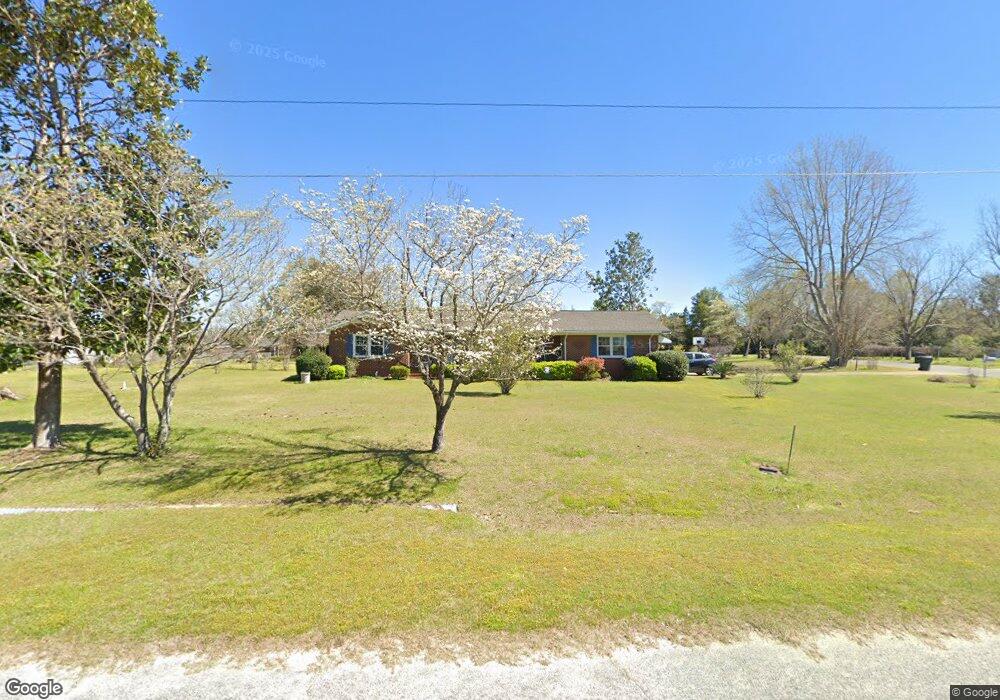
124 Leonard Ave Twin City, GA 30471
Estimated Value: $158,224 - $218,000
3
Beds
2
Baths
1,436
Sq Ft
$131/Sq Ft
Est. Value
About This Home
This home is located at 124 Leonard Ave, Twin City, GA 30471 and is currently estimated at $188,556, approximately $131 per square foot. 124 Leonard Ave is a home located in Emanuel County with nearby schools including Twin City Elementary School.
Ownership History
Date
Name
Owned For
Owner Type
Purchase Details
Closed on
Dec 14, 2012
Sold by
Grimes John Henry
Bought by
Wilkinson Martha Ann G
Current Estimated Value
Purchase Details
Closed on
Jun 9, 2011
Sold by
Grimes John Henry
Bought by
Wilkerson Martha G
Purchase Details
Closed on
Apr 16, 2007
Sold by
Smallwood Faye S
Bought by
Grimes Martha Hall and Grimes John H
Purchase Details
Closed on
Feb 1, 2007
Sold by
Brown Bonnie D
Bought by
Smallwood Faye S
Create a Home Valuation Report for This Property
The Home Valuation Report is an in-depth analysis detailing your home's value as well as a comparison with similar homes in the area
Home Values in the Area
Average Home Value in this Area
Purchase History
| Date | Buyer | Sale Price | Title Company |
|---|---|---|---|
| Wilkinson Martha Ann G | $50,000 | -- | |
| Wilkerson Martha G | -- | -- | |
| Grimes John Henry | -- | -- | |
| Grimes Martha Hall | $80,000 | -- | |
| Smallwood Faye S | -- | -- |
Source: Public Records
Tax History Compared to Growth
Tax History
| Year | Tax Paid | Tax Assessment Tax Assessment Total Assessment is a certain percentage of the fair market value that is determined by local assessors to be the total taxable value of land and additions on the property. | Land | Improvement |
|---|---|---|---|---|
| 2024 | $1,537 | $50,338 | $3,882 | $46,456 |
| 2023 | $592 | $45,543 | $3,882 | $41,661 |
| 2022 | $1,073 | $42,131 | $3,882 | $38,249 |
| 2021 | $1,024 | $39,527 | $3,375 | $36,152 |
| 2020 | $763 | $28,224 | $4,987 | $23,237 |
| 2019 | $758 | $28,224 | $4,987 | $23,237 |
| 2018 | $783 | $28,543 | $4,987 | $23,556 |
| 2017 | $785 | $28,543 | $4,987 | $23,556 |
| 2016 | $713 | $27,910 | $4,987 | $22,923 |
| 2015 | -- | $28,044 | $5,121 | $22,923 |
| 2014 | -- | $26,757 | $3,983 | $22,774 |
| 2013 | -- | $26,575 | $3,983 | $22,592 |
Source: Public Records
Map
Nearby Homes
- 317 5th Ave
- 164 5th Ave
- 211 6th Ave
- 912 5th Ave
- 1120 5th Ave
- 0 Scarboro Church Rd Unit 25066343
- 889 Ga Highway 192 N
- 501 S Old Reidsville Rd
- S S Old Reidsville Rd
- 184 Eagle Pass
- 56 Rock Creek Rd
- 3770 Hill Rd
- 11 Plantation Dr
- 75 Scuffletown Rd
- 000 Scuffletown Rd
- 410 L B Hall Rd
- 875 Prosperity Dr
- 760 Memphis Rd
- 849 Prosperity Dr
- 843 Prosperity Dr
- 130 Leonard Ave
- 0 Central St Unit 7375076
- 0 Central St Unit 7074358
- 0 Central St
- 0 Leonard Ave Unit 8544979
- 116 Central St
- 128 Central St
- 134 Leonard Ave
- 112 Leonard Ave
- 104 Central St
- 143 Old Swainsboro Rd
- 0 Lane Ave Unit 3066981
- 139 Old Swainsboro Rd
- 149 Old Swainsboro Rd
- 131 Central St
- 134 Lane Ave
- 133 Central St
- 119 Lane Ave
- 111 Sergeant St
- 207 N Railroad Ave
