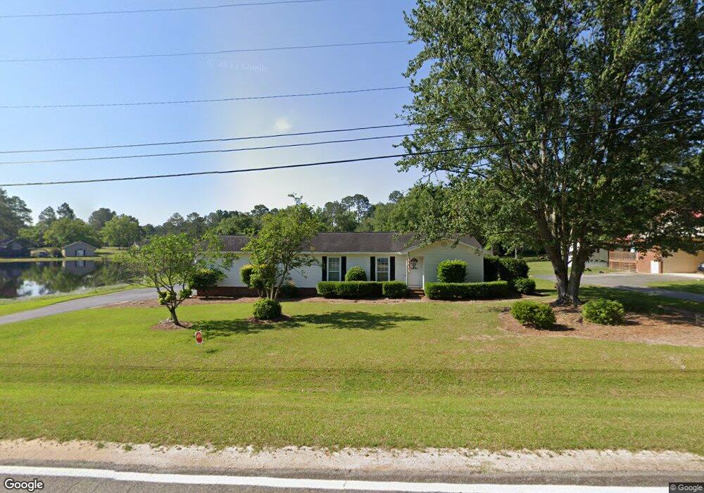
124 Lonesome Pine Trail Moultrie, GA 31788
Estimated Value: $252,510 - $300,000
--
Bed
2
Baths
1,748
Sq Ft
$159/Sq Ft
Est. Value
About This Home
This home is located at 124 Lonesome Pine Trail, Moultrie, GA 31788 and is currently estimated at $277,378, approximately $158 per square foot. 124 Lonesome Pine Trail is a home located in Colquitt County with nearby schools including Sunset Elementary School, Willie J. Williams Middle School, and C.A. Gray Junior High School.
Ownership History
Date
Name
Owned For
Owner Type
Purchase Details
Closed on
Apr 1, 2015
Sold by
Webb V Paul
Bought by
Davis Carly M
Current Estimated Value
Home Financials for this Owner
Home Financials are based on the most recent Mortgage that was taken out on this home.
Original Mortgage
$100,000
Outstanding Balance
$77,261
Interest Rate
3.84%
Mortgage Type
New Conventional
Estimated Equity
$200,117
Purchase Details
Closed on
Jul 19, 1986
Bought by
Webb Paul V
Create a Home Valuation Report for This Property
The Home Valuation Report is an in-depth analysis detailing your home's value as well as a comparison with similar homes in the area
Home Values in the Area
Average Home Value in this Area
Purchase History
| Date | Buyer | Sale Price | Title Company |
|---|---|---|---|
| Davis Carly M | $149,500 | -- | |
| Webb Paul V | $63,600 | -- |
Source: Public Records
Mortgage History
| Date | Status | Borrower | Loan Amount |
|---|---|---|---|
| Open | Davis Carly M | $100,000 |
Source: Public Records
Tax History Compared to Growth
Tax History
| Year | Tax Paid | Tax Assessment Tax Assessment Total Assessment is a certain percentage of the fair market value that is determined by local assessors to be the total taxable value of land and additions on the property. | Land | Improvement |
|---|---|---|---|---|
| 2024 | $1,811 | $81,836 | $12,456 | $69,380 |
| 2023 | $1,811 | $68,508 | $12,456 | $56,052 |
| 2022 | $1,594 | $66,960 | $12,456 | $54,504 |
| 2021 | $1,553 | $63,972 | $12,456 | $51,516 |
| 2020 | $1,431 | $57,880 | $12,456 | $45,424 |
| 2019 | $1,319 | $49,996 | $12,456 | $37,540 |
| 2018 | $1,279 | $49,996 | $12,456 | $37,540 |
| 2017 | $1,267 | $48,562 | $10,000 | $38,562 |
| 2016 | $1,284 | $48,562 | $10,000 | $38,562 |
| 2015 | $1,275 | $47,817 | $10,000 | $37,817 |
| 2014 | $1,251 | $47,817 | $10,000 | $37,817 |
| 2013 | -- | $47,817 | $10,000 | $37,817 |
Source: Public Records
Map
Nearby Homes
- 0 Old Timey Trail
- 240 Cheyenne Way
- 125 Inner Cir
- 424 U S Highway 319
- 0 26th Ave SE
- 7 SE Pheasant Ln
- 3222 Tallokas Rd
- 331 Cobblestone Blvd SE
- 3240 Tallokas Rd
- 12 Creekside Way SE
- 204 Nandina Dr
- 65 Packer Pride Dr SE
- 2016 4th St SE
- 124 Flint Dr
- 40 Sloans Village Way SE
- 1935 4th St SE
- 1701 10th St SE
- 2021 S Main St
- 0 S Main St
- 1844 4th St SE
- 120 Lonesome Pine Trail
- 221 Old Timey Trail
- 137 Lonesome Pine Trail
- 133 Lonesome Pine Trail
- 217 Old Timey Trail
- 129 Lonesome Pine Trail
- 125 Lonesome Pine Trail
- 147 Lonesome Pine Trail
- 112 Lonesome Pine Trail
- 2589 Tallokas Rd
- 213 Old Timey Trail
- 117 Lonesome Pine Trail
- 214 Old Timey Trail
- 216 Old Timey Trail
- 212 Old Timey Trail
- 218 Old Timey Trail
- 210 Old Timey Trail
- 2619 Tallokas Rd
- 2581 Tallokas Rd
- 209 Old Timey Trail