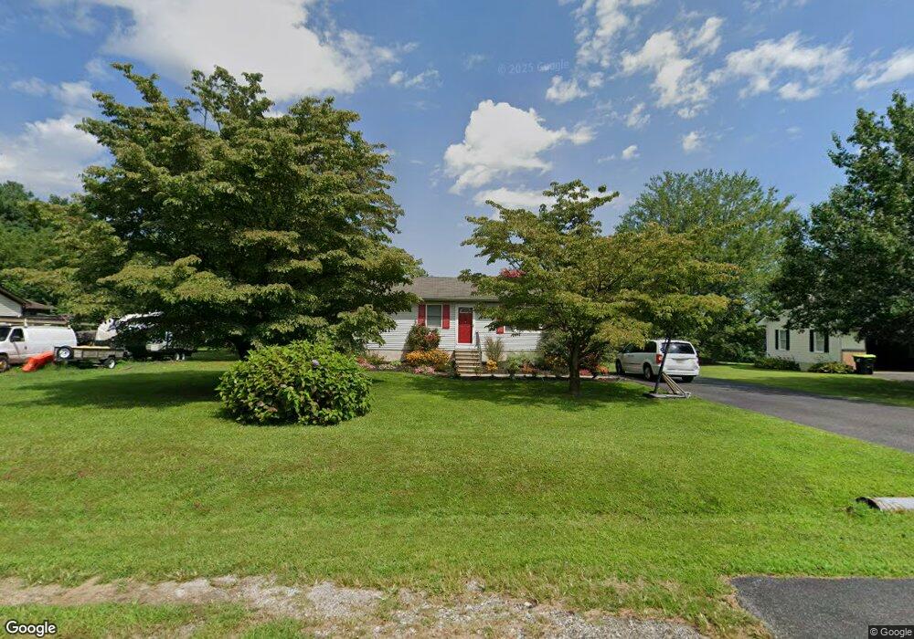
124 Macintosh Dr Colora, MD 21917
Estimated Value: $247,000 - $309,170
Studio
1
Bath
1,040
Sq Ft
$265/Sq Ft
Est. Value
About This Home
This home is located at 124 Macintosh Dr, Colora, MD 21917 and is currently estimated at $276,043, approximately $265 per square foot. 124 Macintosh Dr is a home located in Cecil County with nearby schools including Rising Sun Elementary School, Rising Sun Middle School, and Rising Sun High School.
Ownership History
Date
Name
Owned For
Owner Type
Purchase Details
Closed on
Jun 25, 2002
Sold by
Munyan Jacqueline
Bought by
Roland Daryl and Roland Allison
Current Estimated Value
Purchase Details
Closed on
May 10, 2001
Sold by
The Secretary Of Housing
Bought by
Munyan Jacqueline and Mahan Howard
Purchase Details
Closed on
Feb 20, 2001
Sold by
Bateman George P and Bateman Brenda L
Bought by
The Secretary Of Housing and Urban Development
Create a Home Valuation Report for This Property
The Home Valuation Report is an in-depth analysis detailing your home's value as well as a comparison with similar homes in the area
Home Values in the Area
Average Home Value in this Area
Purchase History
| Date | Buyer | Sale Price | Title Company |
|---|---|---|---|
| Roland Daryl | $130,000 | -- | |
| Munyan Jacqueline | $90,100 | -- | |
| The Secretary Of Housing | $91,100 | -- |
Source: Public Records
Mortgage History
| Date | Status | Borrower | Loan Amount |
|---|---|---|---|
| Closed | Munyan Jacqueline | -- |
Source: Public Records
Tax History
| Year | Tax Paid | Tax Assessment Tax Assessment Total Assessment is a certain percentage of the fair market value that is determined by local assessors to be the total taxable value of land and additions on the property. | Land | Improvement |
|---|---|---|---|---|
| 2025 | $2,266 | $203,800 | $80,300 | $123,500 |
| 2024 | $1,831 | $195,533 | $0 | $0 |
| 2023 | $1,417 | $187,267 | $0 | $0 |
| 2022 | $2,076 | $179,000 | $80,300 | $98,700 |
| 2021 | $2,034 | $173,733 | $0 | $0 |
| 2020 | $2,003 | $168,467 | $0 | $0 |
| 2019 | $1,942 | $163,200 | $80,300 | $82,900 |
| 2018 | $1,929 | $162,033 | $0 | $0 |
| 2017 | $1,915 | $160,867 | $0 | $0 |
| 2016 | $1,820 | $159,700 | $0 | $0 |
| 2015 | $1,820 | $159,567 | $0 | $0 |
| 2014 | $1,676 | $159,433 | $0 | $0 |
Source: Public Records
Map
Nearby Homes
- Lot 8 White Spruce Way
- 35 Coulson Dr
- 0 Colora Rd
- 945 Firetower Rd
- 1621 Liberty Grove Rd
- 66 Spready Oak Rd
- 404 Pearl St
- 43 Pearl St
- 27 Haines Ave
- lot 2 White Spruce Way
- 10 Pogue Ave
- 27 Behm Ln
- TBD Rowland Dr
- 62 Porters Bridge Rd
- 149 Geralds Way
- 10 N Hills Dr
- 39 N Friendship Ct
- 1746 Hopewell Rd
- Lots 126-127 Codjus Dr
- 66 Ayers Dr
- 116 Macintosh Dr
- 132 Macintosh Dr
- 140 Macintosh Dr
- 108 Macintosh Dr
- 129 Macintosh Dr
- 119 Macintosh Dr
- 139 Macintosh Dr
- 107 Macintosh Dr
- 100 Macintosh Dr
- 147 Macintosh Dr
- 97 Macintosh Dr
- 0 Get Around Dr NE Unit 1000105103
- 0 Get Around Dr NE Unit CC9880607
- 88 Macintosh Dr
- 162 Macintosh Dr
- 157 Macintosh Dr
- 85 Macintosh Dr
- 75 Macintosh Dr
- 167 Macintosh Dr
- 52 Get Around Dr
Your Personal Tour Guide
Ask me questions while you tour the home.