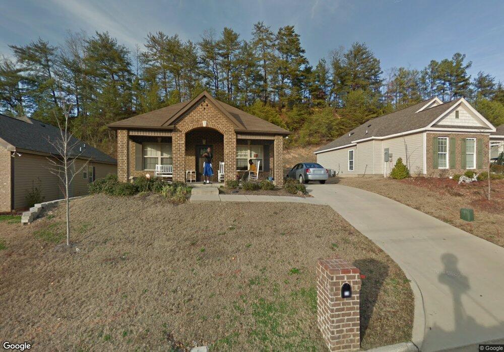
124 Martin Dr Birmingham, AL 35215
Estimated Value: $122,095 - $185,000
3
Beds
2
Baths
1,164
Sq Ft
$138/Sq Ft
Est. Value
About This Home
This home is located at 124 Martin Dr, Birmingham, AL 35215 and is currently estimated at $160,774, approximately $138 per square foot. 124 Martin Dr is a home with nearby schools including Sun Valley Elementary School, Smith Middle School, and Huffman High School.
Ownership History
Date
Name
Owned For
Owner Type
Purchase Details
Closed on
Jun 16, 2022
Sold by
Owens Rochelle
Bought by
Greater Birmingham Habitat For Humanity
Current Estimated Value
Purchase Details
Closed on
Aug 4, 2011
Sold by
Greater Birmingham Habitat For Humanity
Bought by
Owens Rochelle
Home Financials for this Owner
Home Financials are based on the most recent Mortgage that was taken out on this home.
Original Mortgage
$81,276
Interest Rate
4.53%
Mortgage Type
Seller Take Back
Create a Home Valuation Report for This Property
The Home Valuation Report is an in-depth analysis detailing your home's value as well as a comparison with similar homes in the area
Home Values in the Area
Average Home Value in this Area
Purchase History
| Date | Buyer | Sale Price | Title Company |
|---|---|---|---|
| Greater Birmingham Habitat For Humanity | $115,000 | -- | |
| Owens Rochelle | $112,000 | None Available |
Source: Public Records
Mortgage History
| Date | Status | Borrower | Loan Amount |
|---|---|---|---|
| Previous Owner | Owens Rochelle | $81,276 | |
| Previous Owner | Owens Rochelle | $32,160 |
Source: Public Records
Tax History Compared to Growth
Tax History
| Year | Tax Paid | Tax Assessment Tax Assessment Total Assessment is a certain percentage of the fair market value that is determined by local assessors to be the total taxable value of land and additions on the property. | Land | Improvement |
|---|---|---|---|---|
| 2024 | $813 | $27,740 | -- | -- |
| 2022 | $813 | $12,190 | $1,600 | $10,590 |
| 2021 | $649 | $9,930 | $1,600 | $8,330 |
| 2020 | $608 | $9,380 | $1,600 | $7,780 |
| 2019 | $608 | $9,380 | $0 | $0 |
| 2018 | $558 | $8,680 | $0 | $0 |
| 2017 | $558 | $8,680 | $0 | $0 |
| 2016 | $516 | $8,100 | $0 | $0 |
| 2015 | $558 | $8,680 | $0 | $0 |
| 2014 | $593 | $8,120 | $0 | $0 |
| 2013 | $593 | $8,120 | $0 | $0 |
Source: Public Records
Map
Nearby Homes
- 315 40th Ave NE
- 3815 Center Point Pkwy Unit 1
- 132 38th Ave NE
- 5841 Princess Blvd
- 6 37th Ave NE
- 164 Saturn Ln Unit 12.000
- 5977 Princess Blvd
- 5947 Princess Blvd
- 4005 4th St NE
- 4160 Center Point Rd Unit 1
- 4023 Saint John Way NW
- 4018 Saint John Way NW
- 109 36th Ave NE
- 521 Baily Dr
- 324 36th Ave NE
- 3135 Sleepy Hollow Dr
- 272 Jupiter Dr
- 3146 Sweeney Hollow Rd
- 3116 Fieldstone Cir
- 3204 Sweeney Hollow Rd