Estimated Value: $86,000 - $107,000
--
Bed
--
Bath
1,840
Sq Ft
$54/Sq Ft
Est. Value
About This Home
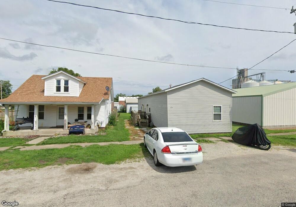
This home is located at 124 N Walnut St, Maroa, IL 61756 and is currently estimated at $99,130, approximately $53 per square foot. 124 N Walnut St is a home located in Macon County with nearby schools including Maroa-Forsyth Grade School, Maroa-Forsyth Middle School, and Maroa-Forsyth Senior High School.
Ownership History
Date
Name
Owned For
Owner Type
Purchase Details
Closed on
Nov 22, 2022
Sold by
Benton Charles
Bought by
Bck Rentals Llc
Current Estimated Value
Home Financials for this Owner
Home Financials are based on the most recent Mortgage that was taken out on this home.
Original Mortgage
$70,400
Outstanding Balance
$33,517
Interest Rate
6.95%
Mortgage Type
New Conventional
Estimated Equity
$65,613
Purchase Details
Closed on
Apr 1, 2015
Purchase Details
Closed on
Nov 30, 2011
Sold by
Agee Dores
Bought by
Mcgraw Raelynn
Create a Home Valuation Report for This Property
The Home Valuation Report is an in-depth analysis detailing your home's value as well as a comparison with similar homes in the area
Home Values in the Area
Average Home Value in this Area
Purchase History
| Date | Buyer | Sale Price | Title Company |
|---|---|---|---|
| Bck Rentals Llc | $82,000 | -- | |
| -- | $15,000 | -- | |
| Mcgraw Raelynn | -- | None Available |
Source: Public Records
Mortgage History
| Date | Status | Borrower | Loan Amount |
|---|---|---|---|
| Open | Bck Rentals Llc | $70,400 |
Source: Public Records
Tax History Compared to Growth
Tax History
| Year | Tax Paid | Tax Assessment Tax Assessment Total Assessment is a certain percentage of the fair market value that is determined by local assessors to be the total taxable value of land and additions on the property. | Land | Improvement |
|---|---|---|---|---|
| 2024 | $1,307 | $14,317 | $3,966 | $10,351 |
| 2023 | $1,234 | $13,303 | $3,685 | $9,618 |
| 2022 | $1,169 | $12,548 | $3,476 | $9,072 |
| 2021 | $1,132 | $11,919 | $3,302 | $8,617 |
| 2020 | $1,038 | $11,232 | $3,112 | $8,120 |
| 2019 | $1,038 | $11,232 | $3,112 | $8,120 |
| 2018 | $992 | $10,965 | $3,038 | $7,927 |
| 2017 | $1,038 | $11,011 | $3,051 | $7,960 |
| 2016 | $1,036 | $10,997 | $3,047 | $7,950 |
| 2015 | $979 | $10,676 | $2,958 | $7,718 |
| 2014 | $948 | $10,571 | $2,929 | $7,642 |
| 2013 | $957 | $10,571 | $2,929 | $7,642 |
Source: Public Records
Map
Nearby Homes
- 212 W Main St
- 303 W Main St
- 309 N Linden St
- 14479 N Oakland Ave
- 3371 Hilltop Ct
- 6690 Little Galilee Rd
- 9150 N Route 51
- 6119 Little Galilee Rd
- 8349 Sawyer Rd
- 5434 Brittany Ln
- 7689 U S 51
- 0 Betty Ln Unit 10514801
- 164 Shadow Ridge Blvd
- 16 Holly Dr
- 157 Shadow Ridge Blvd
- 120 Shadow Ridge Blvd
- 4789 Leghorn Rd
- 335 Loma Dr
- 31 Colonial Dr
- 6080 Stagecoach Rd
- 128 N Walnut St
- 132 N Walnut St
- 129 N Walnut St
- 111 N Hickory St
- 137 N Walnut St
- 109 E Main St
- 107 N Walnut St
- 201 E Main St
- 201 N Walnut St
- 109 W Main St
- 109 W Main St Unit 3D
- 109 W Main St Unit 4E
- 203 E Washington St
- 215 E Washington St
- 111 W Washington St
- 132 N Wood St
- 114 E Main St
- 211 N Walnut St
- 115 W Main St
- 214 N Walnut St