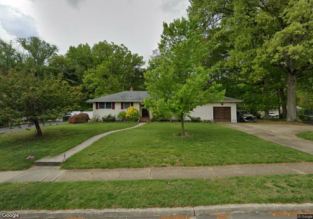
124 Ogden Station Rd Wenonah, NJ 08090
Deptford Township NeighborhoodEstimated Value: $301,724 - $364,000
--
Bed
--
Bath
1,204
Sq Ft
$277/Sq Ft
Est. Value
About This Home
This home is located at 124 Ogden Station Rd, Wenonah, NJ 08090 and is currently estimated at $333,431, approximately $276 per square foot. 124 Ogden Station Rd is a home located in Gloucester County with nearby schools including Deptford Township High School and St Margaret Regional School.
Ownership History
Date
Name
Owned For
Owner Type
Purchase Details
Closed on
Nov 21, 2019
Sold by
Beinke David and Beinke Barbara
Bought by
Puccio David and Puccio Nancy J
Current Estimated Value
Home Financials for this Owner
Home Financials are based on the most recent Mortgage that was taken out on this home.
Original Mortgage
$150,000
Interest Rate
3.73%
Mortgage Type
New Conventional
Purchase Details
Closed on
Sep 28, 2012
Sold by
Boyko Anthony
Bought by
Beinke David
Home Financials for this Owner
Home Financials are based on the most recent Mortgage that was taken out on this home.
Original Mortgage
$168,547
Interest Rate
3.66%
Mortgage Type
VA
Purchase Details
Closed on
Jul 26, 2012
Sold by
Haaf Mary Ann and Estate Of Theresa Boyko
Bought by
Boyko Anthony
Create a Home Valuation Report for This Property
The Home Valuation Report is an in-depth analysis detailing your home's value as well as a comparison with similar homes in the area
Home Values in the Area
Average Home Value in this Area
Purchase History
| Date | Buyer | Sale Price | Title Company |
|---|---|---|---|
| Puccio David | $187,500 | Foundation Title Llc | |
| Beinke David | $165,000 | None Available | |
| Boyko Anthony | -- | None Available |
Source: Public Records
Mortgage History
| Date | Status | Borrower | Loan Amount |
|---|---|---|---|
| Previous Owner | Puccio David | $150,000 | |
| Previous Owner | Beinke David | $168,547 |
Source: Public Records
Tax History Compared to Growth
Tax History
| Year | Tax Paid | Tax Assessment Tax Assessment Total Assessment is a certain percentage of the fair market value that is determined by local assessors to be the total taxable value of land and additions on the property. | Land | Improvement |
|---|---|---|---|---|
| 2025 | $5,263 | $146,800 | $38,000 | $108,800 |
| 2024 | $5,094 | $146,800 | $38,000 | $108,800 |
| 2023 | $5,094 | $146,800 | $38,000 | $108,800 |
| 2022 | $5,057 | $146,800 | $38,000 | $108,800 |
| 2021 | $4,985 | $146,800 | $38,000 | $108,800 |
| 2020 | $4,928 | $146,800 | $38,000 | $108,800 |
| 2019 | $4,834 | $146,800 | $38,000 | $108,800 |
| 2018 | $4,725 | $146,800 | $38,000 | $108,800 |
| 2017 | $4,599 | $146,800 | $38,000 | $108,800 |
| 2016 | $4,505 | $146,800 | $38,000 | $108,800 |
| 2015 | $4,366 | $146,800 | $38,000 | $108,800 |
| 2014 | $4,253 | $146,800 | $38,000 | $108,800 |
Source: Public Records
Map
Nearby Homes
- 7 Manchester Ct
- 100 Buddy Powell Ln
- 114 Buddy Powell Ln
- 125 Ivy Ln
- 629 Vassar Rd
- 748 Dartmouth Dr
- 111 Cove Rd
- 213 Barclay Ct
- 916 Georgetown Rd
- 313 Ogden Station Rd
- 315 Ogden Station Rd
- 711 Howard Ave
- 807 Saint Regis Ct
- 411 Durham Ct Unit 411
- 463 Durham Ct
- 827 Saint Regis Ct
- 136 Vanderbilt Ave
- 75 Hickory Ave
- 505 University Blvd
- 751 Garrison Ct
- 124 Ogden Rd
- 128 Ogden Station Rd
- 709 Poplar Ave
- 120 Ogden Rd
- 120 Ogden Station Rd
- 132 Ogden Station Rd
- 115 Ogden Rd
- 117 Ogden Rd
- 115 Ogden Station Rd
- 117 Ogden Station Rd
- 113 Ogden Station Rd
- 119 Ogden Rd
- 119 Ogden Station Rd
- 711 Poplar Ave
- 711 Poplar St
- 708 Poplar Ave
- 140 Ogden Station Rd
- 111 Ogden Station Rd
- 140 Ogden Rd
- 121 Ogden Rd