Estimated Value: $411,000 - $447,105
--
Bed
--
Bath
1,149
Sq Ft
$372/Sq Ft
Est. Value
About This Home
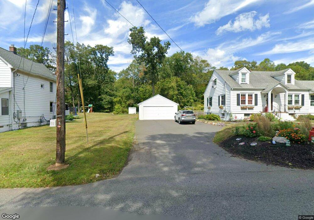
This home is located at 124 Richard Mine Rd, Dover, NJ 07801 and is currently estimated at $427,276, approximately $371 per square foot. 124 Richard Mine Rd is a home located in Morris County with nearby schools including Catherine A. Dwyer Elementary School and Copeland Middle School.
Ownership History
Date
Name
Owned For
Owner Type
Purchase Details
Closed on
Mar 22, 2008
Sold by
Corless Cindy
Bought by
Mckeon John and Mckeon Catherine
Current Estimated Value
Home Financials for this Owner
Home Financials are based on the most recent Mortgage that was taken out on this home.
Original Mortgage
$191,000
Outstanding Balance
$86,810
Interest Rate
6.22%
Mortgage Type
Purchase Money Mortgage
Estimated Equity
$340,466
Purchase Details
Closed on
Feb 9, 2005
Sold by
Donaldson Daniel
Bought by
Corless Cindy
Purchase Details
Closed on
Oct 15, 2003
Sold by
Stark Mary
Bought by
Donaldson Daniel and Corless Cindy
Home Financials for this Owner
Home Financials are based on the most recent Mortgage that was taken out on this home.
Original Mortgage
$247,000
Interest Rate
5.81%
Create a Home Valuation Report for This Property
The Home Valuation Report is an in-depth analysis detailing your home's value as well as a comparison with similar homes in the area
Home Values in the Area
Average Home Value in this Area
Purchase History
| Date | Buyer | Sale Price | Title Company |
|---|---|---|---|
| Mckeon John | $285,000 | None Available | |
| Corless Cindy | -- | -- | |
| Donaldson Daniel | $260,000 | -- |
Source: Public Records
Mortgage History
| Date | Status | Borrower | Loan Amount |
|---|---|---|---|
| Open | Mckeon John | $191,000 | |
| Previous Owner | Donaldson Daniel | $247,000 |
Source: Public Records
Tax History Compared to Growth
Tax History
| Year | Tax Paid | Tax Assessment Tax Assessment Total Assessment is a certain percentage of the fair market value that is determined by local assessors to be the total taxable value of land and additions on the property. | Land | Improvement |
|---|---|---|---|---|
| 2025 | $7,397 | $312,700 | $169,500 | $143,200 |
| 2024 | $7,111 | $288,500 | $153,200 | $135,300 |
| 2023 | $7,111 | $271,000 | $143,000 | $128,000 |
| 2022 | $6,885 | $252,400 | $130,300 | $122,100 |
| 2021 | $6,885 | $242,600 | $125,800 | $116,800 |
| 2020 | $6,750 | $237,600 | $123,500 | $114,100 |
| 2019 | $6,596 | $231,200 | $119,000 | $112,200 |
| 2018 | $6,462 | $222,900 | $115,400 | $107,500 |
| 2017 | $6,372 | $204,100 | $105,100 | $99,000 |
| 2016 | $6,290 | $204,100 | $105,100 | $99,000 |
| 2015 | $6,245 | $204,100 | $105,100 | $99,000 |
| 2014 | $6,129 | $204,100 | $105,100 | $99,000 |
Source: Public Records
Map
Nearby Homes
- 32 Teabo Rd
- 15 Rock Hollow Rd
- 1202 Franklin Ln Unit 202
- 3212 Franklin Ln Unit 212
- 1129 Hamilton Dr
- 204 Cleveland Ln
- 202 Cleveland Ln
- 4300 Cleveland Ln Unit 109
- 5307 Veterans Dr
- 1211 Clinton Ln
- 1111 Clinton Ln Unit 111
- 7311 Polk Dr
- 4 Stanley Terrace
- 1213 Hale Dr
- 1202 Hale Dr
- 135 Hawthorne Ct
- 1110 Johnson Dr
- 1109 Johnson Dr
- 128 Hawthorne Ct Unit 128
- 322 P7 Richard Mine Rd Unit 7
- 120 Richard Mine Rd
- 126 Richard Mine Rd
- 119 Richard Mine Rd
- 118 Richard Mine Rd
- 130 Richard Mine Rd
- 123 Richard Mine Rd
- 117 Richard Mine Rd
- 132 Richard Mine Rd
- 8 Coburn Rd
- 113 Richard Mine Rd
- 110 Richard Mine Rd
- 108 Richard Mine Rd
- 133 Richard Mine Rd
- 12 Coburn Rd
- 111 Richard Mine Rd
- 125 Richard Mine Rd
- 133 Richard Mine Rd
- 322 Richard Mine Rd - B2 Unit B2
- 109 Richard Mine Rd
- 140 Richard Mine Rd