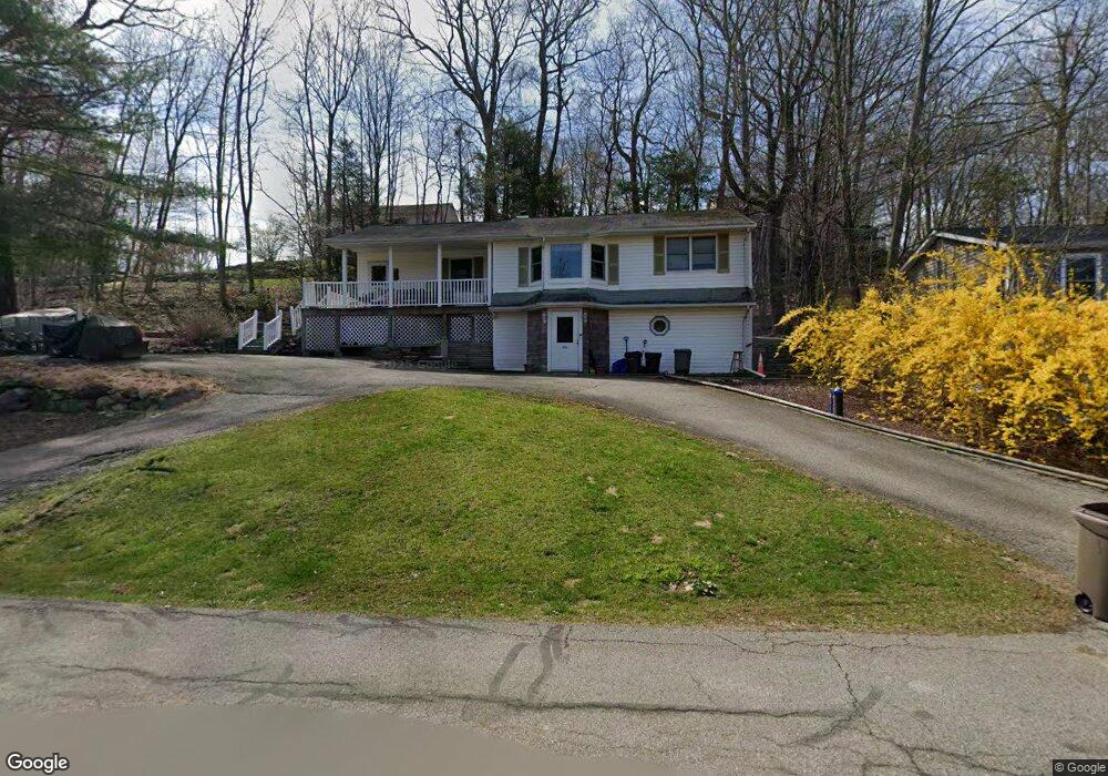
124 Riverside Rd Hewitt, NJ 07421
Estimated Value: $313,000 - $354,000
--
Bed
--
Bath
976
Sq Ft
$343/Sq Ft
Est. Value
About This Home
This home is located at 124 Riverside Rd, Hewitt, NJ 07421 and is currently estimated at $334,796, approximately $343 per square foot. 124 Riverside Rd is a home located in Passaic County with nearby schools including Macopin Middle School and West Milford High School.
Ownership History
Date
Name
Owned For
Owner Type
Purchase Details
Closed on
Jun 15, 2006
Sold by
Kurtisi Emil
Bought by
Guerrieri Brian and Guerrieri Kelly
Current Estimated Value
Home Financials for this Owner
Home Financials are based on the most recent Mortgage that was taken out on this home.
Original Mortgage
$208,000
Outstanding Balance
$124,328
Interest Rate
6.87%
Mortgage Type
Adjustable Rate Mortgage/ARM
Estimated Equity
$210,468
Purchase Details
Closed on
Jul 30, 2004
Sold by
Cook Donna
Bought by
Kurtisi Emil and Kurtisi Igor
Home Financials for this Owner
Home Financials are based on the most recent Mortgage that was taken out on this home.
Original Mortgage
$209,700
Interest Rate
6.2%
Purchase Details
Closed on
Aug 31, 1995
Sold by
Dunaj Richard
Bought by
Cook Gregory and Cook Donna
Home Financials for this Owner
Home Financials are based on the most recent Mortgage that was taken out on this home.
Original Mortgage
$115,000
Interest Rate
7.86%
Create a Home Valuation Report for This Property
The Home Valuation Report is an in-depth analysis detailing your home's value as well as a comparison with similar homes in the area
Home Values in the Area
Average Home Value in this Area
Purchase History
| Date | Buyer | Sale Price | Title Company |
|---|---|---|---|
| Guerrieri Brian | $260,000 | -- | |
| Kurtisi Emil | $233,000 | -- | |
| Cook Gregory | $118,000 | -- |
Source: Public Records
Mortgage History
| Date | Status | Borrower | Loan Amount |
|---|---|---|---|
| Open | Guerrieri Brian | $208,000 | |
| Previous Owner | Kurtisi Emil | $209,700 | |
| Previous Owner | Cook Gregory | $115,000 |
Source: Public Records
Tax History Compared to Growth
Tax History
| Year | Tax Paid | Tax Assessment Tax Assessment Total Assessment is a certain percentage of the fair market value that is determined by local assessors to be the total taxable value of land and additions on the property. | Land | Improvement |
|---|---|---|---|---|
| 2025 | $6,413 | $158,200 | $71,800 | $86,400 |
| 2024 | $6,447 | $158,200 | $71,800 | $86,400 |
| 2022 | $6,119 | $158,200 | $71,800 | $86,400 |
| 2021 | $5,988 | $158,200 | $71,800 | $86,400 |
| 2020 | $5,925 | $158,200 | $71,800 | $86,400 |
| 2019 | $5,845 | $158,200 | $71,800 | $86,400 |
| 2018 | $5,831 | $158,200 | $71,800 | $86,400 |
| 2017 | $5,858 | $158,200 | $71,800 | $86,400 |
| 2016 | $5,868 | $158,200 | $71,800 | $86,400 |
| 2015 | $5,800 | $158,200 | $71,800 | $86,400 |
| 2014 | $5,659 | $158,200 | $71,800 | $86,400 |
Source: Public Records
Map
Nearby Homes
- 40 Kingsland Rd
- 0 Gladstone Rd
- 16 Hampton Rd
- 43 Hampton Rd
- 00 Linwood Rd
- 96 Papscoe Rd
- 147 Papscoe Rd
- 74 Riverside Rd
- 36 Morsemere Rd
- 7 Chatham Rd
- 360 Lake Shore Dr
- 3 Riverside Rd
- 424 Lake Shore Dr
- 5 Fanwood Ct
- 40 Upper Greenwood Lake Rd
- 40 Upper Greenwood Rd
- 00 Fairlawn Dr
- 109 Fairlawn Dr
- 0 Kresson Rd
- 54 Race Track Dr
- 120 Riverside Rd
- 15 Gladstone Rd
- 9 Gladstone Rd
- 17 Gladstone Rd
- 112 Riverside Rd
- 35 Kingsland Rd
- 6 Gladstone Rd
- 20 Gladstone Rd
- 23 Gladstone Rd
- 38 Kingsland Rd
- 108 Riverside Rd
- 34 Kingsland Rd
- 29 Gladstone Rd
- 87 Dunham Rd
- 85 Dunham Rd
- 30 Kingsland Rd
- 28 Kingsland Rd
- 37 Raritan Ct
- 81 Dunham Rd
- 176 Upper Greenwood