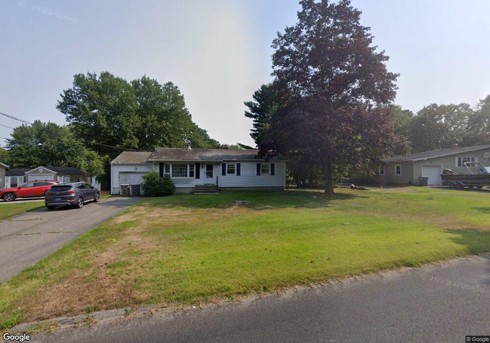
124 Roxbury Rd Niantic, CT 06357
Estimated Value: $381,602 - $419,000
3
Beds
1
Bath
1,050
Sq Ft
$387/Sq Ft
Est. Value
About This Home
This home is located at 124 Roxbury Rd, Niantic, CT 06357 and is currently estimated at $406,651, approximately $387 per square foot. 124 Roxbury Rd is a home located in New London County with nearby schools including East Lyme Middle School, East Lyme High School, and The Light House Voc-Ed Center.
Ownership History
Date
Name
Owned For
Owner Type
Purchase Details
Closed on
Sep 29, 1987
Sold by
Rose Jack
Bought by
Kydes Gus
Current Estimated Value
Home Financials for this Owner
Home Financials are based on the most recent Mortgage that was taken out on this home.
Original Mortgage
$95,200
Interest Rate
10.37%
Create a Home Valuation Report for This Property
The Home Valuation Report is an in-depth analysis detailing your home's value as well as a comparison with similar homes in the area
Home Values in the Area
Average Home Value in this Area
Purchase History
| Date | Buyer | Sale Price | Title Company |
|---|---|---|---|
| Kydes Gus | $127,000 | -- |
Source: Public Records
Mortgage History
| Date | Status | Borrower | Loan Amount |
|---|---|---|---|
| Open | Kydes Gus | $132,000 | |
| Closed | Kydes Gus | $58,500 | |
| Closed | Kydes Gus | $24,000 | |
| Closed | Kydes Gus | $95,200 |
Source: Public Records
Tax History
| Year | Tax Paid | Tax Assessment Tax Assessment Total Assessment is a certain percentage of the fair market value that is determined by local assessors to be the total taxable value of land and additions on the property. | Land | Improvement |
|---|---|---|---|---|
| 2025 | $4,908 | $175,210 | $73,290 | $101,920 |
| 2024 | $4,617 | $175,210 | $73,290 | $101,920 |
| 2023 | $4,359 | $175,210 | $73,290 | $101,920 |
| 2022 | $4,177 | $175,210 | $73,290 | $101,920 |
| 2021 | $3,866 | $135,590 | $69,020 | $66,570 |
| 2020 | $3,845 | $135,590 | $69,020 | $66,570 |
| 2019 | $3,822 | $135,590 | $69,020 | $66,570 |
| 2018 | $3,708 | $135,590 | $69,020 | $66,570 |
| 2017 | $3,547 | $135,590 | $69,020 | $66,570 |
| 2016 | $3,220 | $126,980 | $60,410 | $66,570 |
| 2015 | $3,138 | $126,980 | $60,410 | $66,570 |
| 2014 | $3,051 | $126,980 | $60,410 | $66,570 |
Source: Public Records
Map
Nearby Homes
- 82 Roxbury Rd
- 80 Roxbury Rd
- 37 Stoneywood Dr
- 43 Roxbury Ct
- 97 W Main St Unit 36
- 55 Corey Ln
- 46 Village Crossing Unit 46
- 47 Village Crossing Unit 47
- 86 Corey Ln
- 10 S Ledge Rock Rd
- 19 Sapia Dr
- 12 Spinnaker Dr
- 468 Main St Unit 318
- 468 Main St Unit 111
- 223 N Bride Brook Rd
- 15 Freedom Way Unit 105
- 127 Black Point Rd Unit 7
- 47 Oswegatchie Hills Rd
- 23 Central Ave
- 42 S Washington Ave
- 122 Roxbury Rd
- 126 Roxbury Rd
- Lot 2 Roxbury Rd
- 8 Carriage Hill Dr
- 4 Carriage Hill Dr
- 120 Roxbury Rd
- 123 Roxbury Rd
- 12 Carriage Hill Dr
- 121 Roxbury Rd
- 133 Roxbury Rd
- 2 Surrey Ln
- 116 Roxbury Rd
- 3 Carriage Hill Dr
- 1 Surrey Ln
- 14 Carriage Hill Dr
- 119 Roxbury Rd
- 11 Carriage Hill Dr
- 5 Carriage Hill Dr
- 5 Carriage Hill Dr
- 114 Roxbury Rd
Your Personal Tour Guide
Ask me questions while you tour the home.