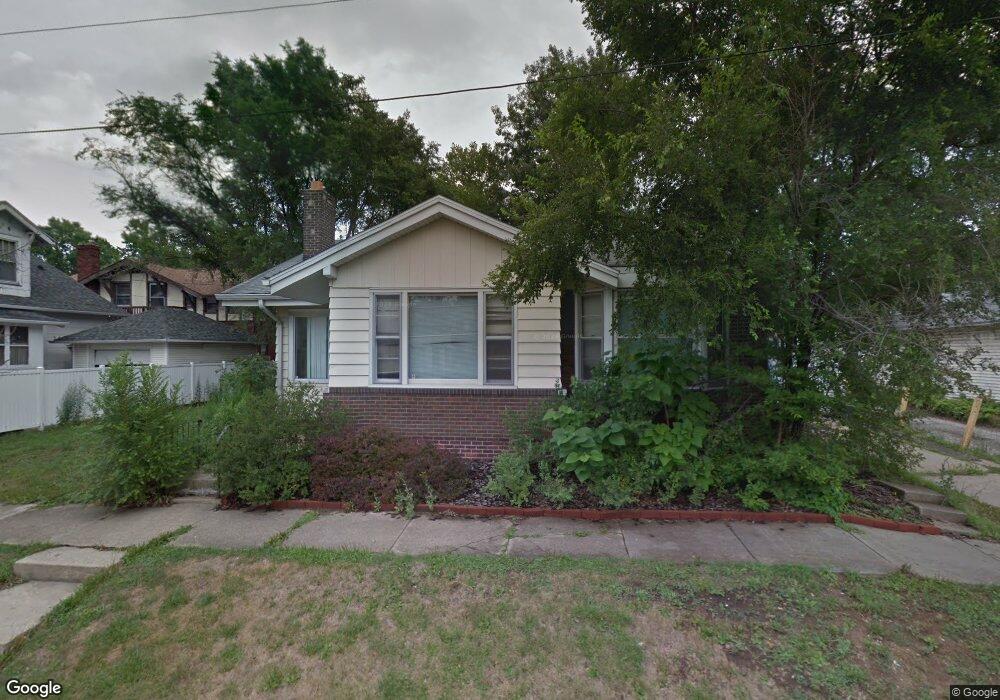
124 S Pine St Decatur, IL 62522
Near West NeighborhoodEstimated Value: $72,000 - $85,781
4
Beds
1
Bath
3,632
Sq Ft
$22/Sq Ft
Est. Value
About This Home
This home is located at 124 S Pine St, Decatur, IL 62522 and is currently estimated at $79,195, approximately $21 per square foot. 124 S Pine St is a home located in Macon County with nearby schools including Dennis Lab School, St. Patrick School, and Teen Challenge-Home For Girls.
Ownership History
Date
Name
Owned For
Owner Type
Purchase Details
Closed on
Sep 28, 2020
Sold by
Koonce Jason
Bought by
Birch Mark A
Current Estimated Value
Purchase Details
Closed on
Apr 16, 2018
Sold by
Birch William L and Birch Arthur M
Bought by
Birch Mark A
Purchase Details
Closed on
Mar 21, 2018
Sold by
Lewis Deborah and Birch William L
Bought by
Koonce Jason
Create a Home Valuation Report for This Property
The Home Valuation Report is an in-depth analysis detailing your home's value as well as a comparison with similar homes in the area
Home Values in the Area
Average Home Value in this Area
Purchase History
| Date | Buyer | Sale Price | Title Company |
|---|---|---|---|
| Birch Mark A | -- | None Available | |
| Birch Mark A | $84,000 | None Available | |
| Koonce Jason | $10,000 | None Available |
Source: Public Records
Tax History Compared to Growth
Tax History
| Year | Tax Paid | Tax Assessment Tax Assessment Total Assessment is a certain percentage of the fair market value that is determined by local assessors to be the total taxable value of land and additions on the property. | Land | Improvement |
|---|---|---|---|---|
| 2024 | $2,331 | $24,084 | $1,529 | $22,555 |
| 2023 | $2,312 | $23,232 | $1,475 | $21,757 |
| 2022 | $2,087 | $20,408 | $1,296 | $19,112 |
| 2021 | $1,961 | $19,059 | $1,210 | $17,849 |
| 2020 | $1,933 | $18,174 | $1,153 | $17,021 |
| 2019 | $1,933 | $18,174 | $1,153 | $17,021 |
| 2018 | $1,916 | $18,234 | $1,157 | $17,077 |
| 2017 | $1,961 | $18,721 | $1,188 | $17,533 |
| 2016 | $1,998 | $18,912 | $1,200 | $17,712 |
| 2015 | $1,899 | $18,578 | $1,179 | $17,399 |
| 2014 | $1,763 | $18,394 | $1,167 | $17,227 |
| 2013 | $1,822 | $19,085 | $1,211 | $17,874 |
Source: Public Records
Map
Nearby Homes
- 717 W Prairie Ave Unit 2
- 657 W Wood St
- 899 W Main St
- 612 W Macon St
- 254 N Pine St
- 609 W William St
- 1005 W Main St
- 617 W Decatur St
- 441 S Seigel St
- 958 W William St
- 450 W Macon St
- 452 W Prairie Ave
- 442 W Prairie Ave
- 440 W Macon St
- 628 W Forest Ave
- 233 N Edward St
- 437 Powers Ln
- 422 W William St
- 366 W Prairie Ave
- 320 W Main St
- 745 W Main St
- 749 W Main St
- 731 W Main St
- 731 W Main St Unit 2
- 731 W Main St Unit 4
- 731 W Main St Unit 3
- 746 W Wood St
- 805 W Main St
- 734 W Wood St
- 723 W Main St
- 723 W Main St Unit 1
- 723 W Main St Unit 4
- 728 W Wood St
- 722 W Wood St
- 804 W Wood St
- 709 W Main St
- 714 W Main St
- 814 W Wood St
- 814 W Wood St Unit 2
- 748 W Main St