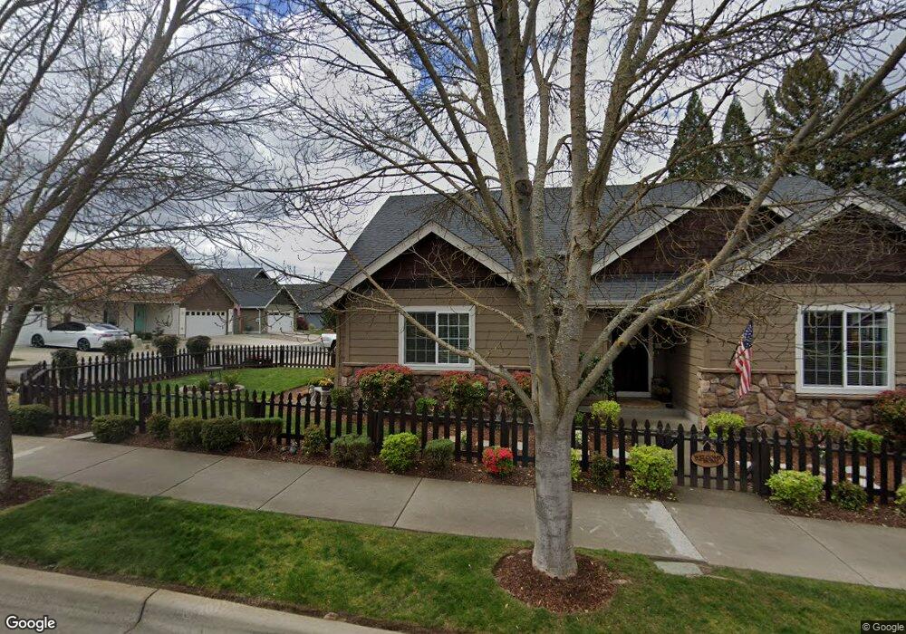
124 SE Yorktown Rd Grants Pass, OR 97527
Estimated Value: $408,313 - $416,000
3
Beds
2
Baths
1,735
Sq Ft
$238/Sq Ft
Est. Value
About This Home
This home is located at 124 SE Yorktown Rd, Grants Pass, OR 97527 and is currently estimated at $412,157, approximately $237 per square foot. 124 SE Yorktown Rd is a home located in Josephine County with nearby schools including Allen Dale Elementary School, South Middle School, and Grants Pass High School.
Ownership History
Date
Name
Owned For
Owner Type
Purchase Details
Closed on
Sep 10, 2009
Sold by
Northridge Enterprises Llc
Bought by
Ellis Dwight F and Ellis Bonnie E
Current Estimated Value
Home Financials for this Owner
Home Financials are based on the most recent Mortgage that was taken out on this home.
Original Mortgage
$140,000
Outstanding Balance
$91,234
Interest Rate
5.2%
Mortgage Type
New Conventional
Estimated Equity
$320,923
Create a Home Valuation Report for This Property
The Home Valuation Report is an in-depth analysis detailing your home's value as well as a comparison with similar homes in the area
Home Values in the Area
Average Home Value in this Area
Purchase History
| Date | Buyer | Sale Price | Title Company |
|---|---|---|---|
| Ellis Dwight F | $257,000 | Ticor Title Company Oregon |
Source: Public Records
Mortgage History
| Date | Status | Borrower | Loan Amount |
|---|---|---|---|
| Open | Ellis Dwight F | $140,000 |
Source: Public Records
Tax History Compared to Growth
Tax History
| Year | Tax Paid | Tax Assessment Tax Assessment Total Assessment is a certain percentage of the fair market value that is determined by local assessors to be the total taxable value of land and additions on the property. | Land | Improvement |
|---|---|---|---|---|
| 2025 | $3,420 | $263,360 | -- | -- |
| 2024 | $3,420 | $255,690 | -- | -- |
| 2023 | $3,321 | $248,250 | $0 | $0 |
| 2022 | $3,237 | $241,020 | -- | -- |
| 2021 | $3,040 | $234,000 | $0 | $0 |
| 2020 | $2,952 | $227,190 | $0 | $0 |
| 2019 | $2,867 | $220,580 | $0 | $0 |
| 2018 | $2,917 | $214,160 | $0 | $0 |
| 2017 | $2,895 | $207,930 | $0 | $0 |
| 2016 | $2,545 | $201,880 | $0 | $0 |
| 2015 | $2,462 | $196,000 | $0 | $0 |
| 2014 | $2,395 | $190,300 | $0 | $0 |
Source: Public Records
Map
Nearby Homes
- 426 SE Cadet Ct
- 1764 Harbeck Rd
- 101 SE Liberty Dr
- 681 W Harbeck Rd
- 185 Independence Dr
- 395 Grandview Ln
- 444 Union Ave Unit TL 1700
- 444 Union Ave Unit TL 1600
- 0 Ramsey Southwest Ave SW Unit 220201654
- 0 Fruitdale Lilac Hilltop Shepha Dr Unit 220196701
- 111 Brandy Ln
- 855 SW West Harbeck Rd
- 2931 Harbeck Rd
- 1626 Poplar Dr
- 333 W Park St
- 1010 Hemlock Ln
- 423 W Park St
- 1048 W Harbeck Rd
- 1736 Drury Ln
- 1219 River Ln
- 438 SE Cadet Ct
- 461 SE Cadet Ct
- 117 Grandview Ave
- 449 SE Cadet Ct
- 141 SE Yorktown Rd
- 437 SE Cadet Ct
- 123 SE Yorktown Dr
- 123 SE Yorktown Rd
- 130 SE Yorktown Rd
- 130 SE Yorktown Dr
- 135 SE Yorktown Rd
- 425 SE Cadet Ct
- 112 SE Yorktown Rd
- 129 SE Yorktown Rd
- 112 SE Yorktown Dr
- 147 SE Yorktown Rd
- 125 Lexington Ct
- 136 SE Yorktown Rd
- 136 SE Yorktown Dr