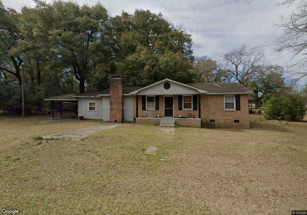
124 Sheba Rd Cordova, SC 29039
Estimated Value: $104,000 - $154,000
3
Beds
2
Baths
1,225
Sq Ft
$112/Sq Ft
Est. Value
About This Home
This home is located at 124 Sheba Rd, Cordova, SC 29039 and is currently estimated at $136,649, approximately $111 per square foot. 124 Sheba Rd is a home with nearby schools including Edisto Primary, Edisto Primary School, and Edisto Elementary School.
Ownership History
Date
Name
Owned For
Owner Type
Purchase Details
Closed on
Mar 30, 2023
Sold by
Maker William J
Bought by
Reitactical Llc
Current Estimated Value
Home Financials for this Owner
Home Financials are based on the most recent Mortgage that was taken out on this home.
Original Mortgage
$35,000
Interest Rate
5.56%
Purchase Details
Closed on
Feb 5, 2003
Sold by
Citifinancial Mortgage Co Inc
Bought by
Maker William J and Maker Judy S
Purchase Details
Closed on
Oct 24, 2002
Sold by
Arrowood Donna Sue
Bought by
Citifinancial Mtg Company Inc
Purchase Details
Closed on
Jun 29, 2000
Sold by
Wepco Ii Inc
Bought by
Jennings Donna
Purchase Details
Closed on
Apr 3, 2000
Sold by
Hud
Bought by
Wepco Ii Inc
Create a Home Valuation Report for This Property
The Home Valuation Report is an in-depth analysis detailing your home's value as well as a comparison with similar homes in the area
Home Values in the Area
Average Home Value in this Area
Purchase History
| Date | Buyer | Sale Price | Title Company |
|---|---|---|---|
| Reitactical Llc | $140,000 | -- | |
| Maker William J | $20,000 | -- | |
| Citifinancial Mtg Company Inc | $2,500 | -- | |
| Jennings Donna | $52,000 | -- | |
| Wepco Ii Inc | $25,200 | -- |
Source: Public Records
Mortgage History
| Date | Status | Borrower | Loan Amount |
|---|---|---|---|
| Closed | Reitactical Llc | $35,000 | |
| Closed | Reitactical Llc | $112,000 |
Source: Public Records
Tax History Compared to Growth
Tax History
| Year | Tax Paid | Tax Assessment Tax Assessment Total Assessment is a certain percentage of the fair market value that is determined by local assessors to be the total taxable value of land and additions on the property. | Land | Improvement |
|---|---|---|---|---|
| 2024 | $1,217 | $4,126 | $616 | $3,510 |
| 2023 | $1,172 | $2,959 | $517 | $2,442 |
| 2022 | $1,157 | $2,959 | $517 | $2,442 |
| 2021 | $1,151 | $2,959 | $517 | $2,442 |
| 2020 | $1,056 | $2,959 | $0 | $0 |
| 2019 | $1,021 | $2,959 | $0 | $0 |
| 2018 | $1,082 | $2,984 | $0 | $0 |
| 2017 | $1,069 | $2,984 | $0 | $0 |
| 2016 | $1,063 | $2,984 | $0 | $0 |
| 2015 | $1,291 | $2,984 | $0 | $0 |
| 2014 | $1,291 | $4,220 | $518 | $3,702 |
| 2013 | -- | $2,865 | $345 | $2,520 |
Source: Public Records
Map
Nearby Homes
- 136 Highland Park Cir
- 118 Highland Park Cir
- 1983 Cannon Bridge Rd
- 147 Podium Rd
- 1811 Cannon Bridge Rd
- 128 Buster Ln
- 183 Baycreek Ln
- 1609 Cannon Bridge Rd
- 123 Peaceful Dr
- 123 Dawsey St
- 110 Red Cedar Dr
- 137 Williams St
- 115 Williams St
- 29 Meadowcrest Dr
- 17 Knotty Pine
- 219 Cannon Bridge Rd
- 2953 Cordova Rd
- 2099 Legrand Smoak St
- 2655 Cordova Rd
- 2636 Cordova Rd SW