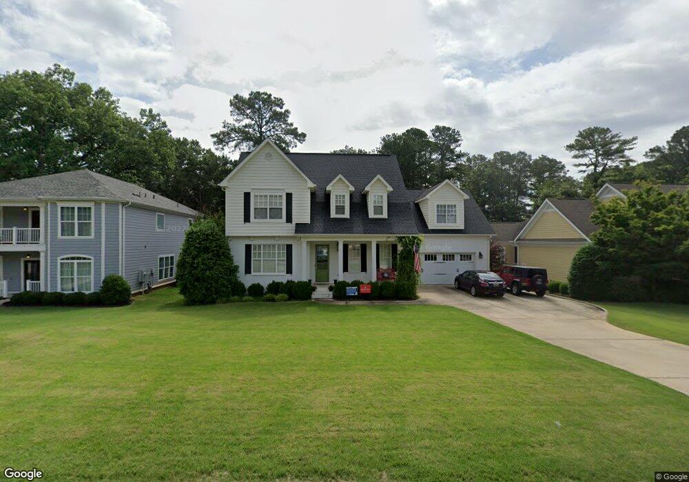
124 Sturdivant St Madison, AL 35758
Estimated Value: $589,000 - $885,000
--
Bed
1
Bath
2,320
Sq Ft
$302/Sq Ft
Est. Value
About This Home
This home is located at 124 Sturdivant St, Madison, AL 35758 and is currently estimated at $701,065, approximately $302 per square foot. 124 Sturdivant St is a home with nearby schools including Madison Elementary School, Liberty Middle School, and James Clemens High School.
Ownership History
Date
Name
Owned For
Owner Type
Purchase Details
Closed on
Aug 26, 2010
Sold by
Open Gate Homes Llc
Bought by
Zesinger Mark R and Zesinger Janell S
Current Estimated Value
Home Financials for this Owner
Home Financials are based on the most recent Mortgage that was taken out on this home.
Original Mortgage
$364,321
Outstanding Balance
$240,761
Interest Rate
4.61%
Mortgage Type
New Conventional
Estimated Equity
$460,304
Purchase Details
Closed on
Apr 29, 2010
Sold by
Zesinger Mark R and Zesinger Janell S
Bought by
Open Gate Homes Llc
Home Financials for this Owner
Home Financials are based on the most recent Mortgage that was taken out on this home.
Original Mortgage
$392,000
Interest Rate
4.94%
Mortgage Type
Future Advance Clause Open End Mortgage
Create a Home Valuation Report for This Property
The Home Valuation Report is an in-depth analysis detailing your home's value as well as a comparison with similar homes in the area
Home Values in the Area
Average Home Value in this Area
Purchase History
| Date | Buyer | Sale Price | Title Company |
|---|---|---|---|
| Zesinger Mark R | -- | -- | |
| Open Gate Homes Llc | -- | -- |
Source: Public Records
Mortgage History
| Date | Status | Borrower | Loan Amount |
|---|---|---|---|
| Open | Zesinger Mark R | $364,321 | |
| Previous Owner | Open Gate Homes Llc | $392,000 |
Source: Public Records
Tax History Compared to Growth
Tax History
| Year | Tax Paid | Tax Assessment Tax Assessment Total Assessment is a certain percentage of the fair market value that is determined by local assessors to be the total taxable value of land and additions on the property. | Land | Improvement |
|---|---|---|---|---|
| 2025 | $4,267 | $61,940 | $6,500 | $55,440 |
| 2024 | $4,267 | $57,980 | $6,500 | $51,480 |
| 2023 | $3,992 | $57,980 | $6,500 | $51,480 |
| 2022 | $3,523 | $51,240 | $6,500 | $44,740 |
| 2021 | $3,295 | $47,960 | $6,500 | $41,460 |
| 2020 | $3,259 | $47,440 | $6,000 | $41,440 |
| 2019 | $2,690 | $47,440 | $6,000 | $41,440 |
| 2018 | $2,670 | $46,800 | $0 | $0 |
| 2017 | $2,545 | $44,920 | $0 | $0 |
| 2016 | $2,545 | $44,920 | $0 | $0 |
| 2015 | $2,545 | $44,920 | $0 | $0 |
| 2014 | $2,512 | $44,520 | $0 | $0 |
Source: Public Records
Map
Nearby Homes
- 102 Evergreen Mill Ln
- 302 Church St
- 259 Mill Rd
- 405 Landers Rd
- 112 Michli Rd
- 4286 Sullivan St
- 4260 Sullivan St
- 4218 Sullivan St
- 109 Westminster Way
- 117 Westminster Way
- 16 Cain St
- 501 Brentwood Dr
- 176 Browns Ferry Rd
- 303 Pension Row
- 510 Clift Dr
- 114 Carnette Dr
- 704 Larry Dr
- 309 Maplewood Dr
- 306 Glenwood Dr
- 13 Pension Row