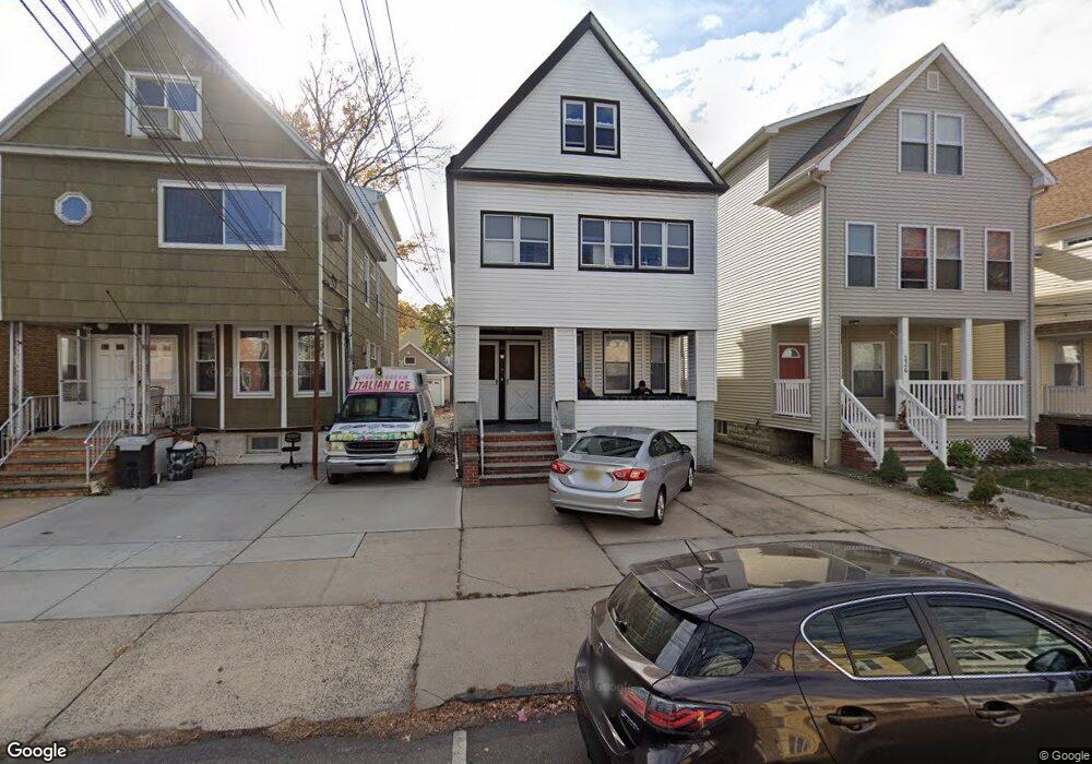
124 W 10th St Unit 1 Bayonne, NJ 07002
Constable Hook NeighborhoodEstimated Value: $560,000 - $757,000
2
Beds
1
Bath
1,000
Sq Ft
$686/Sq Ft
Est. Value
About This Home
This home is located at 124 W 10th St Unit 1, Bayonne, NJ 07002 and is currently estimated at $686,123, approximately $686 per square foot. 124 W 10th St Unit 1 is a home located in Hudson County with nearby schools including Bayonne High School and All Saints Catholic Academy.
Ownership History
Date
Name
Owned For
Owner Type
Purchase Details
Closed on
Aug 15, 2011
Sold by
Filipowicz Phyllis
Bought by
Brenner Jeffrey A and Brenner Shari
Current Estimated Value
Home Financials for this Owner
Home Financials are based on the most recent Mortgage that was taken out on this home.
Original Mortgage
$185,183
Outstanding Balance
$126,289
Interest Rate
4.25%
Mortgage Type
FHA
Estimated Equity
$559,834
Create a Home Valuation Report for This Property
The Home Valuation Report is an in-depth analysis detailing your home's value as well as a comparison with similar homes in the area
Home Values in the Area
Average Home Value in this Area
Purchase History
| Date | Buyer | Sale Price | Title Company |
|---|---|---|---|
| Brenner Jeffrey A | $190,000 | -- |
Source: Public Records
Mortgage History
| Date | Status | Borrower | Loan Amount |
|---|---|---|---|
| Open | Brenner Jeffrey A | $185,183 |
Source: Public Records
Tax History Compared to Growth
Tax History
| Year | Tax Paid | Tax Assessment Tax Assessment Total Assessment is a certain percentage of the fair market value that is determined by local assessors to be the total taxable value of land and additions on the property. | Land | Improvement |
|---|---|---|---|---|
| 2025 | $11,503 | $411,400 | $182,000 | $229,400 |
| 2024 | $11,038 | $411,400 | $182,000 | $229,400 |
| 2023 | $11,038 | $411,400 | $182,000 | $229,400 |
| 2022 | $10,832 | $411,400 | $182,000 | $229,400 |
| 2021 | $10,746 | $411,400 | $182,000 | $229,400 |
| 2020 | $10,557 | $411,400 | $182,000 | $229,400 |
| 2019 | $11,530 | $133,600 | $84,000 | $49,600 |
| 2018 | $11,300 | $133,600 | $84,000 | $49,600 |
| 2017 | $11,007 | $133,600 | $84,000 | $49,600 |
| 2016 | $10,601 | $133,600 | $84,000 | $49,600 |
| 2015 | $10,252 | $133,600 | $84,000 | $49,600 |
| 2014 | $9,947 | $133,600 | $84,000 | $49,600 |
Source: Public Records
Map
Nearby Homes
- 131 W 10th St
- 128 W 11th St
- 153 W 9th St
- 158 W 8th St
- 169 W 9th St
- 73 W 12th St
- 54 Boatworks Dr Unit 210
- 293 Avenue C
- 214 Avenue A Unit A4
- 34 Boatworks Dr Unit 407
- 101 North St
- 46 W 11th St Unit 48
- 367 Avenue A
- 14 Boatworks Dr Unit 506
- 313-315 Avenue C Unit 6
- 4 Boatworks Dr
- 6 Elco Ct Unit 1606
- 35 W 11th St
- 29 W 9th St
- 135 W 15th St
- 124 W 10th St
- 126 W 10th St
- 126 W 10th St Unit 2
- 122 W 10th St
- 130 W 10th St
- 120 W 10th St
- 118 W 10th St
- 118 W 10th St Unit 1
- 284 Avenue A
- 286 Avenue A
- 282 Avenue A
- 282 Avenue A Unit 2
- 125 W 9th St
- 127 W 9th St
- 123 W 9th St
- 123 W 9th St Unit 2
- 280 Avenue A
- 121 W 9th St
- 129 W 9th St
- 288 Avenue A Unit 2