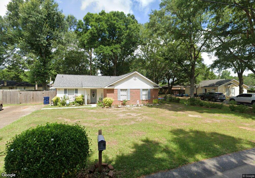
1240 Comstock Ct Mobile, AL 36695
Baker NeighborhoodEstimated Value: $180,205 - $206,000
3
Beds
2
Baths
1,365
Sq Ft
$145/Sq Ft
Est. Value
About This Home
This home is located at 1240 Comstock Ct, Mobile, AL 36695 and is currently estimated at $198,051, approximately $145 per square foot. 1240 Comstock Ct is a home located in Mobile County with nearby schools including Elsie Collier Elementary School, Bernice J Causey Middle School, and Baker High School.
Ownership History
Date
Name
Owned For
Owner Type
Purchase Details
Closed on
Feb 25, 2011
Sold by
Gardner Thomas J and Gardner Tracy Leigh Murrill
Bought by
Gardner Thomas J and Gardner Tracy Leigh Murrill
Current Estimated Value
Purchase Details
Closed on
May 28, 2004
Sold by
Forwood Brothers Rentals Llc
Bought by
Gardner Thomas Joseph
Home Financials for this Owner
Home Financials are based on the most recent Mortgage that was taken out on this home.
Original Mortgage
$78,000
Outstanding Balance
$36,275
Interest Rate
5.6%
Mortgage Type
Unknown
Estimated Equity
$161,776
Purchase Details
Closed on
Jan 22, 2002
Sold by
Forwood Brothers Builders Inc
Bought by
Forwood Brothers Rentals Llc
Home Financials for this Owner
Home Financials are based on the most recent Mortgage that was taken out on this home.
Original Mortgage
$73,200
Interest Rate
6.95%
Create a Home Valuation Report for This Property
The Home Valuation Report is an in-depth analysis detailing your home's value as well as a comparison with similar homes in the area
Home Values in the Area
Average Home Value in this Area
Purchase History
| Date | Buyer | Sale Price | Title Company |
|---|---|---|---|
| Gardner Thomas J | -- | None Available | |
| Gardner Thomas Joseph | $89,000 | Surety Land Title Inc | |
| Forwood Brothers Rentals Llc | $73,200 | Surety Land Title Inc |
Source: Public Records
Mortgage History
| Date | Status | Borrower | Loan Amount |
|---|---|---|---|
| Open | Gardner Thomas Joseph | $78,000 | |
| Previous Owner | Forwood Brothers Rentals Llc | $73,200 |
Source: Public Records
Tax History
| Year | Tax Paid | Tax Assessment Tax Assessment Total Assessment is a certain percentage of the fair market value that is determined by local assessors to be the total taxable value of land and additions on the property. | Land | Improvement |
|---|---|---|---|---|
| 2025 | -- | $14,760 | $3,000 | $11,760 |
| 2024 | -- | $13,720 | $3,000 | $10,720 |
| 2023 | $0 | $11,930 | $3,300 | $8,630 |
| 2022 | $0 | $10,800 | $3,000 | $7,800 |
| 2021 | $0 | $10,960 | $2,400 | $8,560 |
| 2020 | $515 | $10,960 | $2,400 | $8,560 |
| 2019 | $515 | $10,960 | $0 | $0 |
| 2018 | $0 | $10,300 | $0 | $0 |
| 2017 | $0 | $10,220 | $0 | $0 |
| 2016 | $515 | $10,620 | $0 | $0 |
| 2013 | $567 | $10,120 | $0 | $0 |
Source: Public Records
Map
Nearby Homes
- 9375 Ashwood Ct
- 0 New Neck Rd Unit 387066
- 9613 Oak Forrest Place
- 9630 Oak Forrest Dr Unit 2
- 9650 Oak Forrest Dr
- 11905 Airport Blvd
- 11905 Airport Blvd Unit 3
- 801 Copperfield Dr E
- 835 Royal Woods Dr E
- 860 Trailwood Dr E
- 1151 Twelve Oaks Dr
- 9633 Royal Woods Dr S
- 8880 Ohara Dr
- 1170 Wellington Ct S
- 750 Hale Rd
- 9751 Pine Knoll Rd
- 10635 Burlington Estates Dr
- 1145 Dominion Dr E
- 1509 William Dunn Way
- 9841 Shadow Wood Dr
- 1250 Comstock Ct
- 9351 Burnt Tree Dr
- 9361 Burnt Tree Dr
- 1260 Comstock Ct
- 1251 Comstock Ct
- 9331 Burnt Tree Dr
- 1240 Palmetto Ct
- 1240 Palmetto Ct Unit 3
- 9365 Burnt Tree Dr
- 1261 Palmetto Ct
- 1270 Comstock Ct
- 1271 Comstock Ct
- 9360 Burnt Tree Dr
- 1250 Palmetto Ct
- 9350 Burnt Tree Dr
- 9381 Burnt Tree Dr Unit 3
- 9381 Burnt Tree Dr
- 9321 Burnt Tree Dr
- 1280 Comstock Ct
- 1271 Palmetto Ct
Your Personal Tour Guide
Ask me questions while you tour the home.