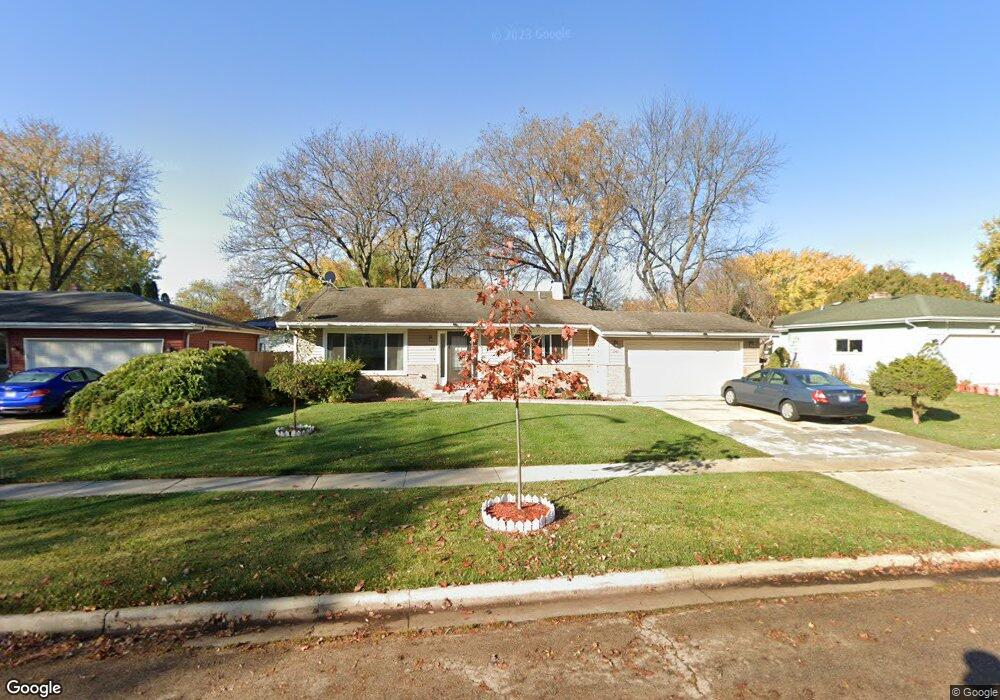
1240 Lennoxshire Dr Elgin, IL 60123
Century Oaks NeighborhoodEstimated Value: $331,000 - $360,350
3
Beds
2
Baths
1,900
Sq Ft
$184/Sq Ft
Est. Value
About This Home
This home is located at 1240 Lennoxshire Dr, Elgin, IL 60123 and is currently estimated at $349,088, approximately $183 per square foot. 1240 Lennoxshire Dr is a home located in Kane County with nearby schools including Century Oaks Elementary School, Kimball Middle School, and Larkin High School.
Ownership History
Date
Name
Owned For
Owner Type
Purchase Details
Closed on
Mar 15, 2022
Sold by
Abdul Azeem
Bought by
Azeem Abdul and Rana Gul E
Current Estimated Value
Home Financials for this Owner
Home Financials are based on the most recent Mortgage that was taken out on this home.
Original Mortgage
$190,000
Outstanding Balance
$178,168
Interest Rate
4.25%
Mortgage Type
New Conventional
Estimated Equity
$170,920
Purchase Details
Closed on
Jul 1, 2011
Sold by
Azeem Abdul
Bought by
Azeem Abdul and Azeem Saad
Home Financials for this Owner
Home Financials are based on the most recent Mortgage that was taken out on this home.
Original Mortgage
$175,500
Interest Rate
4.22%
Mortgage Type
New Conventional
Purchase Details
Closed on
Oct 27, 2003
Sold by
Graff Robert F and Graff Marion T
Bought by
Azeem Abdul
Home Financials for this Owner
Home Financials are based on the most recent Mortgage that was taken out on this home.
Original Mortgage
$195,396
Interest Rate
6.01%
Mortgage Type
FHA
Purchase Details
Closed on
Apr 25, 2001
Sold by
Graff Robert F and Graff Marion T
Bought by
Graff Robert F and Graff Marion T
Purchase Details
Closed on
Oct 30, 1998
Sold by
Danhof Michael J and Danhof Jean M
Bought by
Graff Robert F and Graff Marion T
Home Financials for this Owner
Home Financials are based on the most recent Mortgage that was taken out on this home.
Original Mortgage
$25,000
Interest Rate
6.78%
Purchase Details
Closed on
Nov 11, 1997
Sold by
Duermit Robert F and Duermit Brian J
Bought by
Dunhof Michael J and Dunhof Jean M
Home Financials for this Owner
Home Financials are based on the most recent Mortgage that was taken out on this home.
Original Mortgage
$126,000
Interest Rate
7.43%
Purchase Details
Closed on
Aug 6, 1997
Sold by
Hud
Bought by
Duermit Brian J and Bob Duermit Robert F
Home Financials for this Owner
Home Financials are based on the most recent Mortgage that was taken out on this home.
Original Mortgage
$78,000
Interest Rate
8.5%
Purchase Details
Closed on
Dec 20, 1996
Sold by
Ramsey Kenneth R
Bought by
Hud
Create a Home Valuation Report for This Property
The Home Valuation Report is an in-depth analysis detailing your home's value as well as a comparison with similar homes in the area
Home Values in the Area
Average Home Value in this Area
Purchase History
| Date | Buyer | Sale Price | Title Company |
|---|---|---|---|
| Azeem Abdul | -- | Servicelink | |
| Azeem Abdul | -- | Tek Title L L C | |
| Azeem Abdul | $199,500 | First American Title Ins Co | |
| Graff Robert F | -- | -- | |
| Graff Robert F | $144,500 | -- | |
| Dunhof Michael J | $90,000 | Attorneys National Title | |
| Duermit Brian J | -- | Attorneys Natl Title | |
| Hud | -- | -- |
Source: Public Records
Mortgage History
| Date | Status | Borrower | Loan Amount |
|---|---|---|---|
| Open | Azeem Abdul | $190,000 | |
| Previous Owner | Azeem Abdul | $175,500 | |
| Previous Owner | Azeem Abdul | $195,396 | |
| Previous Owner | Graff Robert F | $25,000 | |
| Previous Owner | Dunhof Michael J | $126,000 | |
| Previous Owner | Duermit Brian J | $78,000 |
Source: Public Records
Tax History Compared to Growth
Tax History
| Year | Tax Paid | Tax Assessment Tax Assessment Total Assessment is a certain percentage of the fair market value that is determined by local assessors to be the total taxable value of land and additions on the property. | Land | Improvement |
|---|---|---|---|---|
| 2024 | $7,108 | $96,823 | $24,998 | $71,825 |
| 2023 | $6,775 | $87,472 | $22,584 | $64,888 |
| 2022 | $6,396 | $79,760 | $20,593 | $59,167 |
| 2021 | $6,118 | $74,570 | $19,253 | $55,317 |
| 2020 | $5,945 | $71,189 | $18,380 | $52,809 |
| 2019 | $5,773 | $67,812 | $17,508 | $50,304 |
| 2018 | $5,437 | $60,995 | $16,494 | $44,501 |
| 2017 | $5,314 | $57,662 | $15,593 | $42,069 |
| 2016 | $5,065 | $53,495 | $14,466 | $39,029 |
| 2015 | -- | $49,033 | $13,259 | $35,774 |
| 2014 | -- | $48,427 | $13,095 | $35,332 |
| 2013 | -- | $49,704 | $13,440 | $36,264 |
Source: Public Records
Map
Nearby Homes
- 1121 Forest Dr
- 1223 Ridgeway Dr
- 89 Brookwood Ct
- 1235 Meadow Ln
- 997 Meadow Ln
- 41 Lockman Cir Unit 5
- 5 Creekside Cir Unit B
- 938 Hillcrest Rd
- 1405 Creekside Ct Unit B
- 1142 Morningside Dr
- 900 Ruth Dr
- 801 N Mclean Blvd Unit 220
- 801 N Mclean Blvd Unit 226
- 801 N Mclean Blvd Unit 316
- 801 N Mclean Blvd Unit 362
- 1104 Florimond Dr
- 2032 Swan Ln
- 587 N Clifton Ave
- 730 N Lyle Ave
- LOT 17 Teal Ave
- 1250 Lennoxshire Dr
- 1230 Lennoxshire Dr
- 1237 Mallard Dr
- 1245 Mallard Dr
- 1229 Mallard Dr
- 1260 Lennoxshire Dr
- 1220 Lennoxshire Dr
- 1235 Lennoxshire Dr
- 1255 Mallard Dr
- 1245 Lennoxshire Dr
- 1219 Mallard Dr
- 1225 Lennoxshire Dr
- 1270 Lennoxshire Dr
- 1255 Lennoxshire Dr
- 1210 Lennoxshire Dr
- 1215 Lennoxshire Dr
- 1265 Mallard Dr
- 1209 Mallard Dr
- 1265 Lennoxshire Dr
- 1427 Century Oaks Dr