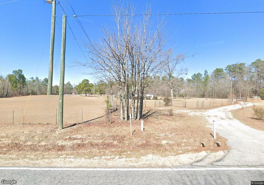
1240 Meadowfield Rd Lexington, SC 29073
Estimated Value: $119,000 - $211,000
2
Beds
2
Baths
1,288
Sq Ft
$121/Sq Ft
Est. Value
About This Home
This home is located at 1240 Meadowfield Rd, Lexington, SC 29073 and is currently estimated at $155,650, approximately $120 per square foot. 1240 Meadowfield Rd is a home located in Lexington County with nearby schools including Sandhills Primary School, Sandhills Elementary School, and Sandhills Middle School.
Ownership History
Date
Name
Owned For
Owner Type
Purchase Details
Closed on
Dec 6, 2021
Sold by
Amodio Kimette and Estate Of Ray Lagene Bloxom
Bought by
Bloxom Kelly Kyle
Current Estimated Value
Purchase Details
Closed on
Apr 28, 2008
Sold by
Lorick Wade Clyde
Bought by
Bloxom Ray L
Home Financials for this Owner
Home Financials are based on the most recent Mortgage that was taken out on this home.
Original Mortgage
$58,500
Interest Rate
5.82%
Mortgage Type
Purchase Money Mortgage
Create a Home Valuation Report for This Property
The Home Valuation Report is an in-depth analysis detailing your home's value as well as a comparison with similar homes in the area
Home Values in the Area
Average Home Value in this Area
Purchase History
| Date | Buyer | Sale Price | Title Company |
|---|---|---|---|
| Bloxom Kelly Kyle | -- | None Available | |
| Bloxom Ray L | $65,000 | -- |
Source: Public Records
Mortgage History
| Date | Status | Borrower | Loan Amount |
|---|---|---|---|
| Previous Owner | Bloxom Ray L | $58,500 |
Source: Public Records
Tax History Compared to Growth
Tax History
| Year | Tax Paid | Tax Assessment Tax Assessment Total Assessment is a certain percentage of the fair market value that is determined by local assessors to be the total taxable value of land and additions on the property. | Land | Improvement |
|---|---|---|---|---|
| 2024 | $368 | $3,227 | $1,598 | $1,629 |
| 2023 | $368 | $3,227 | $1,598 | $1,629 |
| 2022 | $387 | $3,227 | $1,598 | $1,629 |
| 2020 | $390 | $3,227 | $1,598 | $1,629 |
| 2019 | $397 | $3,205 | $1,598 | $1,607 |
| 2018 | $408 | $3,205 | $1,598 | $1,607 |
| 2017 | $378 | $3,205 | $1,598 | $1,607 |
| 2016 | $252 | $3,204 | $1,598 | $1,606 |
| 2014 | $310 | $3,245 | $1,529 | $1,716 |
| 2013 | -- | $3,250 | $1,530 | $1,720 |
Source: Public Records
Map
Nearby Homes
- 1054 Meadowfield Rd
- 223 Mimosa Dr
- 977 Meadowfield Rd
- 4303 Fish Hatchery Rd
- 0 Mimosa Dr
- 252 Doe Trail Dr
- 161 Suzanne Ct
- 117 Macedon Dr
- 141 Dew Blossom Dr
- 137 Dew Blossom Dr
- 133 Dew Blossom Dr
- 158 Macedon Dr
- 125 Dew Blossom Dr
- 187 Federation St
- Broadmoor Plan at Edmund Hill Estates
- Sweetbay Plan at Edmund Hill Estates
- Bradford Plan at Edmund Hill Estates
- Westbury Plan at Edmund Hill Estates
- Crestwind Plan at Edmund Hill Estates
- Baxter Plan at Edmund Hill Estates
- 0 Jim Spence Rd
- 0 Jim Spence Rd
- 1233 Meadowfield Rd
- 1229 Meadowfield Rd
- 1201 Meadowfield Rd
- 1202 Meadowfield Ct
- 1221 Meadowfield Rd
- 1261 Meadowfield Rd
- 3078 Highway 6
- 4624 Fish Hatchery Rd
- 1202 Meadowfield Rd
- 1343 Meadowfield Rd
- 119 Tosha St
- 4540 Fish Hatchery Rd
- 127 Tosha St
- 4536 Fish Hatchery Rd
- 4546 Fish Hatchery Rd
- 135 Tosha St
- 3240 Highway 6
- 1123 Meadowfield Rd
