Estimated Value: $581,000 - $684,000
Studio
--
Bath
2,412
Sq Ft
$254/Sq Ft
Est. Value
About This Home
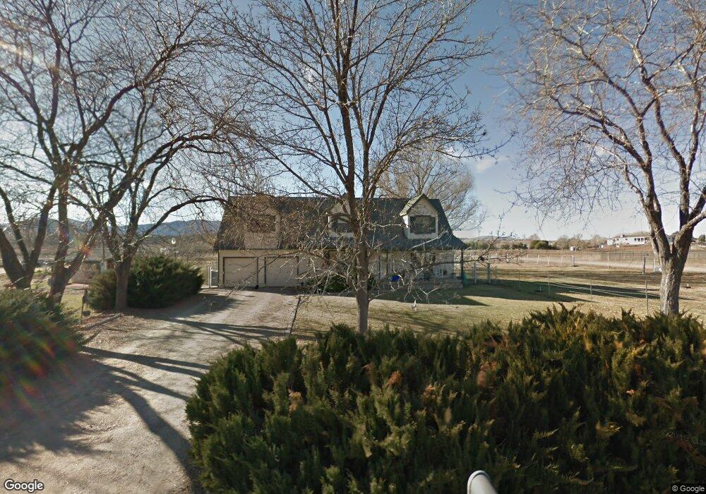
This home is located at 1240 S River Dr, Dewey, AZ 86327 and is currently estimated at $611,806, approximately $253 per square foot. 1240 S River Dr is a home located in Yavapai County with nearby schools including Mountain View Elementary School, Glassford Hill Middle School, and Bradshaw Mountain High School.
Ownership History
Date
Name
Owned For
Owner Type
Purchase Details
Closed on
Oct 14, 1998
Sold by
Cowell Earl V and Cowell Claudine
Bought by
Thomas Richard James and Thomas Lou Ann
Current Estimated Value
Home Financials for this Owner
Home Financials are based on the most recent Mortgage that was taken out on this home.
Original Mortgage
$162,400
Outstanding Balance
$33,790
Interest Rate
6.6%
Mortgage Type
New Conventional
Estimated Equity
$578,016
Create a Home Valuation Report for This Property
The Home Valuation Report is an in-depth analysis detailing your home's value as well as a comparison with similar homes in the area
Home Values in the Area
Average Home Value in this Area
Purchase History
| Date | Buyer | Sale Price | Title Company |
|---|---|---|---|
| Thomas Richard James | $203,000 | Capital Title Agency |
Source: Public Records
Mortgage History
| Date | Status | Borrower | Loan Amount |
|---|---|---|---|
| Open | Thomas Richard James | $162,400 |
Source: Public Records
Tax History
| Year | Tax Paid | Tax Assessment Tax Assessment Total Assessment is a certain percentage of the fair market value that is determined by local assessors to be the total taxable value of land and additions on the property. | Land | Improvement |
|---|---|---|---|---|
| 2026 | $2,152 | $43,085 | -- | -- |
| 2024 | $1,972 | $44,047 | -- | -- |
| 2023 | $1,972 | $35,847 | $0 | $0 |
| 2022 | $1,940 | $28,367 | $4,015 | $24,352 |
| 2021 | $2,027 | $26,628 | $3,639 | $22,989 |
| 2020 | $1,948 | $0 | $0 | $0 |
| 2019 | $1,924 | $0 | $0 | $0 |
| 2018 | $1,829 | $0 | $0 | $0 |
| 2017 | $1,794 | $0 | $0 | $0 |
| 2016 | $1,733 | $0 | $0 | $0 |
| 2015 | $1,708 | $0 | $0 | $0 |
| 2014 | $1,635 | $0 | $0 | $0 |
Source: Public Records
Map
Nearby Homes
- 0 Arizona 69
- 1382 S Foothill Dr
- 1870 S Sierra Dr
- 12880 E Brody Trail
- 1850 S Crooked H Trail
- 169 & I-17 Arizona 169
- 14400 E Sunhill Trail
- 475 S State Route 69
- 14393 E White Dr
- 14410 E Blue Ridge Rd
- 14235 E Leona Ln
- 14563 E Ridge Way
- 14235 E Leona Lane Parcel P
- 14235 E Leona Lane Parcel K
- 12376 E Prescott Dells Ranch Rd
- 0 Hwy 69 Unit 962171
- 000xx E White Dr
- 000xx E White Dr
- 14500 E Eagle Dr
- 14400 E Mustang Dr
- 3 S River Dr
- 0 S River Dr
- 1160 S River Dr
- 1264 S River Dr
- 1160 N River Dr
- 13355 E Dewey Ct
- 1201 S River Dr
- 13480 E Paint Pony
- 1165 S River Dr
- 1318 S River Dr
- 1050 S River Dr
- 1062 S River Dr
- 1074 S River Dr
- 1336 S River Dr
- 1155 S River Dr
- 1155 S River Dr
- 1265 S River Dr
- 1038 S River Dr
- 1364 S River Dr
- 1376 S River Dr