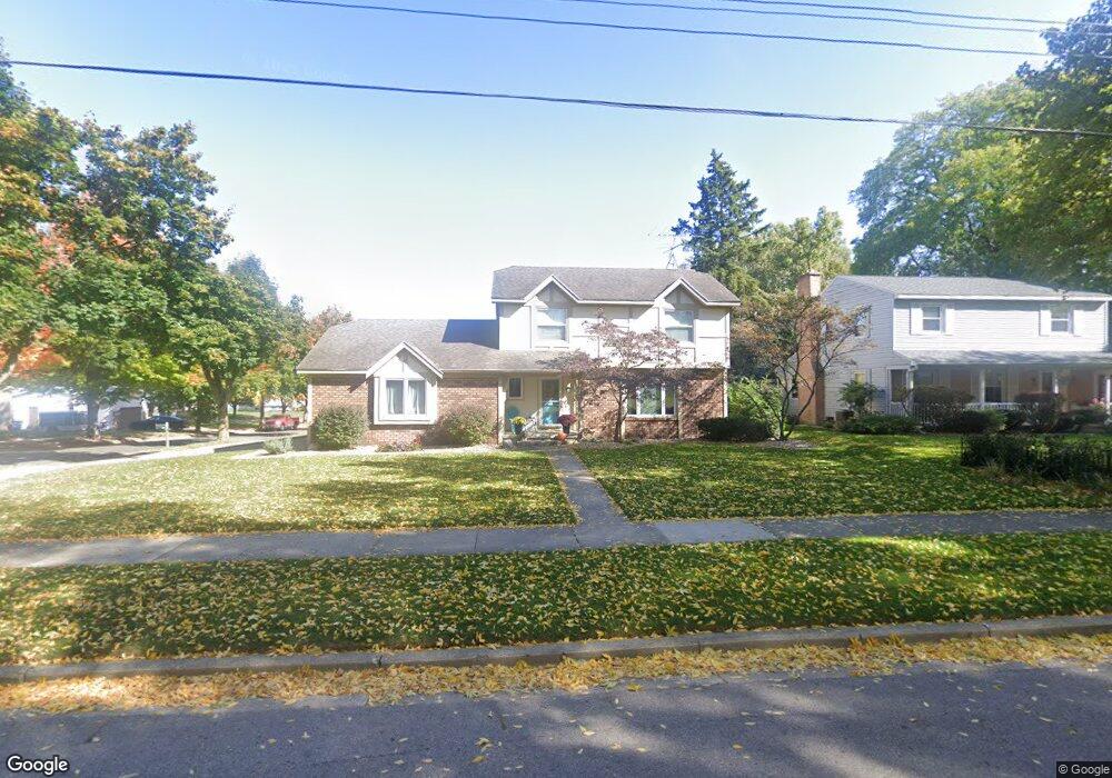
1240 Worcester Dr NE Grand Rapids, MI 49505
North East Citizens Action NeighborhoodEstimated Value: $376,000 - $426,000
3
Beds
2
Baths
1
Sq Ft
$396,663/Sq Ft
Est. Value
About This Home
This home is located at 1240 Worcester Dr NE, Grand Rapids, MI 49505 and is currently estimated at $396,663, approximately $396,663 per square foot. 1240 Worcester Dr NE is a home located in Kent County with nearby schools including Kent Hills School, Riverside Middle School, and Union High School.
Ownership History
Date
Name
Owned For
Owner Type
Purchase Details
Closed on
May 31, 2023
Sold by
Heemstra Michael J and Heemstra Melissa L
Bought by
Michael And Melissa Heemstra Trust and Heemstra
Current Estimated Value
Purchase Details
Closed on
Jun 3, 1993
Sold by
Bierens Bierens J J and Bierens Flanders C
Bought by
Heemstra Michael J Melissa L
Purchase Details
Closed on
Mar 30, 1987
Bought by
Heemstra Michael J Melissa L
Create a Home Valuation Report for This Property
The Home Valuation Report is an in-depth analysis detailing your home's value as well as a comparison with similar homes in the area
Home Values in the Area
Average Home Value in this Area
Purchase History
| Date | Buyer | Sale Price | Title Company |
|---|---|---|---|
| Michael And Melissa Heemstra Trust | -- | None Listed On Document | |
| Heemstra Michael J Melissa L | $100,000 | -- | |
| Heemstra Michael J Melissa L | $86,000 | -- |
Source: Public Records
Tax History
| Year | Tax Paid | Tax Assessment Tax Assessment Total Assessment is a certain percentage of the fair market value that is determined by local assessors to be the total taxable value of land and additions on the property. | Land | Improvement |
|---|---|---|---|---|
| 2025 | $3,358 | $201,700 | $0 | $0 |
| 2024 | $34 | $194,400 | $0 | $0 |
| 2023 | $3,216 | $178,700 | $0 | $0 |
| 2022 | $3,234 | $156,500 | $0 | $0 |
| 2021 | $3,162 | $148,000 | $0 | $0 |
| 2020 | $3,055 | $134,100 | $0 | $0 |
| 2019 | $3,198 | $124,000 | $0 | $0 |
| 2018 | $3,089 | $106,900 | $0 | $0 |
| 2017 | $3,008 | $93,700 | $0 | $0 |
| 2016 | $3,013 | $90,000 | $0 | $0 |
| 2015 | $2,802 | $90,000 | $0 | $0 |
| 2013 | -- | $82,400 | $0 | $0 |
Source: Public Records
Map
Nearby Homes
- 1106 Walwood Dr NE
- 1441 Beckwith Ave NE
- 1410 Beckwith Ave NE
- 2225 Watertown Way
- 2223 Watertown Way
- 2247 Watertown Way
- 2219 Watertown Way
- 2239 Watertown Way
- 2275 Watertown Way
- 2243 Watertown Way
- 2269 Watertown Way
- 2249 Watertown Way
- 2368 Watertown Way Unit 38
- 2324 Whimbrel Ct NE
- 1511 Leonard St NE
- 2154 Globe St NE
- 1403 Matilda St NE
- 2040 Bryceway Ct NE Unit 56
- 1342 Mason St NE
- 1829 Lonsdale Dr NE
- 2200 Cranbrook Dr NE
- 2167 Cranbrook Dr NE
- 1231 Worcester Dr NE
- 2206 Cranbrook Dr NE
- 2201 Cranbrook Dr NE
- 1210 Worcester Dr NE
- 1256 Worcester Dr NE
- 2141 Cranbrook Dr NE
- 2136 Cranbrook Dr NE
- 2136 Cranbrook Dr NE Unit 42
- 2185 Leonard St NE
- 1259 Walwood Dr NE
- 2214 Cranbrook Dr NE
- 2147 Leonard St NE
- 2130 Cranbrook Dr NE
- 2130 Cranbrook Dr NE Unit 43
- 1253 Worcester Dr NE
- 1264 Worcester Dr NE
- 1265 Walwood Dr NE
- 2205 Leonard St NE
Your Personal Tour Guide
Ask me questions while you tour the home.