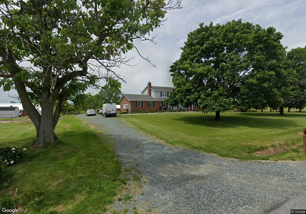
12400 Browntown Rd Kennedyville, MD 21645
Estimated Value: $507,728 - $599,000
--
Bed
3
Baths
3,388
Sq Ft
$161/Sq Ft
Est. Value
About This Home
This home is located at 12400 Browntown Rd, Kennedyville, MD 21645 and is currently estimated at $545,243, approximately $160 per square foot. 12400 Browntown Rd is a home located in Kent County with nearby schools including Kent County Middle School and Kent County High School.
Ownership History
Date
Name
Owned For
Owner Type
Purchase Details
Closed on
Jun 30, 1989
Sold by
Yoder Harry A and Yoder Lizzie A
Bought by
Woodfield John A and Woodfield Theresa M
Current Estimated Value
Home Financials for this Owner
Home Financials are based on the most recent Mortgage that was taken out on this home.
Original Mortgage
$160,000
Interest Rate
10.07%
Purchase Details
Closed on
May 2, 1975
Sold by
Thompson Walter F M and Thompson Margaret A
Bought by
Yoder Harry A and Yoder Lizzie A
Create a Home Valuation Report for This Property
The Home Valuation Report is an in-depth analysis detailing your home's value as well as a comparison with similar homes in the area
Home Values in the Area
Average Home Value in this Area
Purchase History
| Date | Buyer | Sale Price | Title Company |
|---|---|---|---|
| Woodfield John A | $177,800 | -- | |
| Yoder Harry A | $15,000 | -- |
Source: Public Records
Mortgage History
| Date | Status | Borrower | Loan Amount |
|---|---|---|---|
| Closed | Woodfield John A | $160,000 |
Source: Public Records
Tax History Compared to Growth
Tax History
| Year | Tax Paid | Tax Assessment Tax Assessment Total Assessment is a certain percentage of the fair market value that is determined by local assessors to be the total taxable value of land and additions on the property. | Land | Improvement |
|---|---|---|---|---|
| 2025 | $3,260 | $308,267 | $0 | $0 |
| 2024 | $3,161 | $286,833 | $0 | $0 |
| 2023 | $3,070 | $265,400 | $69,400 | $196,000 |
| 2022 | $3,001 | $261,667 | $0 | $0 |
| 2021 | $2,943 | $257,933 | $0 | $0 |
| 2020 | $2,943 | $254,200 | $69,400 | $184,800 |
| 2019 | $2,943 | $254,200 | $69,400 | $184,800 |
| 2018 | $2,943 | $254,200 | $69,400 | $184,800 |
| 2017 | $2,979 | $257,400 | $0 | $0 |
| 2016 | -- | $257,400 | $0 | $0 |
| 2015 | -- | $257,400 | $0 | $0 |
| 2014 | $3,198 | $260,800 | $0 | $0 |
Source: Public Records
Map
Nearby Homes
- 11969 Augustine Herman Hwy
- 11944 Augustine Herman Hwy
- 11960 Flour Mill St
- 29380 Old Locust Grove Rd
- 13983 Turners Point Rd
- 11307 Urieville Ln
- 0 Anglewood Rd
- 28781 Valley Rd
- 11040 Kylie Ln
- 0 Station Rd
- 26994 Branchtown Rd
- 29341 Glencoe Rd
- 26670 Maple Ave
- 0 Medders Rd
- 26959 Branchtown Rd
- 0 Main St
- 12765 Still Pond Rd
- 12776 Still Pond Rd
- 0 Dutchtown Rd
- 0 Blackmon Ln
- 12411 Browntown Rd
- 12420 Browntown Rd
- 12300 Browntown Rd
- 12280 Browntown Rd
- 12262 Browntown Rd
- 12503 Augustine Herman Hwy
- 12515 Augustine Herman Hwy
- 12461 Augustine Herman Hwy
- 12502 Augustine Herman Hwy
- 12371 Augustine Herman Hwy
- 12441 Augustine Herman Hwy
- 12403 Augustine Herman Hwy
- 28470 Lambs Meadow Rd
- 12201 Browntown Rd
- 12176 Browntown Rd
- 12430 Augustine Herman Hwy
- 11979 Dewees Ln
- 28410 Lambs Meadow Rd
- 12655 Augustine Herman Hwy
- 10080 Morgnec Church Rd