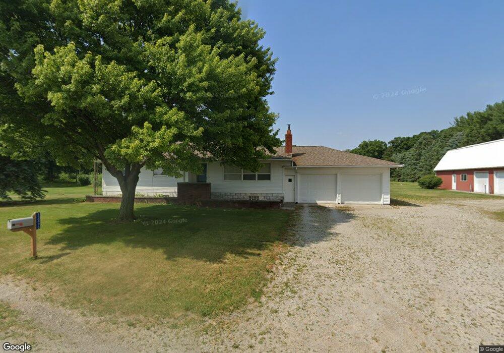
12400 County Road L Wauseon, OH 43567
Estimated Value: $215,000 - $236,000
3
Beds
2
Baths
1,298
Sq Ft
$175/Sq Ft
Est. Value
About This Home
This home is located at 12400 County Road L, Wauseon, OH 43567 and is currently estimated at $227,165, approximately $175 per square foot. 12400 County Road L is a home located in Fulton County with nearby schools including Delta Elementary School, Pike-Delta-York Middle School, and Pike-Delta-York High School.
Ownership History
Date
Name
Owned For
Owner Type
Purchase Details
Closed on
Sep 24, 2024
Sold by
Seigneur Gary A and Seigneur Cheryll A
Bought by
Seigneur Ginger A
Current Estimated Value
Home Financials for this Owner
Home Financials are based on the most recent Mortgage that was taken out on this home.
Original Mortgage
$75,413
Outstanding Balance
$74,641
Interest Rate
6.49%
Mortgage Type
Seller Take Back
Estimated Equity
$152,524
Purchase Details
Closed on
Dec 31, 2013
Sold by
Estate Of Allan G Seigneur
Bought by
Seigneur Eileen L
Purchase Details
Closed on
Jan 1, 1990
Bought by
Seigneur Allan G and Seigneur Eileen
Create a Home Valuation Report for This Property
The Home Valuation Report is an in-depth analysis detailing your home's value as well as a comparison with similar homes in the area
Home Values in the Area
Average Home Value in this Area
Purchase History
| Date | Buyer | Sale Price | Title Company |
|---|---|---|---|
| Seigneur Ginger A | $146,500 | None Listed On Document | |
| Seigneur Ginger A | -- | None Listed On Document | |
| Seigneur Eileen L | -- | None Available | |
| Seigneur Allan G | -- | -- |
Source: Public Records
Mortgage History
| Date | Status | Borrower | Loan Amount |
|---|---|---|---|
| Open | Seigneur Ginger A | $75,413 |
Source: Public Records
Tax History Compared to Growth
Tax History
| Year | Tax Paid | Tax Assessment Tax Assessment Total Assessment is a certain percentage of the fair market value that is determined by local assessors to be the total taxable value of land and additions on the property. | Land | Improvement |
|---|---|---|---|---|
| 2024 | $2,027 | $51,420 | $8,650 | $42,770 |
| 2023 | $2,032 | $51,420 | $8,650 | $42,770 |
| 2022 | $1,444 | $37,770 | $7,210 | $30,560 |
| 2021 | $1,512 | $37,770 | $7,210 | $30,560 |
| 2020 | $1,491 | $37,770 | $7,210 | $30,560 |
| 2019 | $1,279 | $34,720 | $7,070 | $27,650 |
| 2018 | $1,165 | $34,720 | $7,070 | $27,650 |
| 2017 | $1,175 | $34,720 | $7,070 | $27,650 |
| 2016 | $1,071 | $29,820 | $7,070 | $22,750 |
| 2015 | $1,017 | $29,820 | $7,070 | $22,750 |
| 2014 | $1,012 | $29,820 | $7,070 | $22,750 |
| 2013 | $1,525 | $40,150 | $7,630 | $32,520 |
Source: Public Records
Map
Nearby Homes
- 11715 County Road L
- 11517 County Road 11
- 11396 County Road N
- 11670 County Road L
- 8453 County Road 13
- 0 County Road H
- 7620 County Road 12
- 7373 County Road 12
- 14900 W Co Rd H
- 14640 County Road K
- 14900 County Road H
- 13354 U S 20a
- 13242 Us Highway 20a
- 460 Airport Hwy
- 16099 Us Highway 20
- 14578 Us Highway 20a
- 117 Fairview St
- 1209 Apache Dr
- 110 Hinkle St
- Integrity 1830 Plan at Arrowhead Trails
- 12325 County Road L
- 12484 County Road L
- 12511 County Road L
- 12520 County Road L
- 12545 County Road L
- 12244 County Road L
- 12556 County Road L
- 12575 County Road L
- 12606 County Road L
- 12660 County Road L
- 12233 County Road L
- 12500 County Road L
- 12709 County Road L
- 12720 County Road L
- 12730 County Road L
- 12735 County Road L
- 11589 County Road 12
- 11390 County Road 12
- 11430 County Road 12
- 11486 County Road 12