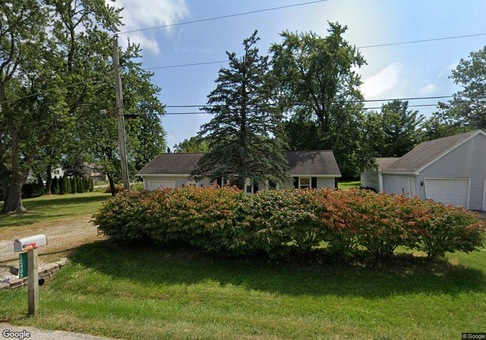
12403 W Atlantic Ave Waukegan, IL 60085
Shore Highlands NeighborhoodEstimated Value: $219,865 - $241,000
2
Beds
1
Bath
792
Sq Ft
$293/Sq Ft
Est. Value
About This Home
This home is located at 12403 W Atlantic Ave, Waukegan, IL 60085 and is currently estimated at $232,216, approximately $293 per square foot. 12403 W Atlantic Ave is a home located in Lake County with nearby schools including Clearview Elementary School, Miguel Juarez Middle School, and Waukegan High School.
Ownership History
Date
Name
Owned For
Owner Type
Purchase Details
Closed on
Jun 19, 2018
Sold by
Hicks Fred and Hicks Eleonora M
Bought by
Swarthont Linda M
Current Estimated Value
Home Financials for this Owner
Home Financials are based on the most recent Mortgage that was taken out on this home.
Original Mortgage
$116,000
Outstanding Balance
$69,293
Interest Rate
4.37%
Mortgage Type
New Conventional
Estimated Equity
$162,923
Purchase Details
Closed on
Mar 22, 2002
Sold by
Hicks Michael
Bought by
Hicks Fred and Hicks Eleanora M
Home Financials for this Owner
Home Financials are based on the most recent Mortgage that was taken out on this home.
Original Mortgage
$76,000
Interest Rate
7.16%
Create a Home Valuation Report for This Property
The Home Valuation Report is an in-depth analysis detailing your home's value as well as a comparison with similar homes in the area
Home Values in the Area
Average Home Value in this Area
Purchase History
| Date | Buyer | Sale Price | Title Company |
|---|---|---|---|
| Swarthont Linda M | $145,000 | Attorneys Title Guaranty Fun | |
| Hicks Fred | $80,000 | -- |
Source: Public Records
Mortgage History
| Date | Status | Borrower | Loan Amount |
|---|---|---|---|
| Open | Swarthont Linda M | $116,000 | |
| Previous Owner | Hicks Fred | $76,000 |
Source: Public Records
Tax History Compared to Growth
Tax History
| Year | Tax Paid | Tax Assessment Tax Assessment Total Assessment is a certain percentage of the fair market value that is determined by local assessors to be the total taxable value of land and additions on the property. | Land | Improvement |
|---|---|---|---|---|
| 2024 | $4,127 | $65,547 | $10,516 | $55,031 |
| 2023 | $3,328 | $58,877 | $9,247 | $49,630 |
| 2022 | $3,328 | $47,419 | $13,711 | $33,708 |
| 2021 | $3,415 | $46,156 | $13,604 | $32,552 |
| 2020 | $3,407 | $43,000 | $12,674 | $30,326 |
| 2019 | $3,433 | $39,403 | $11,614 | $27,789 |
| 2018 | $2,741 | $31,617 | $8,218 | $23,399 |
| 2017 | $2,366 | $27,973 | $7,271 | $20,702 |
| 2016 | $2,116 | $24,307 | $6,318 | $17,989 |
| 2015 | $1,952 | $21,755 | $5,655 | $16,100 |
| 2014 | $1,702 | $19,418 | $5,188 | $14,230 |
| 2012 | $2,435 | $21,039 | $5,621 | $15,418 |
Source: Public Records
Map
Nearby Homes
- 2810 W Atlantic Ave
- 2813 Theresa Ave
- 2715 W Greenwood Ave
- 2928 W Country Club Ave
- 3000 W Country Club Ave
- 2946 W Country Club Ave
- 1430 N Green Bay Rd
- 2440 W Cheyenne Rd
- 12352 W Atlantic Ave
- 1913 Chippewa Rd
- 35400 N Green Bay Rd
- 12698 W Grandview Ave
- 2207 Williamsburg Dr
- 12716 W Grandview Ave
- 12933 W Polo Ave
- 3320 Sunset Ave
- 2009 Harding Ave
- 2008 Harding Ave
- 3210 W Grandview Ave
- 3436 Florida Ave
- 12402 W Atlantic Ave
- 35766 N Frolic Ave
- 12440 W Pacific Ave
- 12442 W Atlantic Ave
- 1545 N Frolic Ave
- 1470 N Frolic Ave
- 12347 W Atlantic Ave
- 35845 N Northern Ave
- 12348 W Atlantic Ave
- 1450 N Frolic Ave
- 1701 N Frolic Ave
- 1702 N Frolic Ave
- 1701 N Ashley Ln
- 1703 N Frolic Ave
- 1704 N Frolic Ave
- 2922 W Keith Ave
- 12316 W Atlantic Ave
- 1705 N Frolic Ave
- 1429 N Frolic Ave
- 12393 W Atlantic Ave