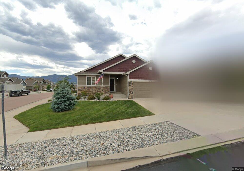
12404 Fish Pond Point Colorado Springs, CO 80921
Middle Creek NeighborhoodEstimated Value: $559,025 - $584,000
3
Beds
3
Baths
2,544
Sq Ft
$225/Sq Ft
Est. Value
About This Home
This home is located at 12404 Fish Pond Point, Colorado Springs, CO 80921 and is currently estimated at $571,506, approximately $224 per square foot. 12404 Fish Pond Point is a home located in El Paso County with nearby schools including The Da Vinci Academy, Discovery Canyon Campus Middle School, and Discovery Canyon Campus High School.
Ownership History
Date
Name
Owned For
Owner Type
Purchase Details
Closed on
Jun 20, 2014
Sold by
Saint Aubyn Homes Llc
Bought by
Brink Gary W and Lois Brink E
Current Estimated Value
Home Financials for this Owner
Home Financials are based on the most recent Mortgage that was taken out on this home.
Original Mortgage
$175,000
Outstanding Balance
$54,620
Interest Rate
4.23%
Mortgage Type
New Conventional
Estimated Equity
$516,886
Create a Home Valuation Report for This Property
The Home Valuation Report is an in-depth analysis detailing your home's value as well as a comparison with similar homes in the area
Home Values in the Area
Average Home Value in this Area
Purchase History
| Date | Buyer | Sale Price | Title Company |
|---|---|---|---|
| Brink Gary W | $285,900 | Heritage Title | |
| Brink Gary W | $285,900 | Heritage Title |
Source: Public Records
Mortgage History
| Date | Status | Borrower | Loan Amount |
|---|---|---|---|
| Open | Brink Gary W | $175,000 | |
| Closed | Brink Gary W | $175,000 |
Source: Public Records
Tax History Compared to Growth
Tax History
| Year | Tax Paid | Tax Assessment Tax Assessment Total Assessment is a certain percentage of the fair market value that is determined by local assessors to be the total taxable value of land and additions on the property. | Land | Improvement |
|---|---|---|---|---|
| 2025 | $1,956 | $38,580 | -- | -- |
| 2024 | $1,918 | $36,480 | $8,780 | $27,700 |
| 2022 | $1,796 | $27,140 | $7,670 | $19,470 |
| 2021 | $1,995 | $27,920 | $7,890 | $20,030 |
| 2020 | $2,001 | $25,990 | $7,290 | $18,700 |
| 2019 | $1,979 | $25,990 | $7,290 | $18,700 |
| 2018 | $2,027 | $26,150 | $5,880 | $20,270 |
| 2017 | $2,019 | $26,150 | $5,880 | $20,270 |
| 2016 | $2,108 | $25,000 | $5,920 | $19,080 |
| 2015 | $2,104 | $25,000 | $5,920 | $19,080 |
| 2014 | $2,045 | $24,280 | $5,640 | $18,640 |
Source: Public Records
Map
Nearby Homes
- 1003 Deschutes Dr
- 12226 Bandon Dr
- 1135 Middle Creek Pkwy
- 12589 Highland Oaks Place
- 12931 Brookhill Dr
- 13017 Rockbridge Cir
- 1073 Native Dancer Terrace
- 1069 Glengary Place
- 1217 Mount Estes Dr
- 1027 Barbaro Terrace
- 1158 Barbaro Terrace
- 1230 Kelso Place
- 12527 Tenny Crags Rd
- 1117 Barbaro Terrace
- Legacy Plan at The Farm - Ranch
- Boulder Plan at The Farm - Ranch
- Arvada Plan at The Farm - Ranch
- Buena Vista II Plan at The Farm - Ranch
- Palisade 1923 Plan at The Farm - Ranch
- Steamboat Plan at The Farm - Two Story
- 12414 Fishpond Point
- 12409 Salmon Point
- 967 Salmon Pond Way
- 12424 Fishpond Point
- 12429 Salmon Point
- 957 Salmon Pond Way
- 1073 Deschutes Dr
- 12403 Fishpond Point
- 947 Salmon Pond Way
- 12423 Fishpond Point
- 986 Pistol River Way
- 1053 Deschutes Dr
- 937 Salmon Pond Way
- 966 Pistol River Way
- 976 Pistol River Way
- 12410 Salmon Point
- 12420 Salmon Point
- 927 Salmon Pond Way
- 1043 Deschutes Dr
- 956 Pistol River Way
