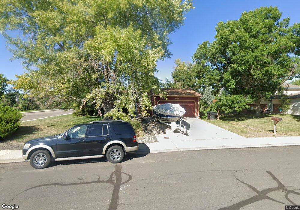
12405 Ash Dr Thornton, CO 80241
Northaven NeighborhoodEstimated Value: $455,000 - $475,000
3
Beds
2
Baths
1,211
Sq Ft
$383/Sq Ft
Est. Value
About This Home
This home is located at 12405 Ash Dr, Thornton, CO 80241 and is currently estimated at $463,550, approximately $382 per square foot. 12405 Ash Dr is a home located in Adams County with nearby schools including Skyview Elementary School, Shadow Ridge Middle School, and Horizon High School.
Ownership History
Date
Name
Owned For
Owner Type
Purchase Details
Closed on
Oct 31, 2002
Sold by
Wagers Kenneth A and Wagers Christine A
Bought by
Franks Robert L
Current Estimated Value
Home Financials for this Owner
Home Financials are based on the most recent Mortgage that was taken out on this home.
Original Mortgage
$163,600
Outstanding Balance
$65,602
Interest Rate
5.95%
Estimated Equity
$397,948
Purchase Details
Closed on
Jan 15, 1999
Sold by
Petrocco Joseph P
Bought by
Wagers Kenneth A and Wagers Christine A
Home Financials for this Owner
Home Financials are based on the most recent Mortgage that was taken out on this home.
Original Mortgage
$133,110
Interest Rate
6.66%
Mortgage Type
FHA
Purchase Details
Closed on
Mar 10, 1995
Sold by
Richt Thomas R and Richt Rhonda L
Bought by
Petrocco Joseph P
Home Financials for this Owner
Home Financials are based on the most recent Mortgage that was taken out on this home.
Original Mortgage
$82,300
Interest Rate
7.25%
Create a Home Valuation Report for This Property
The Home Valuation Report is an in-depth analysis detailing your home's value as well as a comparison with similar homes in the area
Home Values in the Area
Average Home Value in this Area
Purchase History
| Date | Buyer | Sale Price | Title Company |
|---|---|---|---|
| Franks Robert L | $204,500 | Stewart Title | |
| Wagers Kenneth A | $134,000 | -- | |
| Petrocco Joseph P | $102,900 | Land Title |
Source: Public Records
Mortgage History
| Date | Status | Borrower | Loan Amount |
|---|---|---|---|
| Open | Franks Robert L | $163,600 | |
| Previous Owner | Wagers Kenneth A | $133,110 | |
| Previous Owner | Petrocco Joseph P | $82,300 |
Source: Public Records
Tax History
| Year | Tax Paid | Tax Assessment Tax Assessment Total Assessment is a certain percentage of the fair market value that is determined by local assessors to be the total taxable value of land and additions on the property. | Land | Improvement |
|---|---|---|---|---|
| 2025 | $3,089 | $31,550 | $6,530 | $25,020 |
| 2024 | $3,089 | $29,000 | $6,000 | $23,000 |
| 2023 | $3,057 | $33,560 | $6,090 | $27,470 |
| 2022 | $2,797 | $25,390 | $6,050 | $19,340 |
| 2021 | $2,890 | $25,390 | $6,050 | $19,340 |
| 2020 | $2,801 | $25,110 | $6,220 | $18,890 |
| 2019 | $2,807 | $25,110 | $6,220 | $18,890 |
| 2018 | $2,425 | $21,070 | $6,700 | $14,370 |
| 2017 | $2,204 | $21,070 | $6,700 | $14,370 |
| 2016 | $1,839 | $17,110 | $3,340 | $13,770 |
| 2015 | $1,836 | $17,110 | $3,340 | $13,770 |
| 2014 | $1,580 | $14,310 | $2,870 | $11,440 |
Source: Public Records
Map
Nearby Homes
- 12332 Colorado Blvd Unit 30
- 12458 Albion St
- 12312 Colorado Blvd Unit 10
- 3991 E 121st Ave
- 12711 Colorado Blvd Unit 108A
- 12711 Colorado Blvd Unit 314C
- 4904 E 125th Ave
- 12625 Fairfax St
- 12791 Clermont St
- 12672 Madison Ct
- 12562 Forest St
- 11961 Bellaire St Unit C
- 12698 Fairfax St
- 12152 Dahlia Dr
- 11981 Bellaire St Unit D
- 12804 Harrison St
- 3765 E 127th Way
- 12187 Fairfax St
- 12506 Forest Dr
- 3715 E 127th Way
Your Personal Tour Guide
Ask me questions while you tour the home.