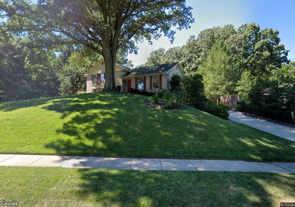
12408 Borges Ave Silver Spring, MD 20904
Estimated Value: $693,000 - $788,000
Studio
3
Baths
2,172
Sq Ft
$340/Sq Ft
Est. Value
About This Home
This home is located at 12408 Borges Ave, Silver Spring, MD 20904 and is currently estimated at $739,262, approximately $340 per square foot. 12408 Borges Ave is a home located in Montgomery County with nearby schools including Burnt Mills Elementary School, Francis Scott Key Middle School, and Springbrook High School.
Ownership History
Date
Name
Owned For
Owner Type
Purchase Details
Closed on
Sep 12, 2005
Sold by
Baxter Ralph C and Baxter J B
Bought by
Brecht Richard and Brecht Kristine Forster
Current Estimated Value
Home Financials for this Owner
Home Financials are based on the most recent Mortgage that was taken out on this home.
Original Mortgage
$621,000
Outstanding Balance
$328,469
Interest Rate
5.67%
Mortgage Type
New Conventional
Estimated Equity
$410,793
Purchase Details
Closed on
Jul 16, 1993
Sold by
David C D and David Fullarton L
Bought by
Baxter Ralph C and B J
Create a Home Valuation Report for This Property
The Home Valuation Report is an in-depth analysis detailing your home's value as well as a comparison with similar homes in the area
Home Values in the Area
Average Home Value in this Area
Purchase History
| Date | Buyer | Sale Price | Title Company |
|---|---|---|---|
| Brecht Richard | $777,000 | -- | |
| Baxter Ralph C | $339,000 | -- |
Source: Public Records
Mortgage History
| Date | Status | Borrower | Loan Amount |
|---|---|---|---|
| Open | Brecht Richard | $621,000 | |
| Closed | Brecht Richard | $99,000 |
Source: Public Records
Tax History
| Year | Tax Paid | Tax Assessment Tax Assessment Total Assessment is a certain percentage of the fair market value that is determined by local assessors to be the total taxable value of land and additions on the property. | Land | Improvement |
|---|---|---|---|---|
| 2025 | $6,929 | $604,433 | -- | -- |
| 2024 | $6,929 | $545,267 | $0 | $0 |
| 2023 | $5,517 | $486,100 | $267,500 | $218,600 |
| 2022 | $5,214 | $482,033 | $0 | $0 |
| 2021 | $3,657 | $477,967 | $0 | $0 |
| 2020 | $3,657 | $473,900 | $267,500 | $206,400 |
| 2019 | $4,323 | $473,900 | $267,500 | $206,400 |
| 2018 | $4,957 | $473,900 | $267,500 | $206,400 |
| 2017 | $4,395 | $476,000 | $0 | $0 |
| 2016 | -- | $467,567 | $0 | $0 |
| 2015 | $5,603 | $459,133 | $0 | $0 |
| 2014 | $5,603 | $450,700 | $0 | $0 |
Source: Public Records
Map
Nearby Homes
- 531 Norcross Way
- 604 Venice Dr
- 605 Rosemere Ave
- 12829 Baker Dr
- 12916 Shaw Place
- 807 Winhall Way
- 816 Rosemere Ave
- 808 Johnson Ave
- 217 Kimblewick Dr
- 512 Quaint Acres Dr
- 600 Seminole Creek Way
- 13307 Bregman Rd
- 420 Lamberton Dr
- 13106 Quail Creek Ct
- 712 Brandon Green Dr
- 12805 Brandon Green Ct
- 604 Hawkesbury Terrace
- 644 Symphony Woods Dr
- 11412 Fairoak Dr
- 13524 Sherwood Forest Dr
- 12404 Borges Ave
- 12412 Borges Ave
- 12416 Borges Ave
- 12400 Borges Ave
- 12435 Meadowood Dr
- 12420 Borges Ave
- 12430 Meadowood Dr
- 12503 Two Farm Dr
- 12505 Two Farm Dr
- 12409 Borges Ave
- 12405 Borges Ave
- 12413 Borges Ave
- 12401 Borges Ave
- 12507 Two Farm Dr
- 12417 Borges Ave
- 12501 Meadowood Dr
- 101 Valley Brook Dr
- 12500 Meadowood Dr
- 12421 Borges Ave
- 12501 Two Farm Dr
Your Personal Tour Guide
Ask me questions while you tour the home.