NOT LISTED FOR SALE

12408 Mineral Springs Rd West Fork, AR 72774

Estimated Value: $793,000

61 Acres
$12,945 Price per Acre
2,668,486 Sq Ft Lot

Last Sold September 25, 2013

Last sale price $156,213 $127 Per Sq Ft

Est. 408% increase in value since last sale

Current estimated payment $4,435/month

139 Days on Market

Highlights

  • Home fronts a pond
  • Secluded Lot
  • Wooded Lot
  • 61.26 Acre Lot
  • Pond
  • Views

About This Lot

As of September 2013

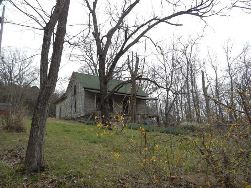
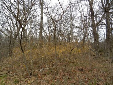
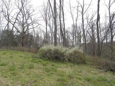
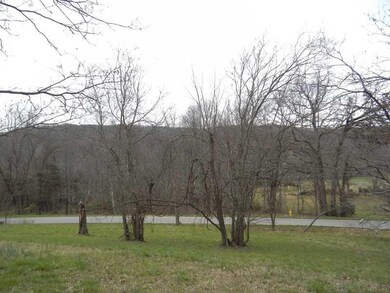
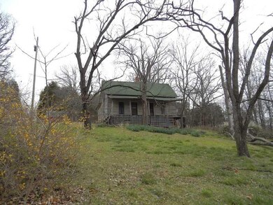
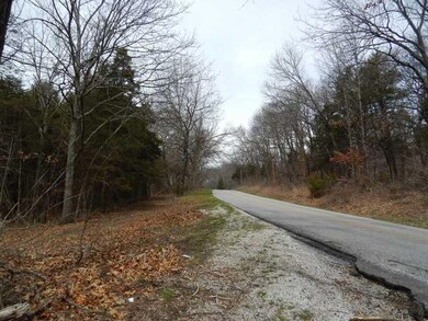
FRONTING PICTURESQUE MINERAL SPRINGS ROAD ONLY 10 MINUTES FROM FAYETTEVILLE THIS 59 ACRES INCLUDES AN OLD HOME SITE WITH ESTABLISHED SHRUBS & FLOWERS. WEST FORK CITY WATER. OLDER WELLS, POND & BEAUTIFUL WOODLAND.

Last Agent to Sell the Property

Jan Newlin

Newlin Realty Company License #PB00008437 Listed on: 04/08/2013

Last Buyer's Agent

James Henington

Newlin Realty Company License #SA00043802

Property Details

Property Type

  • Land

Est. Annual Taxes

  • $2

Year Built

  • 1885

Lot Details

  • 61.26 Acre Lot
  • Home fronts a pond
  • Property fronts a county road
  • Rural Setting
  • Partially Fenced Property
  • Secluded Lot
  • Sloped Lot
  • Wooded Lot

Home Design

  • Mixed Use

Additional Features

  • Pond
  • Mobile Home Allowed
  • Septic Tank
  • Property Views

Property Details

Property Type

Land

Est. Annual Taxes

$2

Year Built

1885

Lot Details

0

Listing Details

  • Property Sub Type: Mixed Use
  • Prop. Type: Land
  • Lot Size Acres: 61.26
  • Lot Size: .
  • Road Frontage Type: County Road
  • Road Surface Type: Paved
  • Subdivision Name: .
  • Directions: HWY 71 WEST FORK & EAST ON MINERAL SPRINGS ROAD (CR# 30) 9/10 MILE TO PROPERTY ON LEFT.
  • ResoPropertyType: Land
  • Special Features: None
  • Year Built: 1885

Interior Features

  • Possible Use: Residential

Exterior Features

  • Fencing: Partial
  • Lot Features: Mobile Home Allowed, Not In Subdivision, Other, Rural Lot, Secluded, Sloped, See Remarks, Views, Pond, Wooded
  • Topography: Sloping
  • View: Yes
  • Waterfront Features: Pond

Utilities

  • Electricity On Property: Yes
  • Sewer: Septic Tank
  • Utilities: Electricity Available
  • Water Source: Not Connected (nearby), Public

Schools

  • Junior High Dist: West Fork

Lot Info

  • Zoning Description: Residential
  • Zoning: N
  • ResoLotSizeUnits: Acres

Tax Info

  • Tax Block: .
  • Tax Lot: .

Ownership History

Date Name Owned For Owner Type

Purchase Details

Closed on
Jan 1, 1985
Bought by
O'Brien Mamie
Total Days on Market
139
Current Estimated Value
$793,000
Source: Public Records

Range of Values:

Collateral Analytics

Collateral Analytics Collateral Analytics AVMs (Automated Valuation Model) employ a number of statistical approaches combined with neighborhood-specific comparable selection guarantees the most up-to-date and precise valuations.

Not Available

Collateral Analytics does not have data for the current month. Please view the chart for historical values.

ICE

ICE Mortgage Technology ICE Mortgage Technology’s AVM (Automated Valuation Model) is a state-of-the-art online residential property valuation tool that provides a quick and accurate estimate of the value of almost any home in the U.S.

Not Available

ICE Mortgage Technology does not have data for the current month. Please view the chart for historical values.

First American

First American First American Data & Analytics’ next-generation AVM combines unrivaled data assets with a blended ensemble of valuation models to produce highly accurate, reliable valuations you can trust.

Not Available

First American does not have data for the current month. Please view the chart for historical values.

Quantarium

Quantarium Quantarium’s valuation service, repeatedly proven the industry’s most accurate and comprehensive, is supercharged with a self-learning and auto-tuning AI engine that continually becomes smarter and more accurate as it processes daily inputs from the industry’s leading RE data lake.

Not Available

Quantarium does not have data for the current month. Please view the chart for historical values.

Average Value
Not Available
List Price
Sold Price
Create a Home Valuation Report for This Property
The Home Valuation Report is an in-depth analysis detailing your home's value as well as a comparison with similar homes in the area

Home Values in the Area

Source: Public Records

Average Home Value in this Area


Source: Public Records

Purchase History

Date Buyer Sale Price Title Company
O'Brien Mamie -- --
Source: Public Records

Mortgage History

Date Status Borrower Loan Amount
Open Childress Andrew $375,000
Source: Public Records

Property History

Date Event Price Change Sq Ft Price
09/25/2013 09/25/13 Sold $156,213 -16.0% $127 / Sq Ft
08/26/2013 08/26/13 Pending -- -- --
04/08/2013 04/08/13 For Sale $186,000 -- $151 / Sq Ft
Source: Northwest Arkansas Board of REALTORS®

Tax History Compared to Growth

Source: Public Records

Tax History

Year Tax Paid Tax Assessment Tax Assessment Total Assessment is a certain percentage of the fair market value that is determined by local assessors to be the total taxable value of land and additions on the property. Land Improvement
2024 $2 $50 $50 $0
2023 $2 $50 $50 $0
2022 $2 $50 $50 $0
2021 $2 $50 $50 $0
2020 $3 $50 $50 $0
2019 $4 $70 $70 $0
2018 $3 $70 $70 $0
2017 $3 $70 $70 $0
2016 $4 $70 $70 $0
2015 $4 $70 $70 $0
2014 -- $80 $80 $0
Source: Public Records

Agents Affiliated with this Home

  • Section Image
See All Agents

Map

Source: Northwest Arkansas Board of REALTORS®

MLS Number: 677616

Northwest Arkansas Board of REALTORS®

APN: 001-07260-000