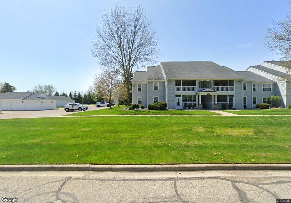
12408 Saint Andrews Way Unit Bldg-Unit Fenton, MI 48430
Estimated Value: $184,437 - $198,000
--
Bed
2
Baths
1,251
Sq Ft
$151/Sq Ft
Est. Value
About This Home
This home is located at 12408 Saint Andrews Way Unit Bldg-Unit, Fenton, MI 48430 and is currently estimated at $188,359, approximately $150 per square foot. 12408 Saint Andrews Way Unit Bldg-Unit is a home located in Genesee County with nearby schools including West Shore Elementary School, Torrey Hill Intermediate School, and Lake Fenton Middle School.
Ownership History
Date
Name
Owned For
Owner Type
Purchase Details
Closed on
Apr 15, 2024
Sold by
Sables Judy A
Bought by
Sables Judy A and Judy A Sables Living Trust
Current Estimated Value
Purchase Details
Closed on
Jan 31, 2018
Sold by
Hudgins Andrew
Bought by
Sables Judy Ann
Purchase Details
Closed on
Dec 13, 2016
Sold by
Marson Keith and Marson Madelaine
Bought by
Hudgins Andrew
Purchase Details
Closed on
Jan 31, 2013
Sold by
Munsell Jo Anne
Bought by
Marson Keith and Marson Madelaine
Create a Home Valuation Report for This Property
The Home Valuation Report is an in-depth analysis detailing your home's value as well as a comparison with similar homes in the area
Home Values in the Area
Average Home Value in this Area
Purchase History
| Date | Buyer | Sale Price | Title Company |
|---|---|---|---|
| Sables Judy A | -- | Michigan Land Title | |
| Sables Judy Ann | $114,000 | First American Title Ins Co | |
| Hudgins Andrew | $99,000 | None Available | |
| Marson Keith | $51,500 | None Available |
Source: Public Records
Tax History Compared to Growth
Tax History
| Year | Tax Paid | Tax Assessment Tax Assessment Total Assessment is a certain percentage of the fair market value that is determined by local assessors to be the total taxable value of land and additions on the property. | Land | Improvement |
|---|---|---|---|---|
| 2025 | $2,702 | $86,600 | $0 | $0 |
| 2024 | $635 | $80,000 | $0 | $0 |
| 2023 | $606 | $72,200 | $0 | $0 |
| 2022 | $2,363 | $69,800 | $0 | $0 |
| 2021 | $2,513 | $54,600 | $0 | $0 |
| 2020 | $554 | $50,900 | $0 | $0 |
| 2019 | $545 | $47,000 | $0 | $0 |
| 2018 | $1,393 | $42,600 | $0 | $0 |
| 2017 | $1,339 | $39,900 | $0 | $0 |
| 2016 | $1,006 | $34,900 | $0 | $0 |
| 2015 | $989 | $32,400 | $0 | $0 |
| 2014 | $333 | $28,900 | $0 | $0 |
| 2012 | -- | $31,300 | $31,300 | $0 |
Source: Public Records
Map
Nearby Homes
- 12364 Saint Andrews Way Unit 66
- 13167 Harbor Landings Dr
- 13163 Harbor Landings Dr Unit 112
- 12333 Saint Andrews Way Unit 86
- 3129 Harbor Pointe Cir
- 3127 Harbor Pointe Cir
- 3130 Harbor Pointe Cir Unit 64
- 13111 Harbor Landings Dr Unit 46
- 2410 Torrey Grove Ct Unit 12
- 2414 Cranewood Dr
- 3302 Rolston Rd
- 24 S Hill Dr
- 2509 Golden Shores Dr
- VL Crane Crane Rd
- 2497 Golden Shores Dr
- 12147 Torrey Rd
- 2369 Golden Shores Dr
- 2361 Golden Shore Dr
- 12356 Jennings Rd
- 2234 Toledo St
- 12408 Saint Andrews Way
- 12408 Saint Andrews Way Unit 30
- 12404 Saint Andrews Way Unit 26
- 12406 Saint Andrews Way
- 12416 Saint Andrews Way Unit 31
- 12402 Saint Andrews Way
- 12412 Saint Andrews Way
- 12418 Saint Andrews Way Unit 32
- 12414 Saint Andrews Way Unit 28
- 12434 Saint Andrews Way
- 12434 Saint Andrews Way Unit 4
- 12424 Saint Andrews Way Unit 58
- 12438 Saint Andrews Way Unit 64
- 12438 Saint Andrews Way Unit 12438
- 12382 Saint Andrews Way Unit 1
- 12428 Saint Andrews Way Unit 60
- 12428 St Andrews Way
- 12386 St Andrews Way
- 12386 Saint Andrews Way
- 12386 Saint Andrews Way Unit 5