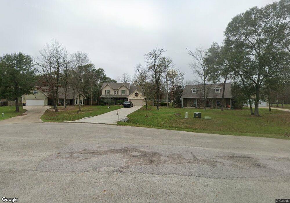
12409 Red Stag Ct Conroe, TX 77303
Estimated Value: $502,519 - $541,000
--
Bed
1
Bath
2,810
Sq Ft
$183/Sq Ft
Est. Value
About This Home
This home is located at 12409 Red Stag Ct, Conroe, TX 77303 and is currently estimated at $515,380, approximately $183 per square foot. 12409 Red Stag Ct is a home located in Montgomery County with nearby schools including Patterson Elementary School, Bozman Intermediate School, and Stockton Junior High School.
Ownership History
Date
Name
Owned For
Owner Type
Purchase Details
Closed on
Mar 29, 2018
Sold by
Khbm Partners Iii Ltd
Bought by
Crouch Gary and Crouch Teresa Cheri
Current Estimated Value
Home Financials for this Owner
Home Financials are based on the most recent Mortgage that was taken out on this home.
Original Mortgage
$306,838
Outstanding Balance
$270,032
Interest Rate
5.5%
Mortgage Type
FHA
Estimated Equity
$245,348
Purchase Details
Closed on
Jun 20, 2015
Sold by
Kelly Christopher and Kelly Norma
Bought by
Khbm Partners Iii Ltd
Home Financials for this Owner
Home Financials are based on the most recent Mortgage that was taken out on this home.
Original Mortgage
$30,000
Interest Rate
3.9%
Mortgage Type
Purchase Money Mortgage
Purchase Details
Closed on
Apr 17, 2012
Sold by
Corley Duane T
Bought by
Khbm Partners Iii Ltd
Create a Home Valuation Report for This Property
The Home Valuation Report is an in-depth analysis detailing your home's value as well as a comparison with similar homes in the area
Home Values in the Area
Average Home Value in this Area
Purchase History
| Date | Buyer | Sale Price | Title Company |
|---|---|---|---|
| Crouch Gary | -- | Great American Title | |
| Khbm Partners Iii Ltd | -- | Startex Title | |
| Khbm Partners Iii Ltd | -- | -- |
Source: Public Records
Mortgage History
| Date | Status | Borrower | Loan Amount |
|---|---|---|---|
| Open | Crouch Gary | $306,838 | |
| Previous Owner | Khbm Partners Iii Ltd | $30,000 |
Source: Public Records
Tax History Compared to Growth
Tax History
| Year | Tax Paid | Tax Assessment Tax Assessment Total Assessment is a certain percentage of the fair market value that is determined by local assessors to be the total taxable value of land and additions on the property. | Land | Improvement |
|---|---|---|---|---|
| 2025 | $6,009 | $513,185 | -- | -- |
| 2024 | $5,379 | $466,532 | -- | -- |
| 2023 | $5,379 | $424,120 | $76,110 | $430,310 |
| 2022 | $6,717 | $385,560 | $76,110 | $403,040 |
| 2021 | $6,480 | $350,510 | $65,050 | $285,460 |
| 2020 | $6,683 | $343,750 | $19,520 | $359,110 |
| 2019 | $6,295 | $312,500 | $19,520 | $292,980 |
| 2018 | $3,486 | $173,070 | $19,520 | $153,550 |
| 2017 | $395 | $19,520 | $19,520 | $0 |
| 2016 | $395 | $19,520 | $19,520 | $0 |
| 2015 | $398 | $19,520 | $19,520 | $0 |
| 2014 | $398 | $19,520 | $19,520 | $0 |
Source: Public Records
Map
Nearby Homes
- 9079 Red Stag Ln
- 6358 Rolling Hills Rd
- 8621 Hoda Dr
- 9107 Black Buck Ln
- 6186 White Oak Leaf Loop
- 11767 Mindybrook Ct
- 6263 Rolling Hills Rd
- 6248 Rolling Hills Rd
- 7300 Hoda Dr
- 12125 Willis Waukegan Rd
- Discovery Plan at Stonebrooke
- Athena Plan at Stonebrooke
- Magellan Plan at Stonebrooke
- Odyssey Plan at Stonebrooke
- Atlantis Plan at Stonebrooke
- Voyager Plan at Stonebrooke
- 6026 Hazel Place Dr
- Plan 1602-1 at Stonebrooke
- Plan 2025 at Stonebrooke
- Plan 1503 at Stonebrooke
- 12405 Red Stag Ct
- 12413 Red Stag Ct
- 12401 Red Stag Ct
- 12408 NE Red Stag Ct
- 12412 Red Stag Ct
- 12416 Red Stag Ct
- 12421 Red Stag Ct
- 12420 Red Stag Ct
- 6438 Rolling Hills Rd
- 6446 Rolling Hills Rd
- 12424 Red Stag Ct
- 12429 Red Stag Ct
- 6430 Rolling Hills Rd
- 6422 Rolling Hills Rd
- 9103 Red Stag Ln
- 12428 Red Stag Ct
- 9099 Red Stag Ln
- 6414 Rolling Hills Rd
- 9095 Red Stag Ln
- 12433 Red Stag Ct