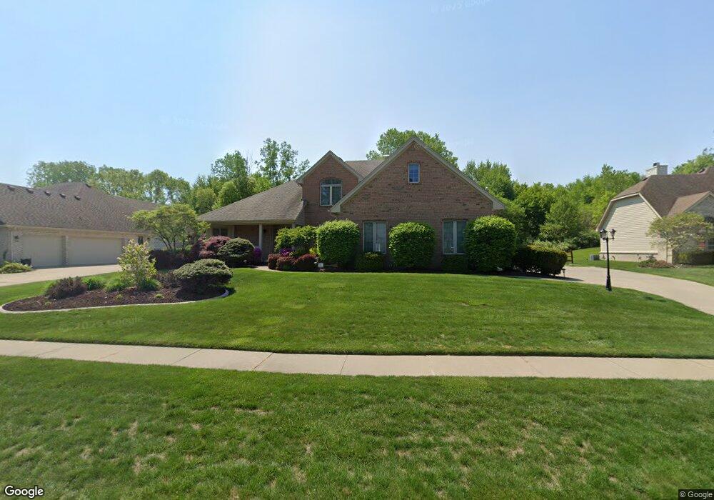
1241 Burningbush Ct Temperance, MI 48182
Estimated Value: $416,517 - $510,000
Studio
--
Bath
--
Sq Ft
0.34
Acres
About This Home
This home is located at 1241 Burningbush Ct, Temperance, MI 48182 and is currently estimated at $453,879. 1241 Burningbush Ct is a home located in Monroe County with nearby schools including Jackman Road Elementary School, Bedford Junior High School, and Bedford High School.
Ownership History
Date
Name
Owned For
Owner Type
Purchase Details
Closed on
Feb 5, 2001
Sold by
Yun Daniel
Bought by
Swanson Carl and Swanson Nancy
Current Estimated Value
Home Financials for this Owner
Home Financials are based on the most recent Mortgage that was taken out on this home.
Original Mortgage
$204,000
Interest Rate
7.18%
Mortgage Type
New Conventional
Purchase Details
Closed on
Oct 24, 1997
Sold by
Demuth Dennis L
Bought by
Yun Daniel D and Paik Juliana
Home Financials for this Owner
Home Financials are based on the most recent Mortgage that was taken out on this home.
Original Mortgage
$276,450
Interest Rate
6.75%
Mortgage Type
New Conventional
Purchase Details
Closed on
Feb 28, 1997
Sold by
Firecreek Golf Club Ins
Bought by
Deumuth Dennis L
Home Financials for this Owner
Home Financials are based on the most recent Mortgage that was taken out on this home.
Original Mortgage
$223,600
Interest Rate
6.5%
Mortgage Type
New Conventional
Create a Home Valuation Report for This Property
The Home Valuation Report is an in-depth analysis detailing your home's value as well as a comparison with similar homes in the area
Home Values in the Area
Average Home Value in this Area
Purchase History
| Date | Buyer | Sale Price | Title Company |
|---|---|---|---|
| Swanson Carl | $255,000 | -- | |
| Yun Daniel D | $289,900 | -- | |
| Deumuth Dennis L | $52,900 | -- |
Source: Public Records
Mortgage History
| Date | Status | Borrower | Loan Amount |
|---|---|---|---|
| Previous Owner | Swanson Carl | $204,000 | |
| Previous Owner | Yun Daniel D | $276,450 | |
| Previous Owner | Deumuth Dennis L | $223,600 |
Source: Public Records
Tax History
| Year | Tax Paid | Tax Assessment Tax Assessment Total Assessment is a certain percentage of the fair market value that is determined by local assessors to be the total taxable value of land and additions on the property. | Land | Improvement |
|---|---|---|---|---|
| 2025 | $1,770 | $199,000 | $199,000 | $0 |
| 2024 | $1,716 | $189,400 | $0 | $0 |
| 2023 | $1,635 | $169,900 | $0 | $0 |
| 2022 | $3,851 | $169,900 | $0 | $0 |
| 2021 | $3,723 | $169,100 | $0 | $0 |
| 2020 | $3,545 | $175,100 | $0 | $0 |
| 2019 | $3,510 | $175,100 | $0 | $0 |
| 2018 | $3,155 | $165,900 | $0 | $0 |
| 2017 | $2,999 | $165,900 | $0 | $0 |
| 2016 | $2,965 | $136,600 | $0 | $0 |
| 2015 | $2,791 | $123,600 | $0 | $0 |
| 2014 | $2,791 | $123,600 | $0 | $0 |
| 2013 | $3,167 | $141,200 | $0 | $0 |
Source: Public Records
Map
Nearby Homes
- 1835 W Sterns Rd
- 1660 W Sterns Rd
- 7497 Savanna Dr
- 7808 Lewis Ave
- 1440 Tennyson Dr
- 1191 Mapleway Dr
- 7305 Cinden Rd
- 398 Somerset Ln
- 1138 Mapleway Dr
- 6712 Nanafield Dr
- 7768 Jackman Rd
- 1456 Meadowbrook Way
- 6749 Stonegate Dr
- 8010 Timber Wood Ln Unit 14
- 6805 Jackman Rd
- 1747 Center Dr
- 1173 Hackman Dr
- 450 Glencoe
- 251 Inverness Ln
- 173 Preswick St
- 1229 Burningbush Ct
- 1253 Burningbush Ct
- 1217 Burningbush Ct
- 1265 Burningbush Ct
- 1236 Burningbush Ct
- 1224 Burningbush Ct
- 1250 Burningbush Ct
- 1248 Burningbush Ct
- 1205 Burningbush Ct
- 1212 Burningbush Ct
- 7335 Bentcreek Dr
- 1200 Burningbush Ct
- 7323 Bentcreek Dr
- 1287 W Sterns Rd
- 1309 W Sterns Rd
- 7311 Bentcreek Dr
- 7342 Bentcreek Dr
- 7330 Bentcreek Dr
- 1331 W Sterns Rd
- 7299 Bentcreek Dr