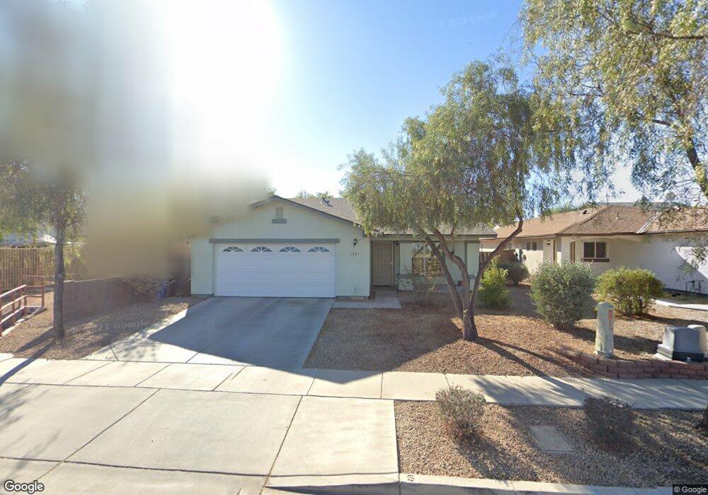
1241 E Carson Rd Phoenix, AZ 85042
South Mountain NeighborhoodEstimated Value: $343,317 - $419,000
Studio
2
Baths
1,519
Sq Ft
$251/Sq Ft
Est. Value
About This Home
This home is located at 1241 E Carson Rd, Phoenix, AZ 85042 and is currently estimated at $381,579, approximately $251 per square foot. 1241 E Carson Rd is a home located in Maricopa County with nearby schools including John F. Kennedy Elementary School, C O Greenfield School, and South Mountain High School.
Ownership History
Date
Name
Owned For
Owner Type
Purchase Details
Closed on
Feb 22, 2011
Sold by
Habitat For Huamnity Centrla Arizona
Bought by
Cole Tauheedah Mahasin
Current Estimated Value
Home Financials for this Owner
Home Financials are based on the most recent Mortgage that was taken out on this home.
Original Mortgage
$85,000
Outstanding Balance
$57,859
Interest Rate
4.67%
Mortgage Type
Purchase Money Mortgage
Estimated Equity
$323,720
Create a Home Valuation Report for This Property
The Home Valuation Report is an in-depth analysis detailing your home's value as well as a comparison with similar homes in the area
Home Values in the Area
Average Home Value in this Area
Purchase History
| Date | Buyer | Sale Price | Title Company |
|---|---|---|---|
| Cole Tauheedah Mahasin | $110,000 | Grand Canyon Title Agency | |
| Ibrahim Shafi Jemal | $110,000 | Grand Canyon Title Agency |
Source: Public Records
Mortgage History
| Date | Status | Borrower | Loan Amount |
|---|---|---|---|
| Open | Ibrahim Shafi Jemal | $85,000 | |
| Closed | Cole Tauheedah Mahasin | $85,000 |
Source: Public Records
Tax History
| Year | Tax Paid | Tax Assessment Tax Assessment Total Assessment is a certain percentage of the fair market value that is determined by local assessors to be the total taxable value of land and additions on the property. | Land | Improvement |
|---|---|---|---|---|
| 2025 | $1,764 | $13,050 | -- | -- |
| 2024 | $1,667 | $12,428 | -- | -- |
| 2023 | $1,667 | $27,760 | $5,550 | $22,210 |
| 2022 | $1,632 | $20,160 | $4,030 | $16,130 |
| 2021 | $1,683 | $18,510 | $3,700 | $14,810 |
| 2020 | $1,662 | $17,170 | $3,430 | $13,740 |
| 2019 | $1,605 | $15,300 | $3,060 | $12,240 |
| 2018 | $1,560 | $13,880 | $2,770 | $11,110 |
| 2017 | $1,454 | $12,250 | $2,450 | $9,800 |
| 2016 | $1,379 | $11,900 | $2,380 | $9,520 |
| 2015 | $1,281 | $10,330 | $2,060 | $8,270 |
Source: Public Records
Map
Nearby Homes
- 1329 E Irwin Ave
- 1317 E Fremont Rd
- 1346 E Dunbar Dr
- 7527 S 13th Place
- 7514 S 14th St
- 6630 S 11th St Unit 1
- 1516 E Fremont Rd
- 7611 S 15th St
- 913 E Fremont Rd Unit 1
- 1507 E Apollo Rd
- 1515 E Apollo Rd
- 1322 E Harwell Rd
- 819 E Apollo Rd
- 1635 E Fremont Rd
- 1653 E Vineyard Rd
- 916 E Harwell Rd
- 849 E Constance Way
- 1634 E Harwell Rd
- 1705 E Beautiful Ln
- 6025 S 13th St
- 1237 E Carson Rd
- 7204 S 13th St
- 7208 S 13th St
- 7212 S 13th St
- 7203 S 12th Way
- 7207 S 12th Way
- 7211 S 12th Way
- 7215 S 12th Way
- 7216 S 13th St
- 1243 E Irwin Ave
- 1239 E Irwin Ave
- 1235 E Irwin Ave
- 7220 S 13th St
- 1309 E Irwin Ave
- 7219 S 12th Way
- 7211 S 13th St
- 1231 E Irwin Ave
- 1313 E Irwin Ave
- 7206 S 12th Way
- 7210 S 12th Way
Your Personal Tour Guide
Ask me questions while you tour the home.