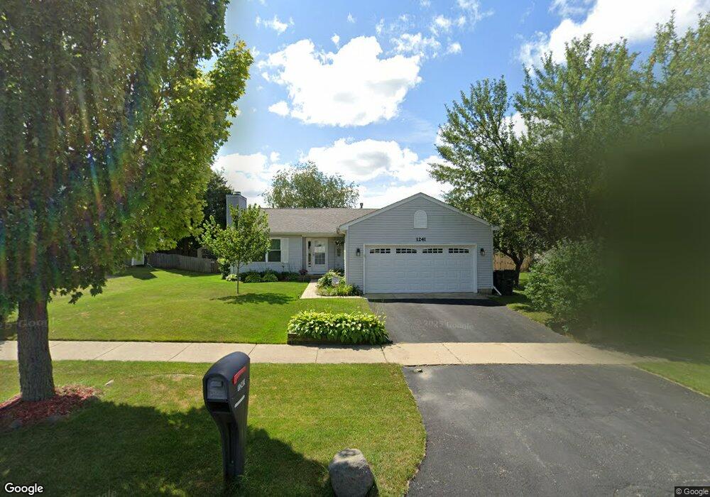
1241 Pheasant Run Zion, IL 60099
West Zion NeighborhoodEstimated Value: $270,000 - $312,000
3
Beds
2
Baths
1,191
Sq Ft
$236/Sq Ft
Est. Value
About This Home
This home is located at 1241 Pheasant Run, Zion, IL 60099 and is currently estimated at $281,328, approximately $236 per square foot. 1241 Pheasant Run is a home located in Lake County with nearby schools including Newport Elementary School, Beach Park Middle School, and Zion-Benton Township High School.
Ownership History
Date
Name
Owned For
Owner Type
Purchase Details
Closed on
May 30, 2002
Sold by
Mallek Daniel W and Mallek Patricia A
Bought by
Russell Jacqueline
Current Estimated Value
Home Financials for this Owner
Home Financials are based on the most recent Mortgage that was taken out on this home.
Original Mortgage
$110,000
Interest Rate
6.93%
Purchase Details
Closed on
Nov 11, 1998
Sold by
Bank Of Waukegan
Bought by
Daniel W Mallek & Patricia A Mallek Tr
Create a Home Valuation Report for This Property
The Home Valuation Report is an in-depth analysis detailing your home's value as well as a comparison with similar homes in the area
Home Values in the Area
Average Home Value in this Area
Purchase History
| Date | Buyer | Sale Price | Title Company |
|---|---|---|---|
| Russell Jacqueline | $160,000 | Chicago Title Insurance Co | |
| Daniel W Mallek & Patricia A Mallek Tr | $130,500 | -- |
Source: Public Records
Mortgage History
| Date | Status | Borrower | Loan Amount |
|---|---|---|---|
| Closed | Russell Jacqueline | $110,000 |
Source: Public Records
Tax History Compared to Growth
Tax History
| Year | Tax Paid | Tax Assessment Tax Assessment Total Assessment is a certain percentage of the fair market value that is determined by local assessors to be the total taxable value of land and additions on the property. | Land | Improvement |
|---|---|---|---|---|
| 2024 | $6,297 | $64,255 | $9,824 | $54,431 |
| 2023 | $6,027 | $57,289 | $8,759 | $48,530 |
| 2022 | $6,027 | $52,195 | $7,215 | $44,980 |
| 2021 | $5,923 | $48,963 | $6,768 | $42,195 |
| 2020 | $5,695 | $46,053 | $6,366 | $39,687 |
| 2019 | $5,522 | $42,900 | $5,930 | $36,970 |
| 2018 | $4,940 | $37,769 | $5,420 | $32,349 |
| 2017 | $4,725 | $35,036 | $5,028 | $30,008 |
| 2016 | $4,342 | $31,804 | $4,564 | $27,240 |
| 2015 | $4,126 | $28,857 | $4,141 | $24,716 |
| 2014 | $3,915 | $28,121 | $3,920 | $24,201 |
| 2012 | $4,400 | $29,948 | $4,175 | $25,773 |
Source: Public Records
Map
Nearby Homes
- 1305 Reed Rd
- 1210 Lorelei Dr
- 4014 Ridge Rd
- 1524 Anderson Trail
- 4004 Gregory Dr
- 1712 Dusk Dr
- 4108 Douglas Dr
- 4539 Illinois 173
- 4533 Illinois 173
- 3903 9th St
- 1907 Dawn Ln
- 11778 W 12th St
- 1521 Southport Ct
- 1405 Lewis Ave
- 12434 W Van Ct
- 4109 Sarah Dr
- 41616 N Delany Rd
- 42908 N Lewis Ave
- 2407 Phillip Dr
- 42333 N Theodore Ct
- 1243 Pheasant Run
- 1239 Pheasant Run
- 3804 Tickseed Dr
- 3802 Tickseed Dr
- 1245 Pheasant Run
- 3806 Tickseed Dr
- 1237 Pheasant Run
- 1213 Cardinal Dr
- 3800 Tickseed Dr
- 1247 Pheasant Run
- 1235 Pheasant Run
- 1238 Pheasant Run
- 3808 Tickseed Dr
- 1236 Pheasant Run
- 1211 Cardinal Dr
- 1300 Reed Rd
- 3811 Tickseed Dr
- 1249 Pheasant Run
- 1301 Reed Rd
- 1234 Pheasant Run