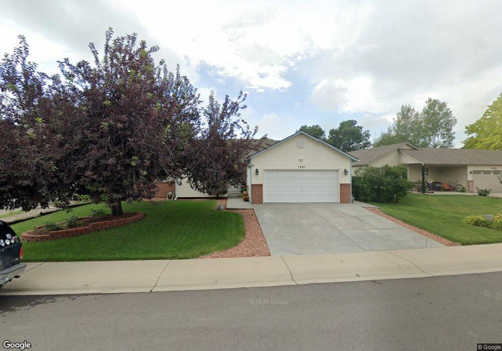
1241 Teakwood Ct Windsor, CO 80550
Estimated Value: $485,274 - $519,000
3
Beds
6
Baths
1,298
Sq Ft
$384/Sq Ft
Est. Value
About This Home
This home is located at 1241 Teakwood Ct, Windsor, CO 80550 and is currently estimated at $498,569, approximately $384 per square foot. 1241 Teakwood Ct is a home located in Weld County with nearby schools including Skyview Elementary School, Windsor Middle School, and Windsor High School.
Ownership History
Date
Name
Owned For
Owner Type
Purchase Details
Closed on
Jun 28, 1996
Sold by
Executive Homes Inc
Bought by
Iannuzzi Michael A and Iannuzzi Diann Marie
Current Estimated Value
Home Financials for this Owner
Home Financials are based on the most recent Mortgage that was taken out on this home.
Original Mortgage
$108,000
Outstanding Balance
$7,711
Interest Rate
8.1%
Mortgage Type
Balloon
Estimated Equity
$490,858
Purchase Details
Closed on
Mar 20, 1996
Sold by
Everitt Investments Inc
Bought by
Executive Homes Inc
Purchase Details
Closed on
May 2, 1994
Sold by
Ibc Company
Bought by
Everitt Investments
Create a Home Valuation Report for This Property
The Home Valuation Report is an in-depth analysis detailing your home's value as well as a comparison with similar homes in the area
Home Values in the Area
Average Home Value in this Area
Purchase History
| Date | Buyer | Sale Price | Title Company |
|---|---|---|---|
| Iannuzzi Michael A | $120,423 | -- | |
| Executive Homes Inc | $26,000 | -- | |
| Everitt Investments | -- | -- |
Source: Public Records
Mortgage History
| Date | Status | Borrower | Loan Amount |
|---|---|---|---|
| Open | Iannuzzi Michael A | $108,000 |
Source: Public Records
Tax History Compared to Growth
Tax History
| Year | Tax Paid | Tax Assessment Tax Assessment Total Assessment is a certain percentage of the fair market value that is determined by local assessors to be the total taxable value of land and additions on the property. | Land | Improvement |
|---|---|---|---|---|
| 2025 | $2,609 | $29,030 | $6,440 | $22,590 |
| 2024 | $2,609 | $29,030 | $6,440 | $22,590 |
| 2023 | $2,395 | $31,330 | $5,140 | $26,190 |
| 2022 | $2,454 | $25,280 | $5,000 | $20,280 |
| 2021 | $2,288 | $26,020 | $5,150 | $20,870 |
| 2020 | $2,036 | $23,610 | $4,580 | $19,030 |
| 2019 | $2,018 | $23,610 | $4,580 | $19,030 |
| 2018 | $1,815 | $20,100 | $3,240 | $16,860 |
| 2017 | $1,922 | $20,100 | $3,240 | $16,860 |
| 2016 | $1,793 | $18,940 | $3,180 | $15,760 |
| 2015 | $1,667 | $18,940 | $3,180 | $15,760 |
| 2014 | $1,472 | $15,680 | $2,710 | $12,970 |
Source: Public Records
Map
Nearby Homes
- 515 Trailwood Cir
- 1507 Stonewood Ct
- 1501 Driftwood Ct
- 1421 Canal Dr
- 1107 Crescent Dr
- 1538 Wedgewood Ct
- 813 Walnut St
- 1625 Main St
- 1116 Grand Ave
- 904 Pine Dr
- 1208 Fairfield Ave
- 1228 Fairfield Ave
- 1050 Fairfield Ave
- Summit Plan at Trevenna
- 610 Oak St
- Regent - Premier Plan at Trevenna
- Kensington - Premier Plan at Trevenna
- St. James - Premier Plan at Trevenna
- Charleston - Premier Plan at Trevenna
- Belmont - Premier Plan at Trevenna
- 1243 Teakwood Ct
- 1239 Teakwood Ct
- 1234 Westwood Dr
- 1245 Teakwood Ct
- 1236 Westwood Dr
- 1229 Teakwood Ct
- 1232 Westwood Dr
- 1238 Teakwood Ct
- 1240 Teakwood Ct
- 1238 Westwood Dr
- 1227 Teakwood Ct
- 1242 Teakwood Ct
- 1247 Teakwood Ct
- 1228 Teakwood Ct
- 1228 Westwood Dr
- 1244 Teakwood Ct
- 1240 Westwood Dr
- 1236 Teakwood Ct
- 1225 Teakwood Ct
- 1248 Teakwood Ct