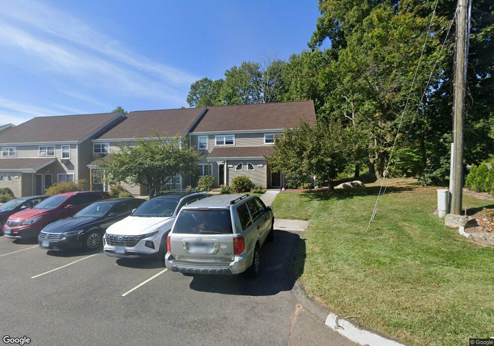
1241 Washington St Unit 10 Middletown, CT 06457
Westfield NeighborhoodEstimated Value: $196,000 - $217,000
3
Beds
1
Bath
1,056
Sq Ft
$192/Sq Ft
Est. Value
About This Home
This home is located at 1241 Washington St Unit 10, Middletown, CT 06457 and is currently estimated at $203,188, approximately $192 per square foot. 1241 Washington St Unit 10 is a home located in Middlesex County with nearby schools including Frank Ward Strong School, Coginchaug Regional High School, and St John Paul II School.
Ownership History
Date
Name
Owned For
Owner Type
Purchase Details
Closed on
Jul 24, 2008
Sold by
Cheney Jeffrey M
Bought by
Runte John J
Current Estimated Value
Home Financials for this Owner
Home Financials are based on the most recent Mortgage that was taken out on this home.
Original Mortgage
$150,636
Outstanding Balance
$98,134
Interest Rate
6.35%
Estimated Equity
$105,054
Purchase Details
Closed on
Aug 16, 2007
Sold by
Grant Roland and Grant Madeline
Bought by
Cheney Jeffrey M
Home Financials for this Owner
Home Financials are based on the most recent Mortgage that was taken out on this home.
Original Mortgage
$120,000
Interest Rate
6.67%
Purchase Details
Closed on
Mar 16, 2001
Sold by
Young Brenda L and Young Steven E
Bought by
Grant Roland
Purchase Details
Closed on
May 30, 1995
Sold by
Fnma
Bought by
Young Brenda and Young Steven
Create a Home Valuation Report for This Property
The Home Valuation Report is an in-depth analysis detailing your home's value as well as a comparison with similar homes in the area
Home Values in the Area
Average Home Value in this Area
Purchase History
| Date | Buyer | Sale Price | Title Company |
|---|---|---|---|
| Runte John J | $153,000 | -- | |
| Cheney Jeffrey M | $150,000 | -- | |
| Grant Roland | $60,000 | -- | |
| Young Brenda | $44,900 | -- |
Source: Public Records
Mortgage History
| Date | Status | Borrower | Loan Amount |
|---|---|---|---|
| Open | Young Brenda | $150,636 | |
| Previous Owner | Young Brenda | $120,000 | |
| Previous Owner | Young Brenda | $38,058 | |
| Previous Owner | Young Brenda | $100,000 |
Source: Public Records
Tax History Compared to Growth
Tax History
| Year | Tax Paid | Tax Assessment Tax Assessment Total Assessment is a certain percentage of the fair market value that is determined by local assessors to be the total taxable value of land and additions on the property. | Land | Improvement |
|---|---|---|---|---|
| 2025 | $3,405 | $87,540 | $0 | $87,540 |
| 2024 | $3,221 | $87,540 | $0 | $87,540 |
| 2023 | $3,073 | $87,540 | $0 | $87,540 |
| 2022 | $2,789 | $63,380 | $0 | $63,380 |
| 2021 | $2,789 | $63,380 | $0 | $63,380 |
| 2020 | $2,801 | $63,380 | $0 | $63,380 |
| 2019 | $2,814 | $63,380 | $0 | $63,380 |
| 2018 | $2,770 | $63,380 | $0 | $63,380 |
| 2017 | $3,045 | $71,810 | $0 | $71,810 |
| 2016 | $2,959 | $71,810 | $0 | $71,810 |
| 2015 | $2,844 | $71,810 | $0 | $71,810 |
| 2014 | $2,872 | $71,810 | $0 | $71,810 |
Source: Public Records
Map
Nearby Homes
- 1271 Washington St Unit 7
- 5 Lorraine Terrace
- 237 Boston Rd
- 84 Camp St
- 3 Sisk St
- 160 Boston Rd
- 358 Ballfall Rd
- 574 Butternut St
- 40 Batt St
- 82 Westfield Terrace
- 59 Westfield Terrace
- 31 Broadview Pkwy
- 59 Willow Bee Ln
- 27 Barbara Rd
- 60 Old Mill Rd
- 18 Phedon Pkwy
- 1 Nathan Hale Rd
- 2 Nathan Hale Rd
- 4 Nathan Hale Rd
- 3 Nathan Hale Rd
- 1241 Washington St Unit 5
- 1241 Washington St Unit 7
- 1271 Washington St Unit 3
- 1241 Washington St Unit 4
- 1221 Washington St Unit 2
- 1261 Washington St Unit 3
- 1241 Washington St Unit 2
- 1241 Washington St Unit 3
- 1231 Washington St Unit 13
- 1261 Washington St Unit 15
- 1261 Washington St Unit 5
- 1231 Washington St Unit 14
- 1251 Washington St Unit 5
- 1231 Washington St Unit 7
- 1241 Washington St Unit 13
- 1251 Washington St Unit 11
- 1241 Washington St Unit 6
- 1241 Washington St Unit 15
- 1261 Washington St Unit 12
- 1251 Washington St Unit 4