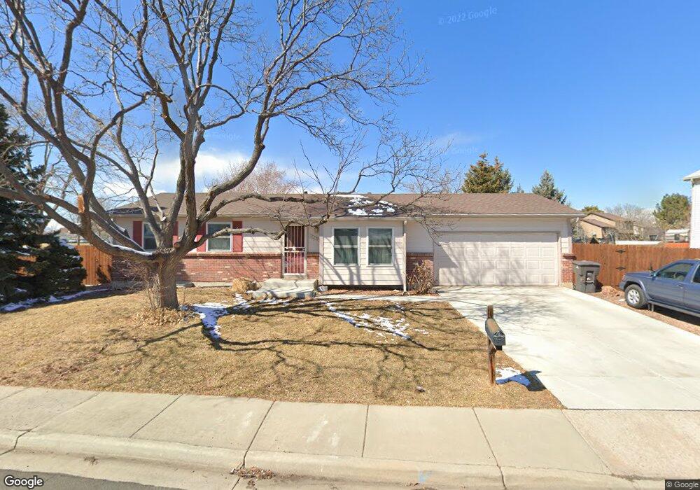
12411 Newton St Broomfield, CO 80020
Brandywine NeighborhoodEstimated Value: $504,000 - $554,000
3
Beds
1
Bath
2,022
Sq Ft
$260/Sq Ft
Est. Value
About This Home
This home is located at 12411 Newton St, Broomfield, CO 80020 and is currently estimated at $525,778, approximately $260 per square foot. 12411 Newton St is a home located in Broomfield County with nearby schools including Mountain View Elementary School, Westlake Middle School, and Legacy High School.
Ownership History
Date
Name
Owned For
Owner Type
Purchase Details
Closed on
May 10, 2011
Sold by
Deutsche Bank National Trust Company
Bought by
Laster Patricia A
Current Estimated Value
Home Financials for this Owner
Home Financials are based on the most recent Mortgage that was taken out on this home.
Original Mortgage
$144,248
Outstanding Balance
$99,643
Interest Rate
4.75%
Mortgage Type
FHA
Estimated Equity
$426,135
Purchase Details
Closed on
Aug 24, 2010
Sold by
Martinez Lorri
Bought by
Deutsche Bank National Trust Company
Purchase Details
Closed on
Oct 28, 1999
Sold by
Kendrick Donald W
Bought by
Martinez Lorri
Purchase Details
Closed on
Apr 21, 1999
Sold by
Carney Elaine
Bought by
Kendrick Donald W
Create a Home Valuation Report for This Property
The Home Valuation Report is an in-depth analysis detailing your home's value as well as a comparison with similar homes in the area
Home Values in the Area
Average Home Value in this Area
Purchase History
| Date | Buyer | Sale Price | Title Company |
|---|---|---|---|
| Laster Patricia A | $148,000 | None Available | |
| Deutsche Bank National Trust Company | -- | None Available | |
| Martinez Lorri | $159,900 | -- | |
| Kendrick Donald W | $115,100 | -- |
Source: Public Records
Mortgage History
| Date | Status | Borrower | Loan Amount |
|---|---|---|---|
| Open | Laster Patricia A | $144,248 |
Source: Public Records
Tax History Compared to Growth
Tax History
| Year | Tax Paid | Tax Assessment Tax Assessment Total Assessment is a certain percentage of the fair market value that is determined by local assessors to be the total taxable value of land and additions on the property. | Land | Improvement |
|---|---|---|---|---|
| 2025 | $2,486 | $33,620 | $9,050 | $24,570 |
| 2024 | $2,486 | $29,880 | $8,050 | $21,830 |
| 2023 | $2,463 | $34,820 | $9,380 | $25,440 |
| 2022 | $1,824 | $23,100 | $6,600 | $16,500 |
| 2021 | $2,690 | $23,760 | $6,790 | $16,970 |
| 2020 | $2,569 | $22,440 | $6,440 | $16,000 |
| 2019 | $2,570 | $22,600 | $6,480 | $16,120 |
| 2018 | $2,135 | $18,100 | $4,680 | $13,420 |
| 2017 | $1,945 | $20,010 | $5,170 | $14,840 |
| 2016 | $1,780 | $16,140 | $5,050 | $11,090 |
| 2015 | $1,779 | $13,180 | $5,050 | $8,130 |
| 2014 | $1,493 | $13,180 | $5,050 | $8,130 |
Source: Public Records
Map
Nearby Homes
- 12510 Newton St
- 12450 Forest View St
- 12205 Pery St
- 12217 Crabapple St
- 12545 Tammywood St
- 3974 Cambridge Ave
- 12205 Perry St Unit 17
- 12205 Perry St Unit 259
- 12205 Perry St Unit 167
- 12205 Perry St Unit 67
- 12205 Perry St Unit 287
- 3981 W 127th Ave
- 12528 James Point
- 3465 W 125th Point
- 12620 Winona Ct
- 3414 W 126th Place
- 12420 James St
- 3422 W 125th Dr
- 3406 W 126th Dr
- 12639 James Ct
- 12441 Newton St
- 12598 Maria Cir
- 12596 Maria Cir
- 12410 Newton St
- 12511 Newton St
- 12440 Newton St
- 12592 Maria Cir
- 12480 Newton St
- 12531 Newton St
- 12411 Maria Cir
- 12590 Maria Cir
- 12421 Maria Cir
- 12597 Maria Cir
- 12593 Maria Cir
- 12431 Maria Cir
- 12530 Newton St
- 12501 Meade Ct
- 12551 Newton St
- 12589 Maria Cir
- 12584 Maria Cir